Showing posts with label asia. Show all posts

Tuesday, October 25, 2016

Syrian Civil War Control Map & Report: October 23, 2016 (Subscription)

SUBSCRIBERS CLICK HERE TO PROCEED TO ARTICLE AND MAP

There are newer versions of this map available. To see them, view all Syria updates.

Research by Djordje Djukic. Map by onestopmap.com, Evan Centanni, and Djordje Djukic
Subscribe for full access to all conflict map reports!

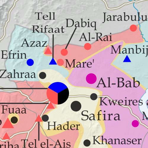
Map of fighting and territorial control in Syria's Civil War (Free Syrian Army rebels, Kurdish YPG, Syrian Democratic Forces (SDF), Jabhat Fateh al-Sham (Al-Nusra Front), Islamic State (ISIS/ISIL), and others), updated to October 25, 2016. Now includes terrain and major roads (highways). Includes recent locations of conflict and territorial control changes, such as Dabiq, Tell Rifaat, Moadamiya, and more (colorblind accessible). Since earlier this month, rebels in Syria have scored an important victory against the so-called "Islamic State" (ISIS/ISIL), even while losing ground to the government - and fighting amongst themselves - in other areas.
 
See all this and more on the latest update to PolGeoNow's concise, professional Syrian Civil War control map, which includes a timeline of changes since our previous Syria map report in early October, with sources cited.

This map and report are premium professional content, available to paid subscribers of the PolGeoNow Conflict Mapping Service.

Want to see before you subscribe? Check out our most recent FREE SAMPLE Syria map!

Exclusive report includes:
  • Up-to-date map of current territorial control in Syria, color-coded for the Assad government, rebel groups, "Islamic State" (ISIS/ISIL) fighters, and Kurdish/SDF forces. Colorblind accessible.
  • Special symbols indicating towns dominated by rebels of the former Nusra Front (now Jabhat Fateh al-Sham) and US-backed Syrian Democratic Forces (SDF).
  • Detailed indication of city-by-city control, including key towns and other locations important to current events.
  • Locations of recent fighting and other important events, including Dabiq, Tell Rifaat, Moadamiya, and more.
  • Detailed timeline of important events and changes to territorial control since October 2, 2016, compiled by our Syria-Iraq expert, with links to sources.

SUBSCRIBERS CLICK HERE TO PROCEED TO ARTICLE AND MAP

Not signed up yet? Click here to learn more about our professional subscription service!

Can I purchase just this map?
This map and report are not available for automated purchase to non-subscribers. If you need access or republication rights for only this map report, contact service@polgeonow.com for options.

Monday, October 3, 2016

Syrian Civil War Control Map & Report: October 2, 2016 (Subscription)

SUBSCRIBERS CLICK HERE TO PROCEED TO ARTICLE AND MAP

There are newer versions of this map available. To see them, view all Syria updates.

Research by Djordje Djukic. Map by onestopmap.com, Evan Centanni, and Djordje Djukic

Subscribe for full access to all conflict map reports!

Map of fighting and territorial control in Syria's Civil War (Free Syrian Army rebels, Kurdish YPG, Syrian Democratic Forces (SDF), Jabhat Fateh al-Sham (Al-Nusra Front), Islamic State (ISIS/ISIL), and others), updated for October 2016. Now includes terrain and major roads (highways). Includes recent locations of conflict and territorial control changes, such as Dabiq, Halfaya, Suran, Jarabulus, and more (colorblind accessible). During the past month, a continued Turkish military incursion into Syria completely cut off the so-called "Islamic State" from the self-proclaimed caliphate's last international border in the region (other than its boundaries with Syrian and Iraqi territory).

Meanwhile, the Assad government and rebel groups have continued to take territory from each other despite a brief attempt at a country-wide ceasefire.
 
See all this and more on the latest update to PolGeoNow's concise, professional Syrian Civil War control map, which includes a timeline of changes since our previous Syria map report in late August, with sources cited.

This map and report are premium professional content, available to paid subscribers of the PolGeoNow Conflict Mapping Service.

Want to see before you subscribe? Check out our most recent FREE SAMPLE Syria map!

Exclusive report includes:
  • Up-to-date map of current territorial control in Syria, color-coded for the Assad government, rebel groups, "Islamic State" (ISIS/ISIL) fighters, and Kurdish/SDF forces. Colorblind accessible.
  • Special symbols indicating towns dominated by rebels of the former Nusra Front (now Jabhat Fateh al-Sham) and US-backed Syrian Democratic Forces (SDF).
  • Detailed indication of city-by-city control, including key towns and other locations important to current events.
  • Locations of recent fighting and military operations, including Dabiq, Halfaya, Suran, Jarabulus, and more.
  • Detailed timeline of important events and changes to territorial control since August 27, 2016, compiled by our Syria-Iraq expert, with links to sources.

SUBSCRIBERS CLICK HERE TO PROCEED TO ARTICLE AND MAP

Not signed up yet? Click here to learn more about our professional subscription service!

Can I purchase just this map?
This map and report are not available for automated purchase to non-subscribers. If you need access or republication rights for only this map report, contact service@polgeonow.com for options.
Friday, September 23, 2016

Yemen Control Map & Report: September 2016 (Subscription)

SUBSCRIBERS CLICK HERE TO PROCEED TO ARTICLE AND MAP

There are newer versions of this map available. To see them, view all Yemen updates.

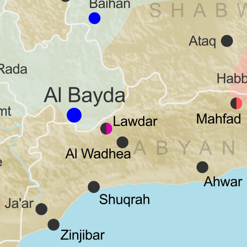
Map of territorial control in Yemen as of September 23, 2016, including territory held by the Houthi rebels and former president Saleh's forces, president-in-exile Hadi and his allies in the Saudi-led coalition and Southern Movement, Al Qaeda in the Arabian Peninsula (AQAP), and the so-called Islamic State (ISIS/ISIL). Includes recent locations of fighting, such as Taiz, Jaar, Zinjibar, Ahwar, and more.
Subscribe for full access to all conflict map reports!

Timeline by Djordje Djukic. Map by Louis Martin-Vézian, Evan Centanni, and Djordje Djukic.

Since our last Yemen control map update almost two months ago, Al Qaeda has lost a large part of its territory in Yemen, even as fighting continues between the Houthis and the Saudi-backed Hadi government.


See all this and more on the newest update to PolGeoNow's Yemen territorial control map, which includes a timeline of changes and important events since our previous Yemen map report in early August.

This map and report are premium professional content, available to paid subscribers of the PolGeoNow Conflict Mapping Service.

Want to see before you buy? Check out our most recent FREE SAMPLE Yemen map report!

Exclusive report includes:
  • Up-to-date map of current territorial control in Yemen, color-coded for the pro-Hadi coalition, Houthi/Saleh forces, Al Qaeda in the Arabian Peninsula (AQAP), and the so-called "Islamic State" (ISIS/ISIL).
  • Color scheme now consistent with Syria, Iraq, and Libya map series
  • Detailed indication of town-by-town control, including provincial boundaries, all major cities, and many smaller ones
  • Markers for recent areas of fighting, including Taiz, Jaar, Zinjibar, Ahwar, and more
  • Timeline of changes to the situation since August 2, 2016, with links to sources

SUBSCRIBERS CLICK HERE TO PROCEED TO ARTICLE AND MAP

Not a member yet? Click here to learn more about our professional subscription service!

Can I purchase just this map?
This map and report are not available for automated purchase to non-subscribers. If you need access or republication rights for only this map report, contact service@polgeonow.com for options.

Wednesday, September 7, 2016

Iraq Control Map & Report: September 2016

There are newer versions of this map available. To see them, view all Iraq updates.

Detailed map of territorial control in Iraq as of September 5, 2016, including territory held by the so-called Islamic State (ISIS, ISIL), the Baghdad government, and the Kurdistan Peshmerga. Includes results of recent fighting around Qaiyarah (Qayyarah) south of Mosul. Color blind accessible.
Basemap by Koen Adams of onestopmap.com, with territorial control by Evan Centanni and Djordje Djukic. All rights reserved.
(Subscribers click here to view this article in the member area.)

Research and timeline by Djordje Djukic

Summary of Recent Events
After recapturing Ramadi from the so-called "Islamic State" (IS; formerly ISIS/ISIL), the Iraqi government and allies have set their sights on Mosul, the largest IS-controlled city, and until a few years ago the second largest city in Iraq (some sources say half or more of its population fled after the IS takeover in 2014). Since our last Iraq control map report at the end of June, the main change to territorial control has been the government capture of Qaiyarah, a town south of Mosul that's still more or less surrounded by IS and Kurdish controlled ground.

Monday, August 29, 2016

Syrian Civil War Control Map & Report: August 2016 (Subscription)

SUBSCRIBERS CLICK HERE TO PROCEED TO ARTICLE AND MAP

There are newer versions of this map available. To see them, view all Syria updates.

Research by Djordje Djukic. Map by onestopmap.com, Evan Centanni, and Djordje Djukic

Subscribe for full access to all conflict map reports!

Map of fighting and territorial control in Syria's Civil War (Free Syrian Army rebels, Kurdish YPG, Syrian Democratic Forces (SDF), Al-Nusra Front, Islamic State (ISIS/ISIL), and others), updated for August 2016. Now includes terrain and major roads (highways). Includes recent locations of conflict and territorial control changes, such as Jarabulus, Manbij, Daraya, Hasakah, and more (color blind accessible). Syria's war has seen several major territorial changes in the past month, with a Turkish military intervention bringing IS defeats even as the rival, Kurdish-led Syrian Democratic Forces have captured key territory from both IS and the Assad government. Meanwhile, the government has scored some major victories of its own against rebel forces.
 
See all this and more on the latest update to PolGeoNow's concise, professional Syrian Civil War control map, which includes a timeline of changes since our previous Syria map report in late July, with sources cited.

This map and report are premium professional content, available to paid subscribers of the PolGeoNow Conflict Mapping Service.

Want to see before you subscribe? Check out our most recent FREE SAMPLE Syria map!

Exclusive report includes:
  • Up-to-date map of current territorial control in Syria, color-coded for the Assad government, rebel groups, "Islamic State" (ISIS/ISIL) fighters, and Kurdish/SDF forces. Color blind accessible.
  • Special symbols indicating towns dominated by rebels of the Nusra Front (now Jabhat Fateh al-Sham) and US-backed Syrian Democratic Forces (SDF).
  • Detailed indication of city-by-city control, including key towns and other locations important to current events.
  • Locations of recent fighting and military operations, including Jarabulus, Manbij, Daraya, Hasakah, and more.
  • Detailed timeline of important events and changes to territorial control since July 25, 2016, compiled by our Syria-Iraq expert, with links to sources.

SUBSCRIBERS CLICK HERE TO PROCEED TO ARTICLE AND MAP

Not signed up yet? Click here to learn more about our professional subscription service!

Can I purchase just this map?
This map and report are not available for automated purchase to non-subscribers. If you need access or republication rights for only this map report, contact service@polgeonow.com for options.

Tuesday, August 2, 2016

Yemen Control Map & Report: August 2016 (Subscription)

MEMBERS CLICK HERE TO PROCEED TO ARTICLE AND MAP

There are newer versions of this map available. To see them, view all Yemen updates.

Map of territorial control in Yemen as of August 2, 2016, including territory held by the Houthi rebels and former president Saleh's forces, president-in-exile Hadi and his allies in the Saudi-led coalition and Southern Movement, Al Qaeda in the Arabian Peninsula (AQAP), and the so-called Islamic State (ISIS/ISIL). Includes recent locations of fighting, such as Taiz, Mukalla, Bayhan, Harad, and more.
Subscribe for full access to all conflict map reports!

Timeline by Djordje Djukic. Map by Louis Martin-Vézian, Evan Centanni, and Djordje Djukic.

In the three months since our previous Yemen map update, Houthi and pro-Hadi forces have continued to trade blows in the south and east, as well as along the border with Saudi Arabia. Meanwhile, Al Qaeda and the so-called "Islamic State" (ISIS/ISIL) have launched attacks in southern cities.


See all this and more on the newest update to PolGeoNow's Yemen territorial control map, which includes a timeline of changes and important events since our previous Yemen map report in February.

This map and report are premium professional content, available to paid subscribers of the PolGeoNow Conflict Mapping Service.

Want to see before you buy? Check out our most recent FREE SAMPLE Yemen map report!

Exclusive report includes:
  • Up-to-date map of current territorial control in Yemen, color-coded for the pro-Hadi coalition, Houthi/Saleh forces, Al Qaeda in the Arabian Peninsula (AQAP), and the so-called "Islamic State" (ISIS/ISIL).
  • Color scheme now consistent with Syria, Iraq, and Libya map series
  • Detailed indication of town-by-town control, including provincial boundaries, all major cities, and many smaller ones
  • Markers for recent areas of fighting, including Taiz, Mukalla, Bayhan, Harad, and more
  • Timeline of changes to the situation since May 1, 2016, with links to sources

MEMBERS CLICK HERE TO PROCEED TO ARTICLE AND MAP

Not a member yet? Click here to learn more about our professional subscription service!

Can I purchase just this map?
This map and report are not available for automated purchase to non-subscribers. If you need access or republication rights for only this map report, contact service@polgeonow.com for options.

Monday, July 25, 2016

Syrian Civil War Control Map & Report: July 2016 (Subscription)

MEMBERS CLICK HERE TO PROCEED TO ARTICLE AND MAP

There are newer versions of this map available. To see them, view all Syria updates.

Research by Djordje Djukic. Map by onestopmap.com, Evan Centanni, and Djordje Djukic

Subscribe for full access to all conflict map reports!

Map of fighting and territorial control in Syria's Civil War (Free Syrian Army rebels, Kurdish YPG, Syrian Democratic Forces (SDF), Al-Nusra Front, Islamic State (ISIS/ISIL), and others), updated for July 2016. Now includes terrain and major roads (highways). Highlights recent locations of conflict and territorial control changes, such as Manbij, Abu Kamal (Al Bukamal), Aleppo, Daraya, Kinsabba and more (color blind accessible). The past month has seen territorial gains both for Syria's Assad government and for rebel forces, while the so-called "Islamic State" (ISIS/ISIL) has mostly held its ground.
 
See all this and more on the latest update to PolGeoNow's concise, professional Syrian Civil War control map, which includes a timeline of changes since our previous Syria map report in late June, with sources cited.

This map and report are premium professional content, available to paid subscribers of the PolGeoNow Conflict Mapping Service.

Want to see before you subscribe? Check out our most recent FREE SAMPLE Syria map!

Exclusive map report includes:
  • Up-to-date map of current territorial control in Syria, color-coded for the Assad government, rebel groups, "Islamic State" (ISIS/ISIL) fighters, and Kurdish/SDF forces (color blind accessible).
  • Special symbols indicating towns dominated by rebels of Al Qaeda affiliate Jabhat al-Nusra (the Nusra Front) and US-backed Syrian Democratic Forces (SDF).
  • Detailed indication of city-by-city control, highlighting key towns and other locations important to current events.
  • Locations of recent fighting and military operations, including Manbij, Abu Kamal (Al Bukamal), Daraya, Kinsabba, and more.
  • Detailed timeline of important events and changes to territorial control since June 26, 2016, compiled by our Syria-Iraq expert, with links to sources.

MEMBERS CLICK HERE TO PROCEED TO ARTICLE AND MAP

Not a member yet? Click here to learn more about our professional subscription service!

Can I purchase just this map?
This map and report are not available for automated purchase to non-subscribers. If you need access or republication rights for only this map report, contact service@polgeonow.com for options.
Friday, July 1, 2016

Iraq Control Map & Report: July 2016 (Subscription)

MEMBERS CLICK HERE TO PROCEED TO ARTICLE AND MAP

There are newer versions of this map available. To see them, view all Iraq updates.

Research by Djordje Djukic. Map by onestopmap.com, Evan Centanni, and Djordje Djukic

Subscribe for full access to all conflict map reports!

Detailed map of territorial control in Iraq as of June 30, 2016, including territory held by the so-called Islamic State (ISIS, ISIL), the Baghdad government, and the Kurdistan Peshmerga. Includes recent flashpoints such as Fallujah, Karma, Saqlawiyah, and Akashat. (color blind accessible) The Iraqi army and allies have driven the so-called "Islamic State" (ISIS/ISIL) out of Fallujah, its last stronghold in central Iraq, even as it continues to lose ground on other fronts.
 
See all this and more on the latest update to PolGeoNow's concise, professional map of control in Iraq's civil war, including a timeline of changes since our previous Iraq map report of May 2016.

This map and report are premium professional content, available to paid subscribers of the PolGeoNow Conflict Mapping Service.

Want to see before you subscribe? Check out our most recent FREE SAMPLE Iraq map report!

Exclusive map report includes:
  • Up-to-date map of current territorial control in Iraq, color-coded for the Iraqi government, "Islamic State" (ISIS/ISIL) extremists, and Kurdistan's Peshmerga forces
  • Detailed indication of town-by-town control, including provincial boundaries, all major cities, and many smaller ones
  • Markers for key areas of recent fighting such as Fallujah, Karma, Saqlawiyah, and Akashat
  • Timeline of changes to the situation since mid-May, compiled by our Iraq specialist, with links to sources 
  • New since last year: Terrain shading and major highways included on map for geographic context

MEMBERS CLICK HERE TO PROCEED TO ARTICLE AND MAP

Not a member yet? Click here to learn more about our professional subscription service!

Can I purchase just this map?
This map and report are not available for automated purchase to non-subscribers. If you need access or republication rights for only this map report, contact service@polgeonow.com for options.

Tuesday, June 28, 2016

Syrian Civil War Control Map & Report: June 2016 (Subscription)

MEMBERS CLICK HERE TO PROCEED TO ARTICLE AND MAP

There are newer versions of this map available. To see them, view all Syria updates.

Research by Djordje Djukic. Map by onestopmap.com, Evan Centanni, and Djordje Djukic

Subscribe for full access to all conflict map reports!

Map of fighting and territorial control in Syria's Civil War (Free Syrian Army rebels, Kurdish YPG, Syrian Democratic Forces (SDF), Al-Nusra Front, Islamic State (ISIS/ISIL), and others), updated for June 2016. Now includes terrain and major roads (highways). Highlights recent locations of conflict and territorial control changes, such as Manbij, Mare, Tanf border crossing, Thawra/Tabqa, Arak, and more. A lot has happened in Syria in the past month, with major SDF and Syrian Army advances against the so-called "Islamic State" (ISIS/ISIL), as well as various smaller changes to rebel control.
 
See all this and more on the latest update to PolGeoNow's concise, professional Syrian Civil War control map, which includes a timeline of changes since our previous Syria map report in mid-May.

This map and report are premium professional content, available to paid subscribers of the PolGeoNow Conflict Mapping Service.

Want to see before you subscribe? Check out our most recent FREE SAMPLE Syria map!

Exclusive map report includes:
  • Up-to-date map of current territorial control in Syria, color-coded for the Assad government, rebel groups, "Islamic State" (ISIS/ISIL) extremists, and Kurdish/SDF forces. 
  • Special symbols indicating towns dominated by rebels of Al Qaeda affiliate Jabhat al-Nusra (the Nusra Front) and US-backed Syrian Democratic Forces (SDF).
  • Detailed indication of city-by-city control, highlighting key towns and other locations important to current events.
  • Locations of recent fighting and military operations, including Manbij, Thawra (Tabqa), Mare, Tanf border crossing, Arak, and more.
  • Detailed timeline of important events and changes to territorial control since May 13, 2016, compiled by our Syria-Iraq expert, with links to sources.

MEMBERS CLICK HERE TO PROCEED TO ARTICLE AND MAP

Not a member yet? Click here to learn more about our professional subscription service!

Can I purchase just this map?
This map and report are not available for automated purchase to non-subscribers. If you need access or republication rights for only this map report, contact service@polgeonow.com for options.

Thursday, May 19, 2016

Iraq Control Map & Report: May 2016 (Subscription)

MEMBERS CLICK HERE TO PROCEED TO ARTICLE AND MAP

There are newer versions of this map available. To see them, view all Iraq updates.

Research by Djordje Djukic. Map by onestopmap.com, Evan Centanni, and Djordje Djukic

Subscribe for full access to all conflict map reports!

Detailed map of territorial control in Iraq as of May 17, 2016, including territory held by the so-called Islamic State (ISIS, ISIL), the Baghdad government, and the Kurdistan Peshmerga. Includes recent flashpoints such as Rutbah, Doulab, Tuz Khurmatu, and more. The past month has seen several small victories of Iraqi government forces against the so-called "Islamic State" (ISIS/ISIL), as well as a handful of other notable territorial events.
 
See all this and more on the latest update to PolGeoNow's concise, professional map of control in Iraq's civil war, including a timeline of changes since our previous Iraq map report of April 2016.

This map and report are premium professional content, available to paid subscribers of the PolGeoNow Conflict Mapping Service.

Want to see before you subscribe? Check out our most recent FREE SAMPLE Iraq map report!

Exclusive map report includes:
  • New since last year: Terrain shading and major highways included on map for geographic context
  • Up-to-date map of current territorial control in Iraq, color-coded for the Iraqi government, "Islamic State" (ISIS/ISIL) extremists, and Kurdistan's Peshmerga forces
  • Detailed indication of town-by-town control, including provincial boundaries, all major cities, and many smaller ones
  • Markers for key areas of recent fighting such as Rutbah, Doulab, Tuz Khurmatu, and more
  • Timeline of changes to the situation since mid-April, compiled by our Iraq specialist, with links to sources

MEMBERS CLICK HERE TO PROCEED TO ARTICLE AND MAP

Not a member yet? Click here to learn more about our professional subscription service!

Can I purchase just this map?
This map and report are not available for automated purchase to non-subscribers. If you need access or republication rights for only this map report, contact service@polgeonow.com for options.
Sunday, May 15, 2016

Syrian Civil War Control Map & Report: May 2016 (Subscription)

MEMBERS CLICK HERE TO PROCEED TO ARTICLE AND MAP

There are newer versions of this map available. To see them, view all Syria updates.

Research by Djordje Djukic. Map by onestopmap.com, Evan Centanni, and Djordje Djukic

Subscribe for full access to all conflict map reports!

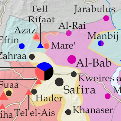
Map of fighting and territorial control in Syria's Civil War (Free Syrian Army rebels, Kurdish YPG, Syrian Democratic Forces (SDF), Al-Nusra Front, Islamic State (ISIS/ISIL), and others), updated for March 2016. Now includes terrain and major roads (highways). Highlights recent locations of conflict and territorial control changes, such as Daraa, Khanaser, Tell Rifaat, Shadadi, the Aleppo Power Plant, and more. The so-called "Islamic State" (ISIS/ISIL) has lost control of several towns in Syria over the past month and a half, but has also scored some victories. Meanwhile, a partial breakdown in the UN-brokered ceasefire has resulted in resumed fighting between government and rebel forces in the Aleppo area.
 
See all this and more on the latest update to PolGeoNow's concise, professional Syrian Civil War control map, which includes a timeline of changes since our previous Syria map report at the end of March.

This map and report are premium professional content, available to paid subscribers of the PolGeoNow Conflict Mapping Service.

Want to see before you subscribe? Check out our most recent FREE SAMPLE Syria map!

Exclusive map report includes:
  • Up-to-date map of current territorial control in Syria, color-coded for the Assad government, rebel groups, "Islamic State" (ISIS/ISIL) extremists, and Kurdish/SDF forces. 
  • Special symbols indicating towns dominated by rebels of Al Qaeda affiliate Jabhat al-Nusra (the Nusra Front) and by multi-ethnic anti-ISIS Syrian Democratic Forces (SDF).
  • Detailed indication of city-by-city control, highlighting key towns and other locations important to current events.
  • Locations of recent fighting and military operations, including Qaryatain, Al-Rai, Shaer gas field, and more.
  • Detailed timeline of important events and changes to territorial control since March 31, 2016, compiled by our Syria-Iraq expert, with links to sources.

MEMBERS CLICK HERE TO PROCEED TO ARTICLE AND MAP

Not a member yet? Click here to learn more about our professional subscription service!

Can I purchase just this map?
This map and report are not available for automated purchase to non-subscribers. If you need access or republication rights for only this map report, contact service@polgeonow.com for options.

Monday, May 2, 2016

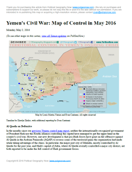
Yemen Control Map & Report: May 2016 (Subscription)

MEMBERS CLICK HERE TO PROCEED TO ARTICLE AND MAP

There are newer versions of this map available. To see them, view all Yemen updates.

Map of territorial control in Yemen as of May 1, 2016, including territory held by the Houthi rebels and former president Saleh's forces, president-in-exile Hadi and his allies in the Saudi-led coalition and Southern Movement, Al Qaeda in the Arabian Peninsula (AQAP), and the so-called Islamic State (ISIS/ISIL). Includes recent locations of fighting, such as Taiz, Aden, Houta, Mukalla, and more.
Subscribe for full access to all conflict map reports!

Download PDF:
Buy now
New discounted price!
Timeline by Djordje Djukic. Map by Louis Martin-Vézian, Evan Centanni, and Djordje Djukic

In the months since our previous Yemen control map report, Al Qaeda has lost some of its most important territory in Yemen, including a major city it's held for the past year. Fighting has also continued between the Hadi government and the Houthi alliance, despite attempts at a ceasefire. 


See all this and more on the newest update to PolGeoNow's Yemen territorial control map, which includes a timeline of changes and important events since our previous Yemen map report in February.

This map and report are exclusive premium content, available to paid subscribers or for individual purchase. Download PDF (US$14.99) New discounted price!

Want to see before you buy? Check out our most recent FREE SAMPLE Yemen map report!

Exclusive report includes:

Map of territorial control in Yemen as of May 1, 2016, including territory held by the Houthi rebels and former president Saleh's forces, president-in-exile Hadi and his allies in the Saudi-led coalition and Southern Movement, Al Qaeda in the Arabian Peninsula (AQAP), and the so-called Islamic State (ISIS/ISIL). Includes recent locations of fighting, such as Taiz, Aden, Houta, Mukalla, and more.
  • Up-to-date map of current territorial control in Yemen, color-coded for the pro-Hadi coalition, Houthi/Saleh forces, Al Qaeda in the Arabian Peninsula (AQAP), and the so-called "Islamic State" (ISIS/ISIL).
  • Color scheme recently updated for consistency with Syria, Iraq, and Libya map series
  • Detailed indication of town-by-town control, including provincial boundaries, all major cities, and many smaller ones
  • Markers for recent areas of fighting, including Taiz, Mukalla, Harib, Ghayl Ba Wazir, and more
  • Timeline of changes to the situation since February 19, 2016, with links to sources

MEMBERS CLICK HERE TO PROCEED TO ARTICLE AND MAP

Not a member yet? Learn more about our professional subscription service!

Thursday, April 14, 2016

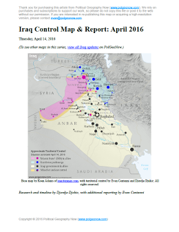
Iraq Control Map & Report: April 2016 (Subscription)

SUBSCRIBERS CLICK HERE TO PROCEED TO ARTICLE AND MAP

There are newer versions of this map available. To see them, view all Iraq updates.

Research by Djordje Djukic. Map by onestopmap.com, Evan Centanni, and Djordje Djukic

Subscribe for full access to all conflict map reports!

Download PDF:
Buy now
New discounted price!
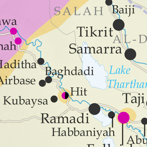
Detailed map of territorial control in Iraq's ongoing war as of April 14, 2016, including territory held by the so-called Islamic State (ISIS, ISIL), the Baghdad government, and the Kurdistan Peshmerga. Includes recent flashpoints including Ramadi, Hit, Bashir, and more. New: Improved map now includes terrain and major roads!

The past four months have seen two significant victories for Iraqi government forces over the so-called "Islamic State" (ISIS/ISIL), despite floundering attempts to retake the city of Mosul.
 
See all this and more on the latest update to PolGeoNow's concise, professional map of control in Iraq's civil war, including a timeline of changes since our previous Iraq map report in December 2015.

This map and report are professional subscriber content, available to paid members or for separate purchase. Download PDF (US$14.99) New discounted price!

Want to see before you buy? Check out our most recent FREE SAMPLE Iraq map report!

Exclusive map report includes:
Detailed map of territorial control in Iraq's ongoing war as of April 14, 2016, including territory held by the so-called Islamic State (ISIS, ISIL), the Baghdad government, and the Kurdistan Peshmerga. Includes recent flashpoints including Ramadi, Hit, Bashir, and more.
  • New since last time: Terrain shading and major highways included on map for geographic context
  • Up-to-date map of current territorial control in Iraq, color-coded for the Iraqi government, "Islamic State" (ISIS/ISIL) extremists, and Kurdistan's Peshmerga forces
  • Detailed indication of town-by-town control, including provincial boundaries, all major cities, and many smaller ones
  • Markers for key areas of recent fighting such as Ramadi, Hit, Bashir, and more
  • Timeline of changes to the situation since December, compiled by our Iraq specialist, with links to sources 
Note: Republishing rights are not included with PDF purchases or basic subscriptions. If you need to use one of our maps in print or online, please contact service@polgeonow.com.

SUBSCRIBERS CLICK HERE TO PROCEED TO ARTICLE AND MAP

NON-MEMBERS: PURCHASE MAP REPORT

Not a member yet? Click here to learn about our professional subscription service!


Thursday, March 31, 2016

Syrian Civil War Control Map: April 2016

There are newer versions of this map available. To see them, view all Syria updates.

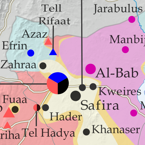
Map of fighting and territorial control in Syria's Civil War (Free Syrian Army rebels, Kurdish YPG, Syrian Democratic Forces (SDF), Al-Nusra Front, Islamic State (ISIS/ISIL), and others), updated for the beginning of April 2016. Now includes terrain and major roads (highways). Highlights recent locations of conflict and territorial control changes, including Palmyra, Qaryatayn, Deir Ez-Zor, and more. (Color blind accessible.)
Base map by Koen Adams of onestopmap.com, with territorial control by Evan Centanni and Djordje Djukic. All rights reserved.
Subscribers click here to view this article in the ad-free members area. Not a member yet? Learn about PolGeoNow subscriptions!

Timeline by Djordje Djukic

Recapture of Palmyra
Since our previous Syria control map report in early March, the Syrian government of Bashar al-Assad has recaptured the historic city of Palmyra (known in modern Arabic as Tadmur) from the so-called "Islamic State" (IS, formerly known as ISIS/ISIL). The military has also pushed back against IS in Qaryatain, one of the group's westernmost outposts, even as IS is showing an increasingly prominent presence in the southwestern corner of Syria near the Golan Heights. Meanwhile, fighting between government and anti-Assad rebel forces has continued, though at a relatively low level, since the implementation of the UN-brokered ceasefire.

Wednesday, March 9, 2016

Syrian Civil War Control Map: March 2016 (Subscription)

MEMBERS CLICK HERE TO PROCEED TO ARTICLE AND MAP

There are newer versions of this map available. To see them, view all Syria updates.

Research by Djordje Djukic. Map by onestopmap.com, Evan Centanni, and Djordje Djukic

Subscribe for full access to all conflict map reports!

Download PDF:
Buy now
New discounted price!
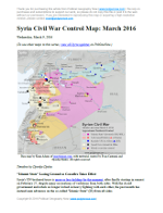
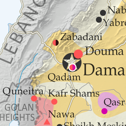
Map of fighting and territorial control in Syria's Civil War (Free Syrian Army rebels, Kurdish YPG, Syrian Democratic Forces (SDF), Al-Nusra Front, Islamic State (ISIS/ISIL), and others), updated for March 2016. Now includes terrain and major roads (highways). Highlights recent locations of conflict and territorial control changes, such as Daraa, Khanaser, Tell Rifaat, Shadadi, the Aleppo Power Plant, and more. New: Improved map now includes terrain and major roads!

With Syria's UN-brokered truce partially holding, government, Kurdish, and rebel forces alike have turned their attention to carving away territory from the so-called "Islamic State" (ISIS/ISIL). However, the rebels also sustained some losses to government forces prior to the ceasefire taking effect.
 
See all this and more on the latest update to PolGeoNow's concise, professional Syrian Civil War control map, which includes a timeline of changes since our previous Syria map report in early February.

This map and report are professional subscriber content, available to paid members or for separate purchase. Download PDF (US$14.99) New discounted price!

Want to see before you buy? Check out our most recent FREE SAMPLE Syria map!

Exclusive map report includes:
Map of fighting and territorial control in Syria's Civil War (Free Syrian Army rebels, Kurdish YPG, Syrian Democratic Forces (SDF), Al-Nusra Front, Islamic State (ISIS/ISIL), and others), updated for March 2016. Now includes terrain and major roads (highways). Highlights recent locations of conflict and territorial control changes, such as Daraa, Khanaser, Tell Rifaat, Shadadi, the Aleppo Power Plant, and more.
  • New since last year: Terrain shading and major highways included on map for geographic context!
  • Up-to-date map of current territorial control in Syria, color-coded for the Assad government, rebel groups, "Islamic State" (ISIS/ISIL) extremists, and Kurdish/SDF forces. 
  • Special symbols indicate towns dominated by rebels of Al Qaeda affiliate Jabhat al-Nusra (the Nusra Front) and by multi-ethnic anti-ISIS Syrian Democratic Forces (SDF).
  • Detailed indication of city-by-city control, highlighting key towns and other locations important to current events.
  • Locations of recent fighting and military operations, including Daraa, Khanaser, Tell Rifaat, Shadadi, the Aleppo Power Plant, and more.
  • Detailed timeline of important events and changes to territorial control since February 10, 2016, compiled by our Syria-Iraq expert, with links to sources.

MEMBERS CLICK HERE TO PROCEED TO ARTICLE AND MAP

Not a member yet? Click here to learn more about our professional subscription service!


Friday, February 19, 2016

Map of Control in Yemen's Civil War: February 2016 (Subscription)

MEMBERS CLICK HERE TO PROCEED TO ARTICLE AND MAP

There are newer versions of this map available. To see them, view all Yemen updates.

Map of territorial control in Yemen as of February 19, 2016, including territory held by the Houthi rebels and former president Saleh's forces, president-in-exile Hadi and his allies in the Saudi-led coalition and Southern Movement, Al Qaeda in the Arabian Peninsula (AQAP), and the so-called Islamic State (ISIS/ISIL). Includes recent areas of Al Qaeda takeovers and locations of other fighting, such as Shuqrah, Azzan, Habban, Ahwar, Misrakh, Fardat Nahm, and more.
Subscribe for full access to all conflict map reports!

Download PDF:
Buy now
New discounted price!
Timeline by Djordje Djukic, with additional reporting by Evan Centanni; map by Louis Martin-Vézian and Evan Centanni

Though it's been less than three weeks since our last Yemen control map update, there have already been several changes to territorial control. Most notably, Al Qaeda in the Arabian Peninsula (AQAP) has rapidly expanded its territory, recapturing most of the towns it held from 2011 to 2012.

Meanwhile, the Saudi-led coalition supporting President Hadi has also made progress against the Houthi rebels over the past weeks.


See all this and more on the newest update to PolGeoNow's Yemen territorial control map, which includes a timeline of changes and important events since our previous Yemen map report at the end of January.

This map and report are exclusive premium content, available to paid subscribers or for individual purchase. Download PDF (US$14.99) New discounted price!

Want to see before you buy? Check out our most recent FREE SAMPLE Yemen map report!

Exclusive map report includes:
Map of territorial control in Yemen as of February 19, 2016, including territory held by the Houthi rebels and former president Saleh's forces, president-in-exile Hadi and his allies in the Saudi-led coalition and Southern Movement, Al Qaeda in the Arabian Peninsula (AQAP), and the so-called Islamic State (ISIS/ISIL). Includes recent areas of Al Qaeda takeovers and locations of other fighting, such as Shuqrah, Azzan, Habban, Ahwar, Misrakh, Fardat Nahm, and more.
  • Up-to-date map of current territorial control in Yemen, color-coded for the pro-Hadi coalition, Houthi/Saleh forces, Al Qaeda in the Arabian Peninsula (AQAP), and "Islamic State" (ISIS/ISIL).
  • Color scheme recently updated for consistency with Syria, Iraq, and Libya map series
  • Detailed indication of town-by-town control, including provincial boundaries, all major cities, and many smaller ones
  • Markers for recent areas of Al Qaeda takeovers and locations of other fighting, such as Shuqrah, Azzan, Habban, Ahwar, Misrakh, Fardat Nahm, and more
  • Timeline of changes to the situation since January 31 2016, with links to sources

MEMBERS CLICK HERE TO PROCEED TO ARTICLE AND MAP

Not a member yet? Click here to learn more about our professional subscription service!

Wednesday, February 17, 2016

Map: Which Countries Recognize Palestine as Independent in 2016?

(Keep up with changes to Palestine's situation: view all Palestine updates.)

Map of countries that recognize the State of Palestine as an independent country, updated for February 2016 with recent addition Saint Lucia highlighted
Click to enlarge. Palestine in magenta (circled). Map by Evan Centanni, modified from public domain graphic (source).
Subscribers click here to view this article in the ad-free members area. Not a member yet? Learn about PolGeoNow subscriptions!

Thursday, February 11, 2016

Syrian Civil War Control Map: February 2016 (Subscription)

MEMBERS CLICK HERE TO PROCEED TO ARTICLE AND MAP

There are newer versions of this map available. To see them, view all Syria updates.

Research by Djordje Djukic. Map by onestopmap.com and Evan Centanni.

Subscribe for full access to all conflict map reports!

Download PDF:
Buy now
New discounted price!
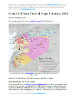
Map of fighting and territorial control in Syria's Civil War (Free Syrian Army rebels, Kurdish YPG, Syrian Democratic Forces (SDF), Al-Nusra Front, Islamic State (ISIS/ISIL), and others), updated for February 2016. Now includes terrain and major roads (highways). Highlights recent locations of conflict and territorial control changes, such as Menagh airbase, northern Aleppo, Salma, Rabia, Nubl, Baghaliya, Tishrin Dam, and more. New: Improved map now includes terrain and major roads!

As a UN-brokered truce approached, tables were beginning to turn in Syria, with the government's Russian-backed offensive making major breakthroughs against rebel forces in Aleppo, Latakia, and elsewhere. 

Meanwhile, the so-called "Islamic State" (ISIS) continued to hold vast tracts of the country, while Kurdish-led forces gradually expanded their control in victories against ISIS and rebel fighters alike.

See all this and more on the newest update to PolGeoNow's concise, professional Syrian Civil War control map, which includes a timeline of changes since our previous Syria map report in mid-December.

This map and report are professional subscriber content, available to paid members or for separate purchase. Download PDF (US$14.99) New discounted price!

Want to see before you buy? Check out our most recent FREE SAMPLE Syria map!

Exclusive map report includes:
Map of fighting and territorial control in Syria's Civil War (Free Syrian Army rebels, Kurdish YPG, Syrian Democratic Forces (SDF), Al-Nusra Front, Islamic State (ISIS/ISIL), and others), updated for February 2016. Now includes terrain and major roads (highways). Highlights recent locations of conflict and territorial control changes, such as Menagh airbase, northern Aleppo, Salma, Rabia, Nubl, Baghaliya, Tishrin Dam, and more.
  • New in this edition: Terrain shading and major highways included on map for geographic context!
  • Up-to-date map of current territorial control in Syria, color-coded for the Assad government, rebel groups, "Islamic State" (ISIS/ISIL) extremists, and Kurdish YPG forces. 
  • Special symbols indicate towns dominated by rebels of Al Qaeda affiliate Jabhat al-Nusra (the Nusra Front) and by multi-ethnic anti-ISIS Syrian Democratic Forces (SDF).
  • Detailed indication of city-by-city control, highlighting key towns and other locations important to current events.
  • Locations of recent fighting and military operations, including Menagh airbase, Aleppo, Salma, Rabia, Nubl, Baghaliya, Tishrin Dam, and more.
  • Detailed timeline of important events and changes to territorial control since December 9, 2015, compiled by our Syria-Iraq expert, with links to sources.

MEMBERS CLICK HERE TO PROCEED TO ARTICLE AND MAP

Not a member yet? Click here to learn more about our professional subscription service!


Sunday, January 31, 2016

Yemen Civil War Control Map: January 2016 (Subscription)

MEMBERS CLICK HERE TO PROCEED TO ARTICLE AND MAP

There are newer versions of this map available. To see them, view all Yemen updates.

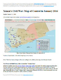
Map of territorial control in Yemen as of January 31, 2016, including territory held by the Houthi rebels and former president Saleh's forces, president-in-exile Hadi and his allies in the Saudi-led coalition and Southern Movement, Al Qaeda in the Arabian Peninsula (AQAP), and the so-called Islamic State (ISIS/ISIL). Includes recent areas of fighting, such as Aden, the Bab al-Mandeb Strait, Dhubab, Hanish Island, Harad, Maydee, Mukallah, and more.
Subscribe for full access to all conflict map reports!

Download PDF:
Buy now
Timeline by Djordje Djukic, with additional reporting by Evan Centanni; map by Louis Martin-Vézian and Evan Centanni

In the two months since our previous Yemen control map update, the Saudi-led coalition supporting President Hadi has opened new fronts against both the rival Houthis and Al Qaeda, using its naval forces to capture islands and seaports along Yemen's coast while also advancing across the border from Saudi Arabia for the first time. 

Meanwhile, the so-called "Islamic State" organization (formerly ISIS/ISIL), based in Iraq and Syria, has for the first time been alleged to control territory in Yemen.

See all this and more on the newest update to PolGeoNow's Yemen territorial control map, which includes a timeline of changes and important events since our previous Yemen map report in November.

This map and report are exclusive premium content, available to paid subscribers or for individual purchase. Download PDF (US$19.99)

Want to see before you buy? Check out our most recent FREE SAMPLE Yemen map report!

Exclusive map report includes:
  • Up-to-date map of current territorial control in Yemen, color-coded for the pro-Hadi coalition, Houthi/Saleh forces, Al Qaeda in the Arabian Peninsula (AQAP), and "Islamic State" (ISIS/ISIL).
  • Color scheme newly updated for consistency with Syria, Iraq, and Libya map series
  • Detailed indication of town-by-town control, including provincial boundaries, all major cities, and many smaller ones
  • Markers for key areas of recent fighting such as Aden, the Bab al-Mandeb Strait, Dhubab, Hanish Island, Harad, Maydee, Mukallah, and more
  • Timeline of changes to the situation since November 2015, with links to sources

MEMBERS CLICK HERE TO PROCEED TO ARTICLE AND MAP

Not a member yet? Click here to learn more about our professional subscription service!