 (To see other maps in this series, view all Afghanistan updates.)
Welcome to PolGeoNow's new series of Afghanistan control maps! In the coming months, we'll publish more maps and timelines spanning the gap between 2015 and 2019, leading into routine updates of the current situation. To secure your access to all future installments, sign up now for our professional conflict map subscription service!
 |
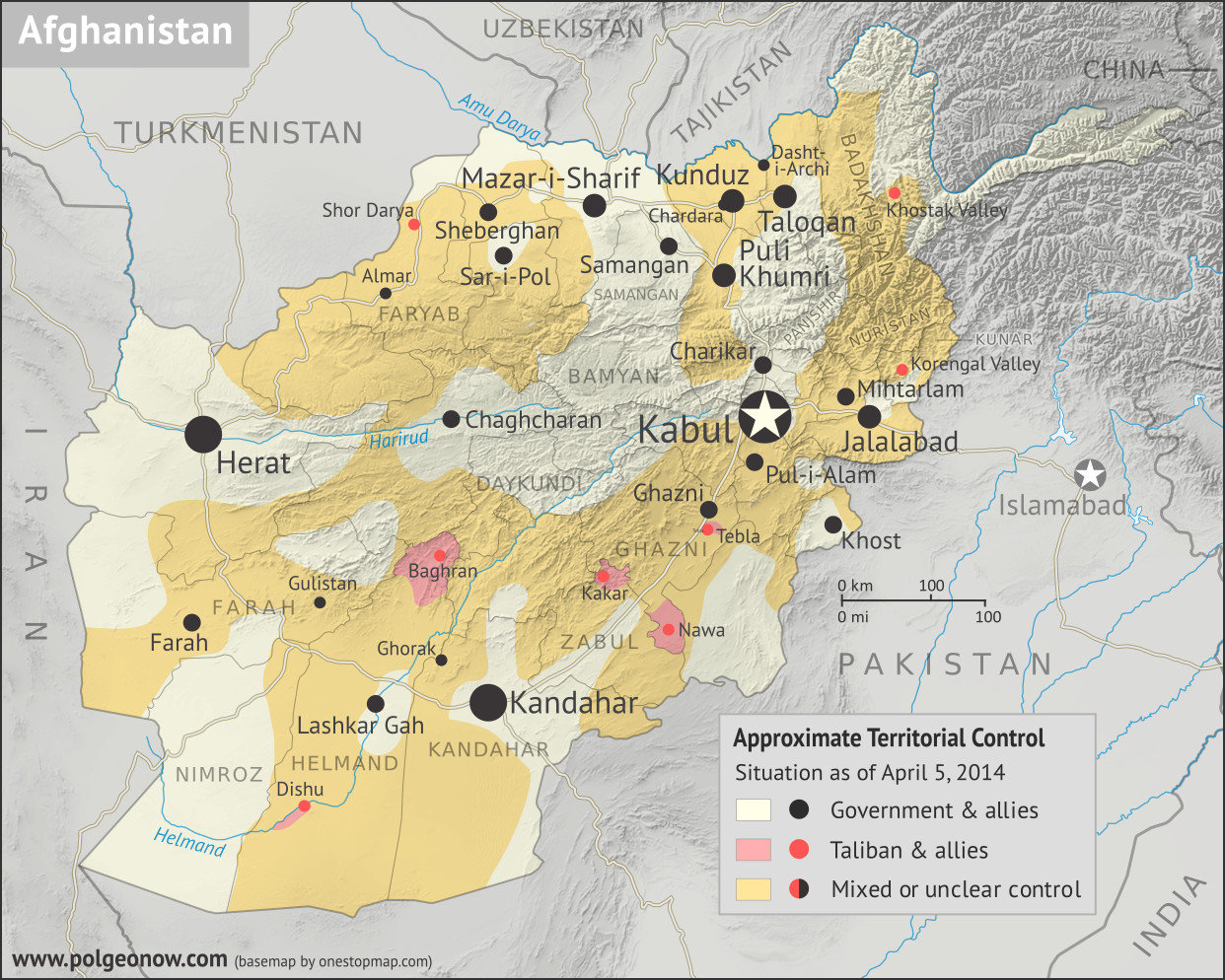
Basemap by Koen Adams of onestopmap.com, with territorial control by Evan Centanni.
Contact us for permission to use this map. |
(Subscribers click here to view this article on the member site)
Timeline by Evan Centanni
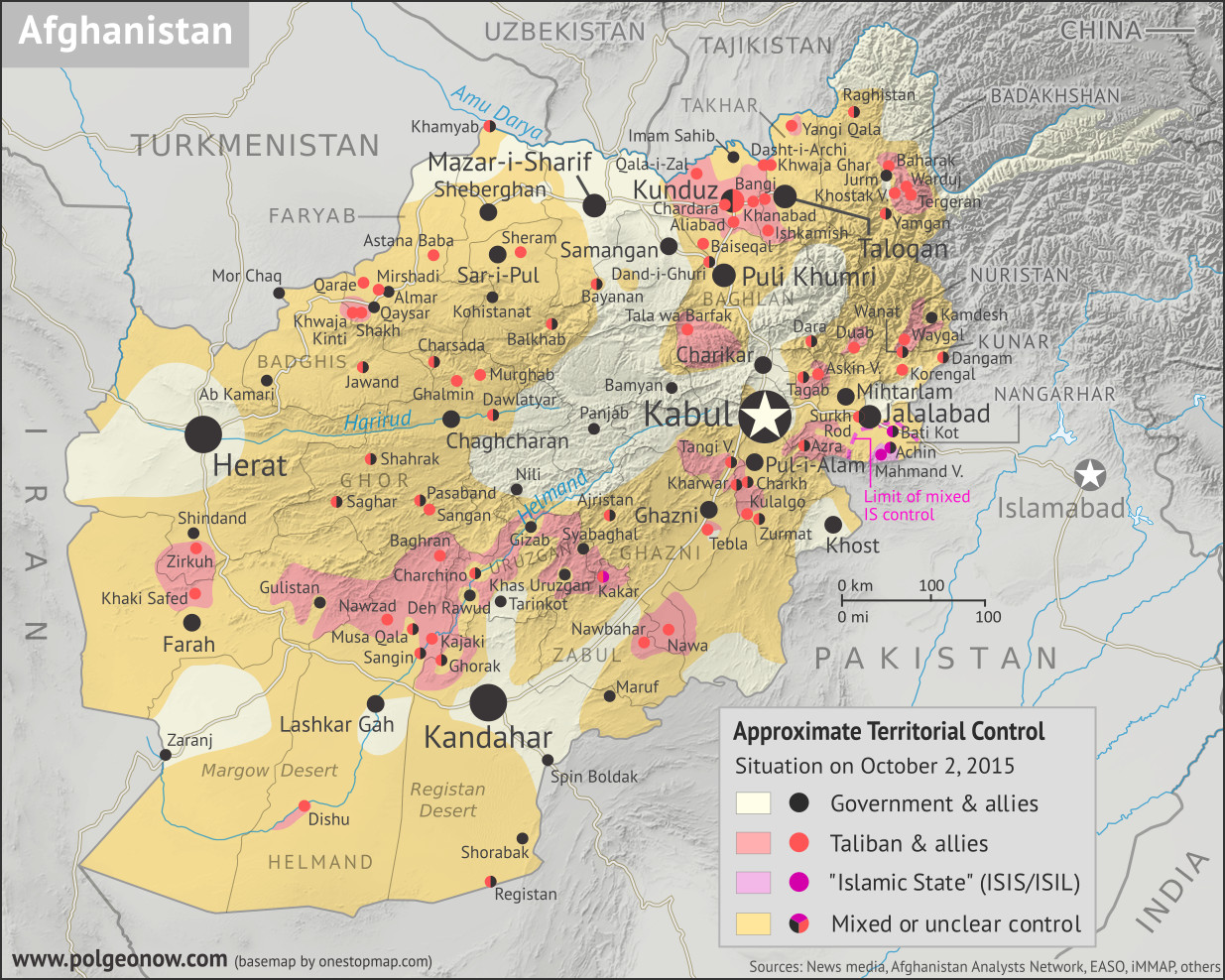
Afghanistan: Who Controlled What in 2015?
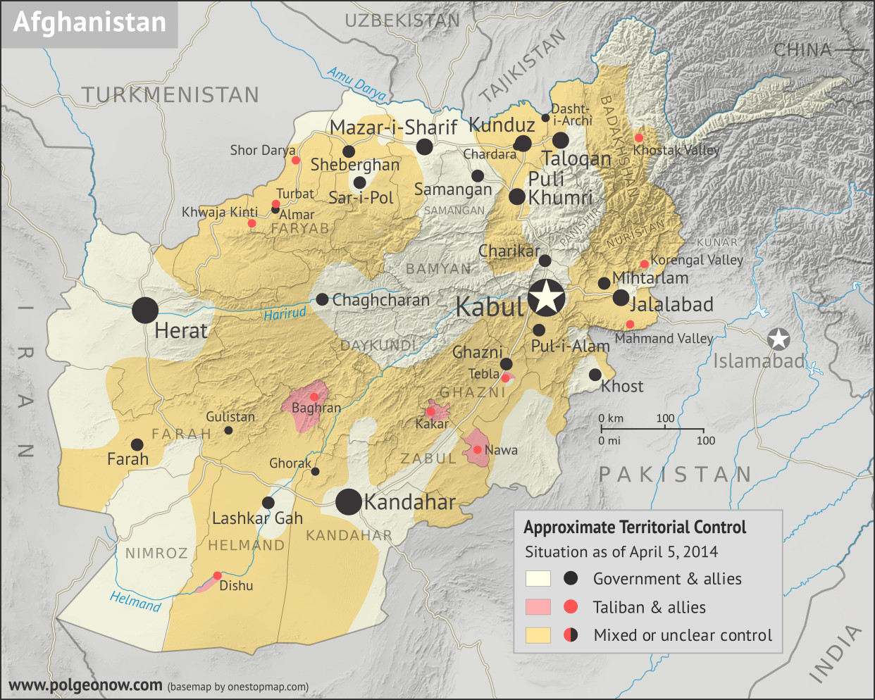
The date is October 2, 2015. In the year and a half since the low point of Taliban control shown in our
April 2014 Afghanistan map, the rebel group has been steadily expanding its territory. Most recently, the Taliban have launched a surprise takeover of Kunduz city, one of northern Afghanistan's major population centers, and the first provincial capital they've controlled since their national government was overthrown in 2001. Meanwhile, as the current government pours all its resources into taking the city back, the Taliban take advantage of the chaos to seize control of various other districts across the Afghan countryside.
Meanwhile, the so-called "Islamic State" (IS; formerly ISIS/ISIL), based thousands of kilometers to the west in Iraq and Syria, has established a formidable new branch in Afghanistan. This IS affiliate - known officially as "Khorasan Province" - has carved out a small territory of its own in Nangarhar, along the border with Pakistan, and is now reaching what will be the height of its power in Afghanistan. Though both IS and the Taliban are religious hardliners, IS's brutal tactics, largely foreign membership, and claimed superiority have made it an enemy of the Taliban, and left it with very little support among the Afghan people.


