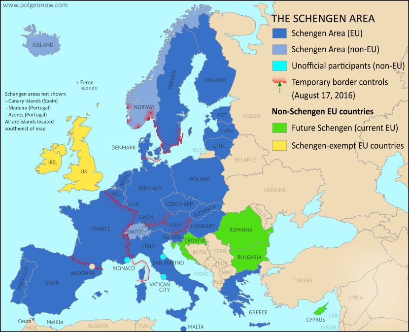
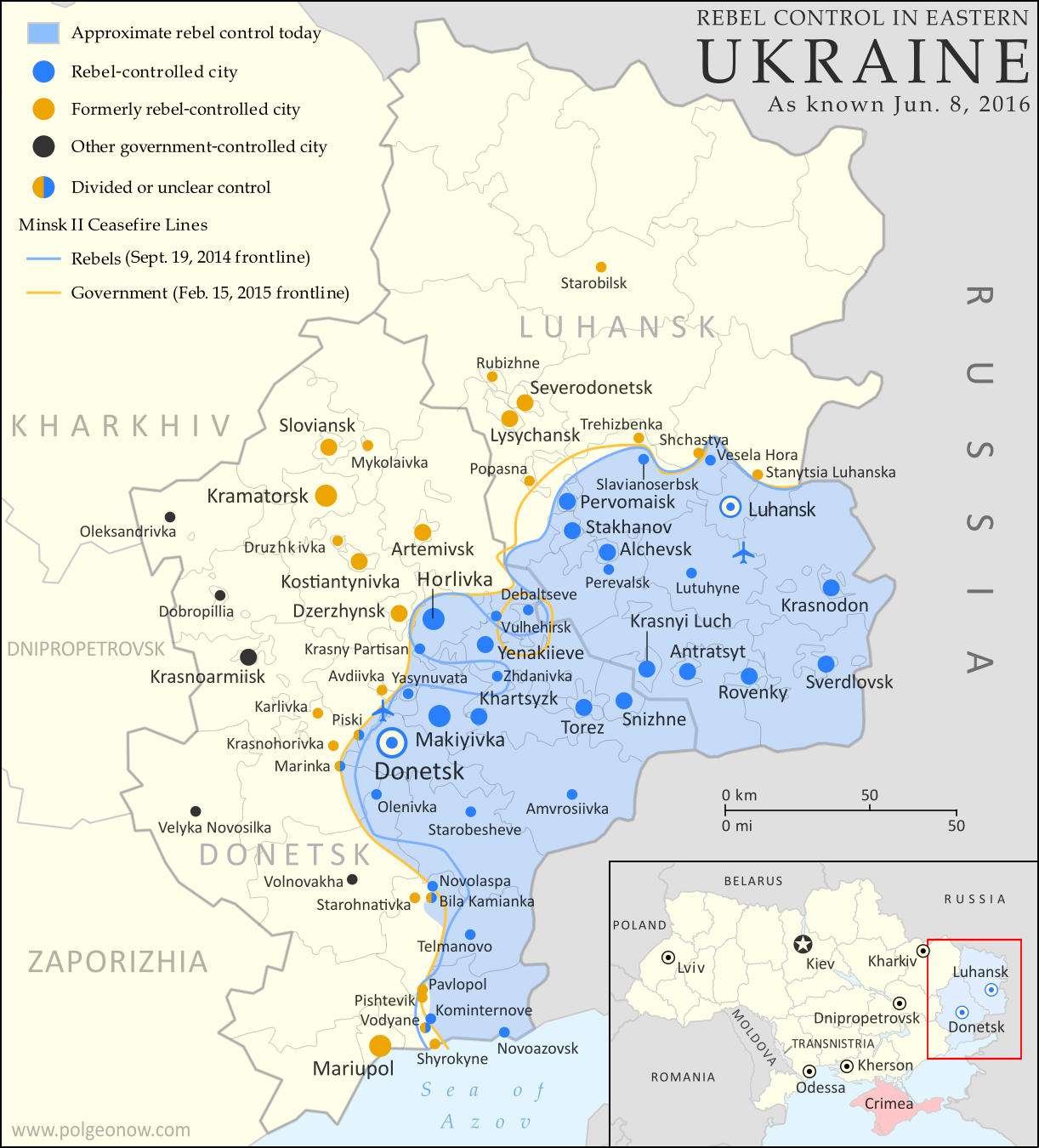
 |
Base map by Koen Adams of onestopmap.com, with territorial control by Evan Centanni and Djordje Djukic.
All rights reserved. |
Timeline by Djordje Djukic, with additional reporting by Evan Centanni
Situation Summary
In the past month since our previous Syrian Civil War map update, fighting has focused largely on the ongoing battle for the city of Aleppo, where rebels control a large enclave in the east, as well as a three-way fight for control of Al-Bab, the largest town in the countryside east of Aleppo (at least, according to pre-war census figures). Held for nearly three years by the so-called "Islamic State" (IS; formerly ISIS/ISIL), Al-Bab is now the target of both the Turkish-backed Free Syrian Army (FSA) rebels and the US-backed Syrian Democratic Forces (SDF) coalition led by Kurdish militias. The SDF has also made progress toward the IS capital of Raqqah in the east, while the Syrian Army of President Bashar al-Assad is making slow progress against rebels in the west of the country.


