There are newer versions of this map available. To see them, view all Ukraine articles on PolGeoNow.
Research by Djordje Djukic. Map by Evan Centanni and Djordje Djukic
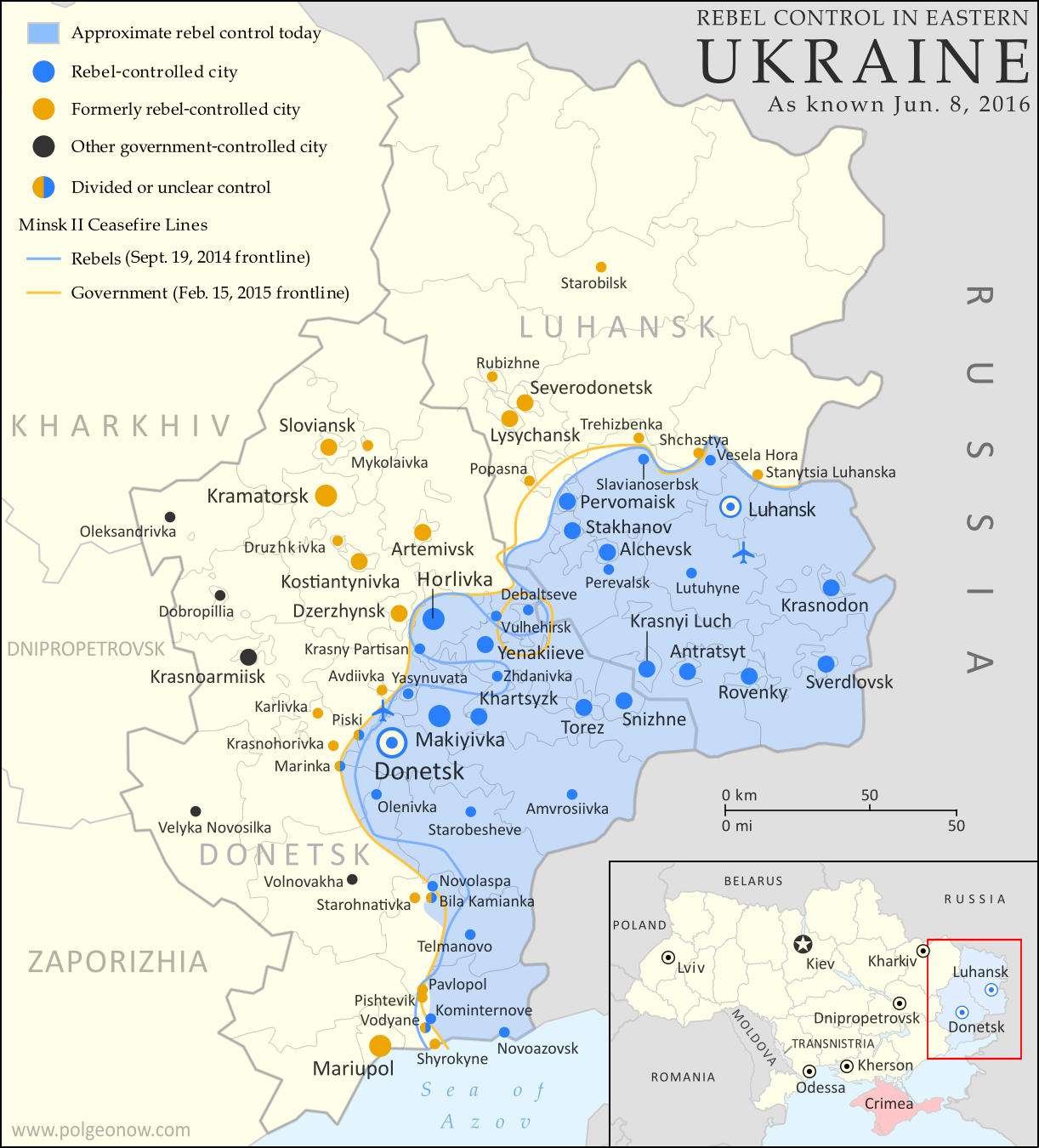
 One month into the Russian invasion of Ukraine, forces of the Ukrainian government have managed to recapture some
ground from Russia. However, Russian troops have made smaller, but still
significant, advances along other fronts, such as within the port city
of Mariupol.
One month into the Russian invasion of Ukraine, forces of the Ukrainian government have managed to recapture some
ground from Russia. However, Russian troops have made smaller, but still
significant, advances along other fronts, such as within the port city
of Mariupol. See all this and more on the latest update to PolGeoNow's concise, professional Ukraine war control map, which includes a timeline of changes since our previous Ukraine map report of March 15, with sources cited.
This map and report are premium content, available to paid subscribers of the PolGeoNow Conflict Mapping Service.
Want to see before you subscribe? Check out our most recent FREE SAMPLE Ukraine map!
Exclusive map report includes:
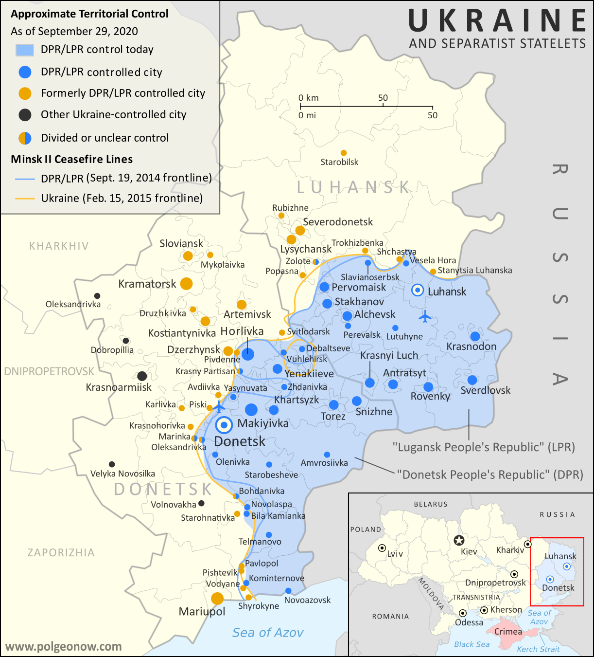
- Up-to-date illustration of current territorial control in Ukraine, color-coded for the Ukrainian government on one side and the Russian military and allied rebels on the other side, with areas of uncertainty indicated. Colorblind accessible.
- Darker color indicating which areas were already under Russian or allied control before the 2022 invasion began
- Claimed borders of the Russia-backed, self-proclaimed Donetsk People's Republic and Lugansk People's Republic in the eastern Donbass region.
- Detailed indication of city-by-city control, including key towns and other locations important to current events
- Locations of recent control changes and other important events, including Irpin, Izium (Izyum), Rubizhne, Baryshivka, Makariv, and more
- Detailed timeline of important events and changes to territorial control since March 15, 2022, with links to sources.
SUBSCRIBERS CLICK HERE TO PROCEED TO ARTICLE AND MAP
Not signed up yet? Click here to learn more about our professional subscription service!
Can I purchase just this map?
This map and report are not available for automated purchase to non-subscribers. If you need access or republication rights for only this map report, contact service@polgeonow.com for options.


