(To see other maps in this series, view all Ukraine articles on PolGeoNow.) 
 |
Map by Evan Centanni and Djordje Djukic. Contact us for permission to use this map.
|
Timeline by Djordje Djukic
 |
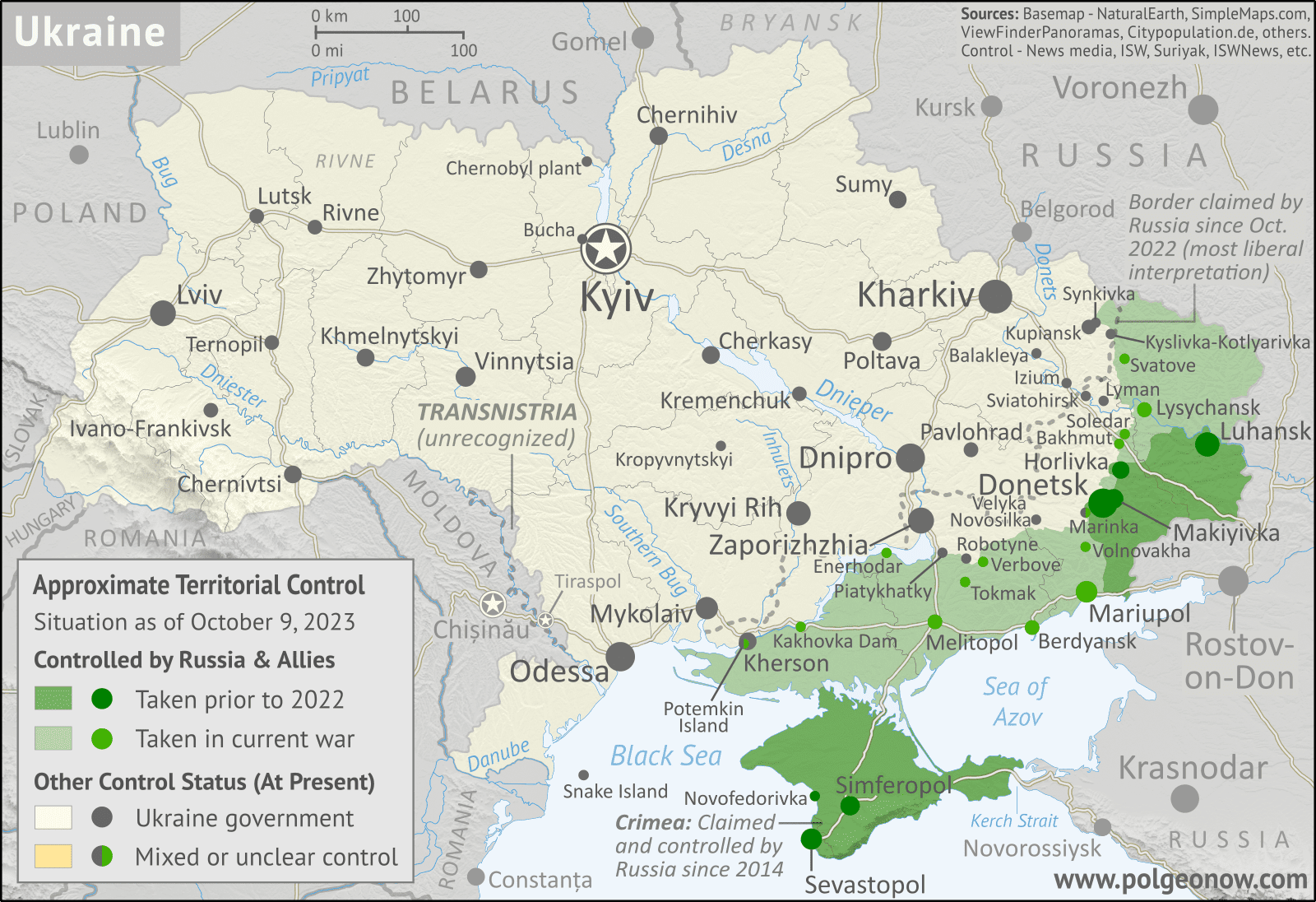
| Map showing what parts of the claimed territory of the self-declared Donetsk and Lugansk People's Republics - now claimed as part of Russia - are controlled by Russian forces and allies, compared to the Ukrainian government. Click to enlarge. Map by Evan Centanni and Djordje Djukic. Contact us for permission to use this map. |
Ukraine retakes towns amid slow-going counteroffensive
(The maps in this report show the situation as of October 9, 2023. Further territorial changes will be covered in an upcoming update.)
Between our previous Ukraine control map of August 2023 and early October, Ukrainian forces managed to secure control of some significant towns and other locations from their Russian opponents, despite Russia having gained more ground overall since the beginning of the year.
Ukraine's capture of Robotyne town in Zaporizhzhia province marked a small step in its efforts to break the Russian "land bridge" of territory connecting Crimea and Donetsk, the focus of Ukraine's much-hyped but ultimately bloody and anticlimactic 2023 counteroffensive.
Meanwhile, the northeastern town of Synkivka was restored to full Ukrainian control after being partly occupied by Russian forces, and Klischivka town, south of the small eastern city of Bakhmut, was captured by Ukraine. In the Black Sea, Ukraine brought the war to the Russian stronghold of Crimea, capturing offshore oil rigs and launching damaging attacks on Russia's navy in Sevastopol.
 There are newer editions of this map available. To see them, view all


