Showing posts with label premium. Show all posts

Monday, December 22, 2014

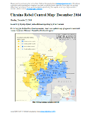
Ukraine War Rebel Control Map: December 2014 (Premium)

There are newer versions of this map available. To see them, view all Ukraine updates.

Detailed map of pro-Russian rebel control in Ukraine's eastern provinces of Donetsk and Luhansk, claimed by the breakaway Donetsk People's Republic and Lugansk People's Republic. Updated to December 21, 2014

Download PDF
Buy now


(Subscribe via Paypal to access all premium content online)
Research by Djordje Djukic, with additional reporting by Evan Centanni

Control lines have begun to solidify in Ukraine's civil war, with government forces on one side and the fighters of the self-proclaimed Donetsk People's Republic, Lugansk People's Republic, and Federation of Novorossiya on the other side. 

PolGeoNow presents our district-by-district map of control in eastern Ukraine, updated for December 2014, including a timeline of major events and changes to territorial control since our previous Ukraine map update in September.

This map report is exclusive premium content, available to paid subscribers or for individual purchase.
Buy now (US$9.99)

Premium map includes:
  • Detailed, updated map of Donetsk and Luhansk regions, showing both past and current rebel control
  • Indication of which districts and cities have had their administrations occupied by separatists
  • Timeline of changes to territorial control since September, and summary of major trends

MEMBERS CLICK HERE TO PROCEED TO ARTICLE AND MAP

NOT A MEMBER YET? SUBSCRIBE NOW!


Wednesday, December 3, 2014

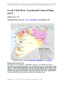
Syria Civil War Map: December 2014 (Premium)

There are newer versions of this map available. To see them, view all Syria updates.

Detailed map of territorial control in Syria's Civil War (Free Syrian Army and Nusra Front rebels, Kurdish groups, ISIS/ISIL/Islamic State and others), updated to December 2014 for siege of Kobani (Ayn al-Arab), government capture of Morek, rebel capture of Nawa, and other developments.

Download PDF
Buy now


(Subscribe via Paypal to view all premium content online)
Research by T.H., with additional reporting by Evan Centanni

Our popular map of territorial control in the Syrian Civil War has been updated for December 2014, showing changes to the situation since the previous Syria map report in October. 

The map and accompanying report show largely unreported advances by the Islamic State, as well as important gains for both the government and rebels.

This map and report are exclusive premium content, available to paid subscribers or for individual purchase.
Download PDF (US$14.99)

Premium map includes:
  • Up-to-date map of current territorial control in Syria, color-coded for the Assad government, rebel groups, Islamic State (ISIS) extremists, and Kurdish self-protection forces
  • Detailed indication of city-by-city control, highlighting key towns relevant to current events
  • Recent areas of fighting, including Kobani (Ayn al-Arab), Morek, Nawa, and many others
  • Timeline of events since early October, with focus on changes to territorial control

MEMBERS CLICK HERE TO PROCEED TO ARTICLE AND MAP

NOT A MEMBER YET? SUBSCRIBE NOW!


Wednesday, November 26, 2014

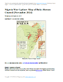
Nigeria War Update: Map of Boko Haram Control (November 2014) (Premium)

There are newer versions of this map available. To see them, view all Nigeria updates.

Detailed map of Boko Haram's territorial control in its war with Nigeria, marking and labeling each town reportedly under the group's control in Borno, Yobe, and Adamawa states. Includes recent flashpoints such as Chibok, Mubi, Maiha, Abadam, Malam Fatori, and Damasak.

Download PDF
Buy now


(Subscribe via Paypal to view all premium content online)
Reporting by T.H. and Evan Centanni

Despite short-lived claims of a ceasefire, Nigeria's northern insurgency has continued unabated since late September, when we published our free map of Boko Haram control in Nigeria.

This premium report and map update detail the many changes since then, which have seen Boko Haram's "Islamic Caliphate" grow to control an area the size of Belgium.

This map and article are exclusive premium content, available only to paid members or for individual purchase. Buy now (US$9.99)

Premium report includes:
  • Map of Boko Haram's overall area of control in Nigeria, updated to Nov. 25, 2014.
  • Detailed map shows almost every individual town or village known to have been captured by the group, including recent flashpoints like Chibok, Mubi, and Abadam.
  • Summary and detailed timeline of territorial changes and major events since late September.

MEMBERS CLICK HERE TO PROCEED TO ARTICLE AND MAP

NOT A MEMBER YET? SUBSCRIBE NOW!


Friday, October 31, 2014

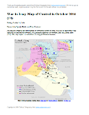
War in Iraq: Map of Control in October 2014 (#4) (Premium)

There are newer versions of this map available. To see them, view all Iraq updates.

Detailed map of control in Iraq in late October 2014, including territory held by the Islamic State (ISIS, ISIL), the Baghdad government, and the Kurdistan Peshmerga.

Download PDF
Buy now


(Subscribe via Paypal to view all premium content online)
Research by Djordje Djukic and Evan Centanni

PolGeoNow presents our latest update on territorial control in Iraq, which is still split three ways between the Baghdad government, the Kurdistan Regional Government, and the Islamic State (ISIS). This report covers a number of important changes to territorial control since our last Iraq map update in August.

This map and article are exclusive premium content, available only to paid members or for individual purchase. Buy now (US$9.99)

Premium map includes:
  • Up-to-date map of current territorial control in Iraq, color-coded for the Iraqi government, ISIS/Islamic State extremists, and Kurdish Peshmerga forces
  • Detailed indication of city-by-city control, highlighting key towns relevant to current events
  • Includes recent areas of fighting including Hit, Jurf al-Sakar, Mosul Dam, Jalula, and more
  • Timeline-style report on changes to the situation since August, with links to sources

MEMBERS CLICK HERE TO PROCEED TO ARTICLE AND MAP

NOT A MEMBER YET? SUBSCRIBE NOW!


Monday, October 6, 2014

Syria Civil War Map: October 2014 (#15) (Premium)

There are newer versions of this map available. To see them, view all Syria updates.

Detailed map of territorial control in Syria's Civil War (Free Syrian Army and Nusra Front rebels, Kurdish groups, ISIS/ISIL/Islamic State and others), updated to October 2014 for siege of Kobani (Ayn al-Arab) and other developments.

Download PDF
buy


(Subscribe via Paypal to view all premium content online)
Our territorial control map of the Syrian Civil War has been updated for October, showing changes to the situation since the previous Syria map report in September. The map and accompanying timeline show the Islamic State's advance against Kurdish-held Kobani, as well as other developments from the past few weeks.

This map and article are exclusive premium content, available to paid subscribers or for individual purchase.
Buy now (US$9.99)

Premium map includes:
  • Up-to-date map of current territorial control in Syria, color-coded for the Assad government, rebel groups, Islamic State (ISIS) extremists, and Kurdish self-protection forces
  • Detailed indication of city-by-city control, highlighting key towns relevant to current events
  • Recent areas of fighting, including Kobani (Ayn al-Arab), Deir al-Adas, and others
  • Timeline of events since mid-September, with focus on changes to territorial control

MEMBERS CLICK HERE TO PROCEED TO ARTICLE AND MAP

NOT A MEMBER YET? SUBSCRIBE NOW!


Sunday, September 14, 2014

Syria Civil War Map: September 2014 (#14) (Premium)

There are newer versions of this map available. To see them, view all Syria updates.

Detailed map of fighting and territorial control in Syria's Civil War (Free Syrian Army and Nusra Front rebels, Kurdish groups, ISIS/ISIL/Islamic State and others), updated to September 2014.

Download PDF
buy


(Subscribe via Paypal to view all premium content online)
Our Syrian Civil War coverage continues with this updated situation map, showing changes to territorial control since our previous Syria map report in August. Government forces, the Islamic State (ISIS), and the allied rebels have all made territorial gains during the past weeks.

This map and article are exclusive premium content, available to paid subscribers or for individual purchase.
Buy now (US$9.99)

Premium map includes:
  • Up-to-date map of current territorial control in Syria, color-coded for the Assad government, rebel groups, Islamic State (ISIS) extremists, and Kurdish self-protection forces
  • Detailed indication of city-by-city control, highlighting key towns relevant to current events
  • Recent areas of fighting including Tabqa Airbase, Halfaya, Quneitra Province and more
  • Timeline of events since mid-August, including both territorial changes and major political happenings

MEMBERS CLICK HERE TO PROCEED TO ARTICLE AND MAP

NOT A MEMBER YET? SUBSCRIBE NOW!


Tuesday, September 2, 2014

Ukraine War Rebel Control Map: September 2014 (Premium)

There are newer versions of this map available. To see them, view all Ukraine updates.

Detailed map of pro-Russian rebel control in Ukraine's eastern provinces of Donetsk and Luhansk, claimed by the breakaway Donetsk People's Republic and Lugansk People's Republic. Updated to September 1, 2014

Download PDF
buy


(Subscribe via Paypal to access all premium content online)
Russia is now being accused of directly invading eastern Ukraine, and opposition control in the region has seen major changes since our last Ukraine war map update.

This is detailed map and timeline of pro-Russian territorial control in eastern Ukraine's Donetsk and Luhansk regions, home to the claimed Donetsk People's Republic, Lugansk People's Republic, and Federation of Novorossiya. Updated to the start of September 2014.

This map report is exclusive premium content, available to paid subscribers or for individual purchase.
Buy now (US$9.99)

Premium map includes:
  • Detailed, updated map of Donetsk and Luhansk regions, showing both past and current rebel control
  • Indication of which districts and cities have had their administrations occupied by separatists
  • Timeline of changes to territorial control since July, and summary of major trends

MEMBERS CLICK HERE TO PROCEED TO ARTICLE AND MAP

NOT A MEMBER YET? SUBSCRIBE NOW!

Sunday, August 10, 2014

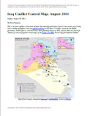
Iraq Conflict Control Map: August 2014 (Premium)

There are newer versions of this map available. To see them, view all Iraq updates.

Detailed map of territorial control in Iraq in August 2014, including cities and countryside held by the Islamic State (ISIS, ISIL) and the Kurdistan Peshmerga.

Download PDF
buy


(Subscribe via Paypal to view all premium content online)
This is the latest update to our series of maps documenting territorial control in the current war in Iraq, with a number of updates since the previous edition in late June. 

It includes control by the Maliki goverment, Kurdish forces, and the Islamic State (formerly known as ISIS), and has been re-styled to fit seamlessly with our popular control maps of the Syrian Civil War.

This map and article are exclusive premium content, available only to paid members or for individual purchase. Buy now (US$9.99)

Premium map includes:
  • Up-to-date map of current territorial control in Iraq, color-coded for the Maliki government, ISIS/Islamic State extremists, and Kurdish forces
  • Detailed indication of city-by-city control, highlighting key towns relevant to current events
  • Includes recent areas of fighting including Sinjar, Qaraqosh, Mosul Dam, Erbil province, and more
  • In-depth article summarizes changes since June, including ISIS's declaration of an Islamic caliphate, with links to sources

MEMBERS CLICK HERE TO PROCEED TO ARTICLE AND MAP

NOT A MEMBER YET? SUBSCRIBE NOW!


Tuesday, July 22, 2014

War in Ukraine: Detailed Map of Rebel Control in Donetsk & Luhansk (Premium)

etailed map of rebel control in Ukraine's eastern provinces of Donetsk and Luhansk, claimed by the breakaway Donetsk People's Republic and Lugansk People's Republic. Updated to July 22, 2014

Download PDF
buy


(Subscribe via Paypal to view all premium content online)
All new, detailed map of rebel control in eastern Ukraine's Donetsk and Luhansk regions, home to the claimed Donetsk People's Republic, Lugansk People's Republic, and Federation of Novorossiya. 

Since our last Ukraine update, pro-Russian rebels have captured much more territory in Donetsk and Luhansk regions, but also lost some of their early strongholds. 

This map report is exclusive premium content, available to paid subscribers or for individual purchase.
Buy now (US$9.99)

Premium map includes:
  • All new, detailed map of Donetsk and Luhansk regions, showing both past and current rebel control
  • Indication of which districts and cities have had their administrations occupied by separatists
  • Important locations of rebel military control marked
  • Article with chronology of events since April, and discussion of the meaning of "control"

MEMBERS CLICK HERE TO PROCEED TO ARTICLE AND MAP

NOT A MEMBER YET? SUBSCRIBE NOW!

Thursday, July 3, 2014

Syria Civil War: Territorial Control Map #12.3 (Premium)

There are newer versions of this map available. To see them, view all Syria updates.

Detailed map of fighting and territorial control in Syria's Civil War (Free Syrian Army and Nusra Front rebels, Kurdish groups, ISIS/ISIL/Islamic State and others), updated to July 3, 2014.

Download PDF
buy


(Subscribe via Paypal to view all premium content online)
This is the Syria update you've been waiting for: our new map includes not only cities, but a full illustration of territorial control for each faction in the civil war. Also includes many updates to the situation since the last edition in April.

This map and article are exclusive premium content, available to paid subscribers or for individual purchase.
Buy now (US$9.99)

Premium map includes:
  • Up-to-date map of current territorial control in Syria, color-coded for the Assad government, rebel groups, ISIS/Islamic State extremists, and Kurdish self-protection forces
  • Detailed indication of city-by-city control, highlighting key towns relevant to current events
  • Includes recent areas of fighting including Deir ez-Zor, Abu Kamal, Mayadin, Khan Shaykhun, and many more
  • In-depth article summarizes changes since April, including ISIS's declaration of an Islamic caliphate, with links to the sources of information
Members click here to proceed to article and map

Not a member yet? Subscribe Now!


Tuesday, June 24, 2014

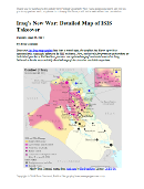
Iraq's New War: Detailed Map of ISIS Takeover (Premium)

There are newer versions of this map available. To see them, view all Iraq updates.

Detailed map of territorial control in Iraq in June 2014, including cities and countryside held by the Islamic State of Iraq and al-Sham (ISIS, ISIL) and the Kurdistan Peshmerga.

Download PDF
buy


(Subscribe via Paypal to view all premium content online)
Since our last Iraq map update less than a month ago, the conflict has blown up with a spectacularly successful offensive by ISIS rebels. PolGeoNow presents here our updated map of territorial control in Iraq, more detailed and accurate than any of the maps available on news websites.

This map and article are exclusive premium content, available only to members or for individual purchase.

 Buy now (US$9.99).


 Premium map includes:
  • Territorial control in Iraq by city, color coded for government, ISIS, or Kurdistan Government
  • Detail of ISIS control and attempted control of small towns, military bases, and border crossings
  • Inset map with extra detail for Kirkuk province, where ISIS and Kurdish forces are facing off
  • Shading showing the estimated total area of ISIS control
  • Article summarizing events since May, explaining the information on the map, and providing in-line links to sources cited
Members click here to proceed to article and map

Not a member yet? Subscribe Now!


Tuesday, May 27, 2014

Iraq: Updated Map of ISIS Control (Premium)

There are newer versions of this map available. To see them, view all Iraq updates.
 
Map of territorial control in Iraq in May 2014, including cities and countryside held by the Islamic State of Iraq and al-Sham (ISIS, ISIL) as well as areas administered by the Kurdistan Region. Includes detail of towns in flashpoint provinces of Anbar and Diyala

Download PDF
buy


(Subscribe via Paypal)
This is our first update to January's map of Al Qaeda control in Iraq. The map has been expanded to show much more detail of the ongoing campaign of control by the Islamic State of Iraq and al-Sham (ISIS), now no longer an Al Qaeda affiliate.

This map and article are exclusive premium content, available only to members or for individual purchase. Buy now (US$9.99).


 Premium map includes:
  • Territorial control in Iraq by city, color coded for government, ISIS, or Kurdistan
  • Detail of ISIS control and attempted control in small towns, including in the eastern flashpoint province of Diyala
  • Inset map with extra detail for Anbar province, where ISIS controls the most populated territory
  • Indications of estimated ISIS control/influence in the countryside
  • Article summarizing events since January, explaining the information on the map, and providing in-line links to the sources of information
Members click here to proceed to article and map

Not a member yet? Subscribe Now!


Thursday, April 24, 2014

Syria Civil War Map: April 2014 (#12.2) (Premium)

There are newer versions of this map available. To see them, view all Syria updates.

Map of territorial control in Syria's civil war, updated for April 2014. Shows control by government, rebels, ISIS extremists, and Kurdish militias. Includes important sites of recent fighting such as Yabroud, Maloula, Kasab, Azaz, Morek, Al Bukamal, and more.

Download PDF
buy


(Subscribe via Paypal)
PolGeoNow's popular Syria civil war control maps are back! Here's the second of our member-exclusive premium updates. 

Developments since our previous Syria map update in January include advances by both the government and the rebels, as well as changes in territorial control for the Islamic State of Iraq and Syria (ISIS).

This map and article are exclusive premium content, available only to members or for individual purchase. Buy now (US$9.99).

Premium article includes:
  • Map of current territorial control in Syria by city, color-coded for the Assad government, rebel groups, ISIS extremists, and Kurdish militias
  • Map includes recent areas of fighting such as Yabroud, Maloula, Kasab, Azaz, Al Bukamal, and more
  • Article summarizing changes since January, with links to the sources of information
Members click here to proceed to article and map

Not a member yet? Subscribe Now!


Wednesday, April 16, 2014

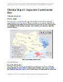
Ukraine Map #3: Separatist Control in the East (Premium)

Updated map of control in Ukraine, as of April 16, 2014. Spotlight on control by separatists in the country's east, including armed takeovers and the claimed Donetsk People's Republic.

Download PDF
buy


(Subscribe via Paypal)
Since our previous Ukraine update ten days ago, there has been a spectacular resurgence of aggressive separatist activity in eastern Ukraine, including not only protester occupations but also armed seizures reminiscent of those that began the Crimea crisis last month.

This is an up-to-date and detailed map of pro-Russian rebel and protester control in Ukraine, including the self-proclaimed "Donetsk People's Republic".

This map and article are exclusive premium content, available only to members or for individual purchase. Buy now (US$5.99).

Premium article includes:
  • Ukraine control map updated for the protester occupations and armed rebel takeovers in eastern Ukraine over the past two weeks
  • Shows both protester occupations and armed takeovers, as well as which regions have declared independence
  • Includes a quick briefing on recent events, with links to the sources of information
Members click here to proceed to article and map

Not a member yet? Subscribe Now!


Saturday, April 5, 2014

Update: Ukraine Control Overview Map (Premium)

Updated map of control in Ukraine, as of April 5, 2014. Includes final protester occupations, annexation of Crimea, and areas seized by Russian and Ukrainian militaries outside of Crimea.

Download PDF
buy


(Subscribe via Paypal)
This is a brief supplement to our Mar. 4 report, Ukraine Map: Occupations, Autonomy, & Invasion. See that report for a detailed overview of protester occupations and declarations of autonomy in the first two stages of the Ukraine crisis: the anti-Yanukovich Maidan movement and the eastern pro-Russian protests. 

The current article is an update on the current control situation in Ukraine from Mar. 4 to the present. This map and article are exclusive premium content, available only to members or for individual purchase. Buy now (US$5.99).

Premium article includes:
  • Simple updated map of the political situation in Ukraine since Mar. 4
  • Shows the last of the pro-Russian protester occupations, the annexation of Crimea, and seizures by the Ukrainian and Russian militaries outside of Crimea proper
  • Report on the course of events since the last report, explaining each detail shown on the map
  • In-line links to sources of information

Members click here to proceed to article and map

Not a member yet? Subscribe Now!


Wednesday, March 26, 2014

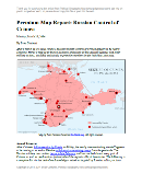
Premium Map Report: Russian Control of Crimea

Map of Russian seizures and military actions in the Crimea region which it recently annexed from Ukraine.

Download PDF
buy


(Subscribe via Paypal)
After a month of low-level conflict, Russian military control of Crimea appears to be nearly complete. Here's a complete map - to the best of our knowledge - of all locations of Russian seizures and other military actions inside and outside of the Crimea region. This map and article are exclusive premium content, available only to members and for individual purchase. Buy now (US$4.99).

Premium article includes:
  • Exclusive map of Russian seizure and attack locations inside and outside of Crimea
  • Guide to all locations on the map, with brief summary of what has happened at each
  • In-line links to sources of information

Members click here to proceed to article and map

Not a member yet? Subscribe Now!


Monday, March 3, 2014

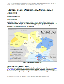
Ukraine Map: Occupations, Autonomy, & Invasion (Premium)

Map of the 2014 Ukraine crisis, before and after the ouster of President Yanukovich, updated to March 3, 2014. Details shown include protester occupations, declarations of autonomy, and Russian invasion.

Download PDF
buy


(Subscribe via Paypal)
PolGeoNow begins our Ukraine coverage with this overview of the political situation from January to the present, both before and after the overthrow of President Viktor Yanukovich's government. Details shown include protester occupations, declarations of autonomy, and Russian invasion. This map and article are exclusive premium content, available only to members and for individual purchase. Buy now (US$5.99).

Premium article includes:
  • Exclusive map of the political situation in Ukraine's 2014 crisis
  • Shows protester occupations, regional capitals overrun, autonomy declarations, and locations of Russian military siege
  • Report on the course of events, explaining each detail shown on the map
  • In-line links to sources of information

Members click here to proceed to article and map

Not a member yet? Subscribe Now!


Saturday, February 22, 2014

South Sudan War Map: Current Rebel Control (Update #4) (Premium)

Map of rebel control in South Sudan's ongoing rebellion, showing situation at the time of the ceasefire of January 23, 2014

Download PDF
buy


(Subscribe via Paypal)
This is Part 1 of a double map report on territorial control in South Sudan's ongoing rebellion, available exclusively to premium subscribers or for individual purchase. This map shows current territorial control for late February 2014, including several changes since the time of the ceasefire. Buy now (US$3.99).

To see the map of control at the time of the ceasefire on January 23, see Part 1.

Premium article includes:
  • Exclusive map of current rebel control up to February 21, 2014
  • Multiple changes to territorial control since previous update
  • Several more new locations added to the map
  • Report chronicling changes to territorial control since the ceasefire, including links to sources

Members click here to proceed to article and map

Not a member yet? Subscribe Now!


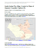
South Sudan War Map: Control at Time of January Ceasefire (Update #3) (Premium)

Map of rebel control in South Sudan's ongoing rebellion, showing situation at the time of the ceasefire of January 23, 2014

Download PDF
buy


(Subscribe via Paypal)
This is Part 1 of a double map report on territorial control in South Sudan's ongoing rebellion, available exclusively to premium subscribers or for individual purchase. This map shows territorial control as of January 23, when the warring parties signed their ceasefire agreement (including major changes from previous update). Buy now (US$3.99).

To see the map of current control as of late February, go to Part 2.

Premium article includes:
  • Exclusive map of rebel control at the time the ceasefire was signed on January 23, 2014
  • Multiple changes to territorial control since previous update
  • Several new locations added to the map
  • Report chronicling changes to territorial control and describing the situation at the time of the ceasefire, including links to sources

Members click here to proceed to article and map

Not a member yet? Subscribe Now!


Tuesday, January 28, 2014

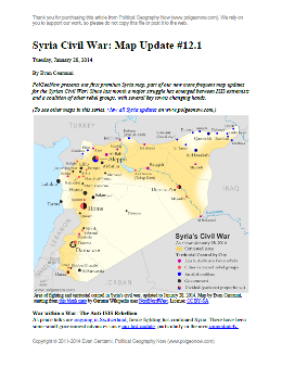
Syria Civil War Map: January 28, 2014 (#12.1) (Premium)

There are newer versions of this map available. To see them, view all Syria updates.

Map of fighting and territorial control in Syria's Civil War (Free Syrian Army rebels, Kurdish groups, Al-Nusra Front, ISIS/ISIL and others), updated to January 28, 2014. Includes recent locations of conflict between ISIS and other rebel groups, including Raqqa, Jarabulus, Manbij, Kafranbel, and others.

Download PDF
buy


(Subscribe via Paypal)
PolGeoNow presents our first premium Syria map, part of our new more frequent updates for the Syrian Civil War! Since last month a major struggle has emerged between ISIS extremists and a coalition of other rebel groups, with several key towns changing hands. See the updated map and briefing in this premium report. Buy now (US$5.99).

Members click here to proceed to article and map

NOT A MEMBER YET? SUBSCRIBE HERE!