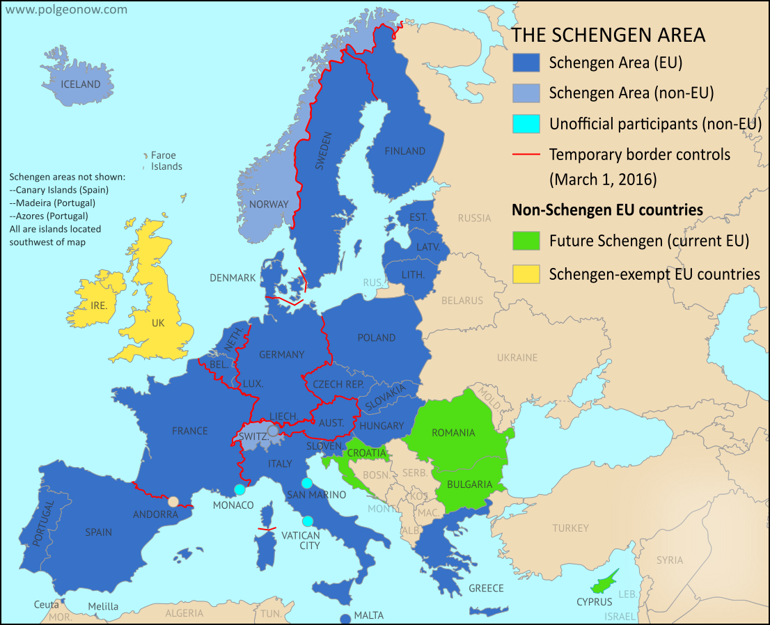
There are newer versions of this map available. To see them, view all Syria updates.
Research by Djordje Djukic. Map by onestopmap.com, Evan Centanni, and Djordje Djukic
 The so-called "Islamic State" (ISIS/ISIL) has lost control of several towns in Syria over the past month and a half, but has also scored some victories. Meanwhile, a partial breakdown in the UN-brokered ceasefire has resulted in resumed fighting between government and rebel forces in the Aleppo area.
See all this and more on the latest update to PolGeoNow's concise, professional Syrian Civil War control map, which includes a timeline of changes since our previous Syria map report at the end of March.
This map and report are premium professional content, available to paid subscribers of the PolGeoNow Conflict Mapping Service.
Want to see before you subscribe? Check out our most recent FREE SAMPLE Syria map!
Exclusive map report includes:
- Up-to-date map of current territorial control in Syria, color-coded for the Assad government, rebel groups, "Islamic State" (ISIS/ISIL) extremists, and Kurdish/SDF forces.
- Special symbols indicating towns dominated by rebels of Al Qaeda affiliate Jabhat al-Nusra (the Nusra Front) and by multi-ethnic anti-ISIS Syrian Democratic Forces (SDF).
- Detailed indication of city-by-city control, highlighting key towns and other locations important to current events.
- Locations of recent fighting and military operations, including Qaryatain, Al-Rai, Shaer gas field, and more.
- Detailed timeline of important events and changes to territorial control since March 31, 2016, compiled by our Syria-Iraq expert, with links to sources.
MEMBERS CLICK HERE TO PROCEED TO ARTICLE AND MAP
Not a member yet? Click here to learn more about our professional subscription service!
Can I purchase just this map?
This map and report are not available for automated purchase to non-subscribers. If you need access or republication rights for only this map report, contact service@polgeonow.com for options.


")


