(There are newer versions of this map available. To see them, view all Ethiopia articles on PolGeoNow.)
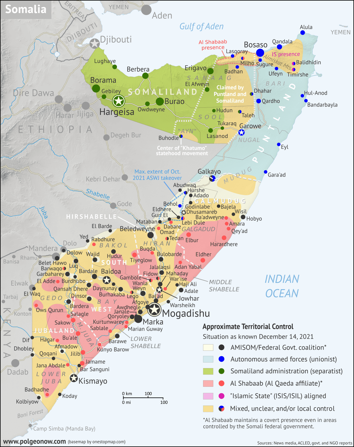
As a followup to the three Tigray war maps we've published as guest features from Daniel of Passport Party, PolGeoNow is pleased to present our new in-house map of control in Ethiopia's ongoing civil war. The new map shows Tigray rebel control both today and at its greatest extent last November, while also highlighting a second insurgency by allied rebel group the Oromo Liberation Army.
 |
Map by Evan Centanni and Djordje Djukic. Terrain data sourced from ViewFinderPanoramas.
Contact us for permission to use this map. |
Timeline by Djordje Djukic, with additional reporting by Evan Centanni
Rebel Advance on Addis Ababa - and Subsequent Retreat
In the five months since our previous report on Ethiopia's civil war, Tigray rebels expanded their control far south of their home state's borders, nearly reaching the national capital city of Addis Ababa. However, despite assistance from another Ethiopian rebel group, their gains were eventually reversed, with Ethiopian federal government forces and allies pushing them back within the boundaries of Tigray state. Now, the situation has almost returned to the same place it was when the war began, with Tigray largely controlled by rebels associated with its former state government, while neighboring Amhara state controls its own territory plus a section of western Tigray.