Showing posts with label the "islamic state". Show all posts

Friday, August 21, 2015

Syrian Civil War Control Map: August 2015 (Subscription)

There are newer versions of this map available. To see them, view all Syria updates.

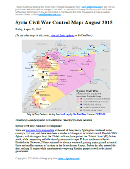
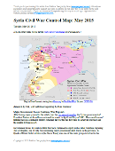
Map of fighting and territorial control in Syria's Civil War (Free Syrian Army rebels, Kurdish YPG, Al-Nusra Front, Islamic State (ISIS/ISIL), and others), updated for August 2015. Highlights recent locations of conflict and territorial control changes, such as Ayn Issa, Sarrin, Hasakah, Mansour, Frikka, Elbeyli, Qaryatain, and more.

Download PDF:
Buy now


(Subscribe via Paypal to view all premium content online)
Research by Djordje Djukic, with additional reporting by Evan Centanni

Since the end of June, the borders of the so-called "Islamic State" (IS) have changed significantly in Syria, with Kurdish advances from the north and IS pushes into the country's west. Meanwhile, rebels continue to struggle with the Assad government for dominance over the country's remaining territory.

See all this and more on the newest update to PolGeoNow's professional Syrian Civil War control map, which includes a timeline of changes since our previous Syria map report at the end of June.

This map and report are professional subscriber content, available to paid members or for separate purchase. Download PDF (US$19.99)

Want to see before you buy? Check out our most recent FREE SAMPLE Syria map!

Exclusive map report includes:
  • Up-to-date map of current territorial control in Syria, color-coded for the Assad government, rebel groups, "Islamic State" (ISIS/ISIL) extremists, and Kurdish YPG forces. Special symbol indicates rebel-held towns dominated by Al Qaeda affiliate Jabhat al-Nusra (the Nusra Front).
  • Detailed indication of city-by-city control, highlighting key towns and other locations relevant to current events.
  • Locations of recent fighting and military operations, including Ayn Issa, Sarrin, Hasakah, Mansour, Frikka, Elbeyli, Qaryatain, and others
  • Detailed timeline of important events and changes to territorial control since June 29, 2015, compiled by our Syria-Iraq expert, with links to sources.

MEMBERS CLICK HERE TO PROCEED TO ARTICLE AND MAP

Not a member yet? Click here to learn more about our professional subscription service!


Friday, July 24, 2015

War in Iraq: Map of "Islamic State" Control in July 2015 (Subscription)

There are newer versions of this map available. To see them, view all Iraq updates.

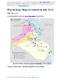
Detailed map of territorial control in Iraq as of July 23, 2015, including territory held by the so-called Islamic State (ISIS, ISIL), the Baghdad government, and the Kurdistan peshmerga. Includes recent flashpoints including Ramadi, Baiji, Habaniyah, Jalawla, and Walid border crossing.

Download PDF:
Buy now


(Subscribe via Paypal to view all premium content online)
Timeline by Djordje Djukic; map and additional reporting by Evan Centanni

Since May, fighting in Iraq has seen small but potentially important advances by all sides, including the Baghdad government (with Iranian support), the "Islamic State" extremists, and Kurdistan's peshmerga.

See all this and more on the newest update to PolGeoNow's Iraq territorial control map, which includes a timeline of changes since our previous Iraq map report in May.

This map and report are exclusive premium content, available to paid subscribers or for separate purchase.
Download PDF (US$14.99)

Want to see before you buy? Check out our most recent FREE SAMPLE Iraq map report!

Exclusive map report includes:
  • Up-to-date map of current territorial control in Iraq, color-coded for the Iraqi government, "Islamic State" (ISIS/ISIL) extremists, and Kurdish peshmerga forces
  • Detailed indication of town-by-town control, including provincial boundaries, all major cities, and many smaller ones
  • Markers for key areas of recent fighting such as Baiji, Ramadi, Husaybah, Walid border crossing, and more
  • Timeline of changes to the situation since May, compiled by our Iraq specialist, with links to sources

MEMBERS CLICK HERE TO PROCEED TO ARTICLE AND MAP

NOT A MEMBER YET? SUBSCRIBE NOW!

Tuesday, June 30, 2015

Syrian Civil War Control Map: June 2015 (Subscription)

There are newer versions of this map available. To see them, view all Syria updates.

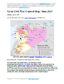
Map of fighting and territorial control in Syria's Civil War (Free Syrian Army rebels, Kurdish groups, Al-Nusra Front, Islamic State (ISIS/ISIL), and others), updated for late June 2015. Highlights recent locations of conflict and territorial control changes, such as Palmyra, Ariha, Tel Abyad, Ayn Issa, and Hasakah, Kobani, and Suwayda.

Download PDF:
Buy now


(Subscribe via Paypal to view all premium content online)
Research by T.H., with additional reporting by Evan Centanni

Since late May, rebels have consolidated their power in Syria's northwest, Kurdish forces have extended their control across most of the border with Turkey, and the Islamic State continues advancing in the direction of Damascus.

See all this and more on the newest update to PolGeoNow's popular Syria control map, which includes a timeline of changes since our previous Syria map report in May.

This map and report are exclusive premium content, available to paid subscribers or for separate purchase.
Download PDF (US$19.99)

Exclusive map report includes:
  • Up-to-date map of current territorial control in Syria, color-coded for the Assad government, rebel groups, Islamic State (ISIS/ISIL) extremists, and Kurdish YPG forces. Special symbol indicates rebel-held towns dominated by Al Qaeda affiliate Jabhat al-Nusra.
  • Detailed indication of city-by-city control, highlighting key towns and other locations relevant to current events.
  • Locations of recent fighting and military operations, including Tel Abyad, Ayn Issa, Hasakah, Kobani, Palmyra, Ariha, Suwayda, and more.
  • Timeline of important events and changes to territorial control since May 24, 2015, with links to sources.

MEMBERS CLICK HERE TO PROCEED TO ARTICLE AND MAP

NOT A MEMBER YET? SUBSCRIBE NOW!


Thursday, May 28, 2015

Map of Boko Haram Control in Nigeria: May 2015 (Subscription)

The best online map of Boko Haram's territorial control - guaranteed! 

There are newer versions of this map available. To see them, view all Boko Haram updates.

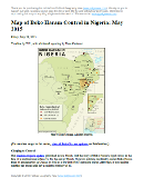
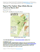
Detailed map of Boko Haram's territorial control in its war with Nigeria, marking each town reportedly under the group's control in Borno, Yobe, and Adamawa states. Includes key recent locations, such as Gwoza, Marte, and the Sambisa Forest.

Download PDF:
Buy now


(Subscribe via Paypal to view all premium content online)
Timeline by T.H., with additional reporting by Evan Centanni

Even as evidence mounts of Boko Haram's ties to the Islamic State, the Nigerian rebel group has been driven from most of its recently-held territory. Yet as Nigeria's new president prepares to take office, Boko Haram may already be making a comeback.

This map report illustrates areas of known and possible Boko Haram control in Nigeria, and for the first time shows the full area of the Sambisa Forest, the rebels' last-resort hideout. The report includes a summary and timeline of events since our previous Boko Haram control map in March.

This map report is exclusive premium content, available to paid subscribers or for separate purchase. Buy now (US$14.99)

Exclusive map report includes:
  • Map of Boko Haram's overall area of control in Nigeria, updated to May 28, 2015.
  • Detailed mapping of each town under Boko Haram's influence, as well as most locations of recent attacks.
  • New: Full outline of the Sambisa Forest, Boko Haram's vast safe haven.
  • Summary and detailed timeline of territorial changes and major events since late March, with links to sources.

MEMBERS CLICK HERE TO PROCEED TO ARTICLE AND MAP

NOT A MEMBER YET? SUBSCRIBE NOW!


Tuesday, May 26, 2015

Syria Civil War Control Map: May 2015 (Subscription)

There are newer versions of this map available. To see them, view all Syria updates.

Map of fighting and territorial control in Syria's Civil War (Free Syrian Army rebels, Kurdish groups, Al-Nusra Front, Islamic State (ISIS/ISIL) and others), updated for late May 2015. Highlights recent locations of conflict and territorial control changes, such as Palmyra, Jisr al-Shughur, al-Janf border crossing, and others.

Download PDF:
Buy now


(Subscribe via Paypal to view all premium content online)
Research by T.H., with additional reporting by Evan Centanni

Since just last month, the Syrian government of Bashar al-Assad has lost important ground to both the rebel coalition (including Al Qaeda affiliate Jabhat al-Nusra) and the Islamic State. The war has also spread into new parts of Syria previously untouched by fighting, while Kurdish groups in the north are continuing to consolidate their gains.

See all this and more on the newest update to PolGeoNow's popular Syria control map, and read a timeline of changes since our previous Syria map report in mid-April.

This map and report are exclusive premium content, available to paid subscribers or for separate purchase.
Download PDF (US$19.99)

Exclusive map report includes:
  • Up-to-date map of current territorial control in Syria, color-coded for the Assad government, rebel groups, Islamic State (ISIS/ISIL) extremists, and Kurdish self-protection forces. Special symbol indicates rebel-held towns dominated by Al Qaeda affiliate Jabhat al-Nusra.
  • Detailed indication of city-by-city control, highlighting key towns and other locations relevant to current events.
  • Locations of recent fighting and military operations, including Palmyra, Jisr al-Shughur, Yarmouk, al-Tanf border crossing, and more.
  • Timeline of important events and changes to territorial control since April 10, 2015.

MEMBERS CLICK HERE TO PROCEED TO ARTICLE AND MAP

NOT A MEMBER YET? SUBSCRIBE NOW!


Friday, May 22, 2015

War in Iraq: Map of Islamic State Control in May 2015

There are newer versions of this map available. To see them, view all Iraq updates.

This is a free sample of our Iraq territorial control map. To access more Iraq control map updates like this one, sign up now for our conflict map subscription service!
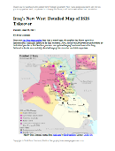
Detailed map of territorial control in Iraq as of May 20, 2015, including territory held by the Islamic State (ISIS, ISIL), the Baghdad government, and the Kurdistan Peshmerga. Includes recent flashpoints including Ramadi, Tikrit, Habbaniyah, Khaldiya, Sinjar, and others, as well as the recently created province of Halabja in Iraqi Kurdistan.
Map by Evan Centanni, starting from blank map by NordNordWest. License: CC BY-SA
Subscribers click here to view this article in the ad-free members area. Not a member yet? Subscribe now!

Timeline by Djordje Djukic, with additional reporting by Evan Centanni

A City for a City
Since PolGeoNow published our February map of control in Iraq, two major cities have changed hands, in opposite directions. Tikrit, known as the home region of former leader Saddam Hussein, was the Islamic State's farthest-forward prize in its spectacular takeover of northern Iraq last June. A priority for Iraq's struggling Baghdad government, Tikrit was finally taken back this March and April in a major push by Shiite militias, led by Iran and ultimately supported by U.S.-Arab coalition airstrikes.

Saturday, April 11, 2015

Syria Civil War Control Map: April 2015 (Subscription)

There are newer versions of this map available. To see them, view all Syria updates.

Map of fighting and territorial control in Syria's Civil War (Free Syrian Army rebels, Kurdish groups, Al-Nusra Front, Islamic State (ISIS/ISIL) and others), updated for April 2015. Highlights recent locations of conflict and territorial control changes, such as Yarmouk, Idlib, Nassib border crossing, Busra, and Tel Hamis.

Download PDF:
Buy now


(Subscribe via Paypal to view all premium content online)
Research by T.H., with additional reporting by Evan Centanni

Since January, the Islamic State has captured part of Syria's capital city, while rebels have gained important ground in both the north and the south. Meanwhile, Kurdish militias have scored victories against the Islamic State on the northeastern front. 

See all this and more on the newest update to PolGeoNow's popular Syria control map, and read a timeline of changes since our previous Syria map report at the end of January.

This map and report are exclusive premium content, available to paid subscribers or for separate purchase.
Download PDF (US$19.99)

Exclusive map report includes:
  • Up-to-date map of current territorial control in Syria, color-coded for the Assad government, rebel groups, Islamic State (ISIS/ISIL) extremists, and Kurdish self-protection forces
  • Detailed indication of city-by-city control, highlighting key towns and other locations relevant to current events
  • Locations of recent fighting and military operations, including Yarmouk, Idlib, Nassib border crossing, Busra, and the Tomb of Suleyman Shah (site of Turkey's brief military incursion in February).
  • Timeline of changes to important events since the end of January, plus summary of important territorial changes in recent months.

MEMBERS CLICK HERE TO PROCEED TO ARTICLE AND MAP

NOT A MEMBER YET? SUBSCRIBE NOW!


Monday, March 23, 2015

Map of Boko Haram Control in Nigeria: March 2015 (Subscription)

The best online map of Boko Haram's territorial control - guaranteed!

There are newer versions of this map available. To see them, view all Boko Haram updates.

Detailed map of Boko Haram's territorial control in its war with Nigeria, marking and labeling each town reportedly under the group's control in Borno, Yobe, and Adamawa states. Includes illustration of multinational campaign against the group by Nigeria, Chad, and Niger.

Download PDF:
Buy now


(Subscribe via Paypal to view all premium content online)
Research by T.H., with additional reporting by Evan Centanni

Boko Haram has now allegedly teamed up with the Islamic State, but the Nigerian rebel group has recently lost most of its territory to a multi-pronged military campaign involving Nigeria, Chad, Niger, and Cameroon.

This map report illustrates the offensive against Boko Haram and the rebel group's remaining territorial holdings, and includes a summary and timeline of events since our previous Boko Haram map report in January.

This map report is exclusive premium content, available to paid subscribers or for separate purchase. Buy now (US$14.99)

Exclusive map report includes:
  • Map of Boko Haram's overall area of control in Nigeria, updated to March 22, 2015.
  • Detailed map showing almost every individual town currently or previously held by Boko Haram, as well as the overall extent of rebel territorial control.
  • Illustrations of the five major military campaigns that have driven Boko Haram back over the past two months, as well as key locations in neighboring countries.
  • Summary and detailed timeline of territorial changes and major events since late January, with links to sources.

MEMBERS CLICK HERE TO PROCEED TO ARTICLE AND MAP

NOT A MEMBER YET? SUBSCRIBE NOW!


Wednesday, February 25, 2015

War in Iraq: Map of Control in February 2015 (Subscription)

There are newer versions of this map available. To see them, view all Iraq updates.

Detailed map of control in Iraq in late February 2015, including territory held by the Islamic State (ISIS, ISIL), the Baghdad government, and the Kurdistan Peshmerga. Includes recent flashpoints including Sinjar, Al Asad Airbase, Mosul, and Barwanah

Download PDF
Buy now


(Subscribe via Paypal to view all premium content online)
Timeline by Djordje Djukic; map and additional reporting by Evan Centanni

The Islamic State has been losing ground in Iraq due to the intervention of two rival air powers: the U.S. and Arab coalition in the west, and an Iranian effort in the east. However, the extremist group has made gains near a major base housing U.S. troops.

See all that and more on this major update to our map of territorial control in Iraq, the first since October. The map and report detail various changes to the control situation on the ground, and also contain updates to the provinces and cities of the Kurdistan region.

This map and article are exclusive member content, accessible only to paid subscribers or by individual purchase. Buy now (US$9.99)

Exclusive report includes:
  • Up-to-date map of current territorial control in Iraq, color-coded for the Iraqi government, ISIS/Islamic State extremists, and Kurdish Peshmerga forces
  • Detailed indication of town-by-town control, including provincial boundaries, all major cities, and many smaller ones
  • Markers for key areas of recent fighting such as Sinjar, Mosul, Al Asad Airbase, the site of the Barwanah massacre, and more
  • Timeline of changes to the situation since October, compiled by our Iraq specialist, with links to sources

MEMBERS CLICK HERE TO PROCEED TO ARTICLE AND MAP

NOT A MEMBER YET? SUBSCRIBE NOW!


Saturday, January 31, 2015

Syria Civil War Map: January 2015 (Premium)

There are newer versions of this map available. To see them, view all Syria updates.

Map of fighting and territorial control in Syria's Civil War (Free Syrian Army rebels, Kurdish groups, Al-Nusra Front, Islamic State (ISIS/ISIL) and others), updated for January 2015. Highlights recent locations of conflict and territorial control changes, such as Kobani (Ayn al-Arab) and others, and for the first time uses a separate symbol for al-Nusra control.

Download PDF
Buy now


(Subscribe via Paypal to view all premium content online)
Research by T.H., with additional reporting by Evan Centanni

PolGeoNow presents the newest edition of our in-demand map of territorial control in the Syrian Civil War. The map has been updated to January 30, 2015, showing the recapture of Kobani by Kurdish forces and several other important changes since our previous Syria map report in December.

For the first time, the Syria Civil War Map now uses a different symbol to indicate local control by al-Qaeda affiliate Jabhat al-Nusra, separate from control by other or mixed rebel groups or the Islamic State organization.

This map and report are exclusive premium content, available to paid subscribers or for individual purchase.
Download PDF (US$14.99)

Premium report includes:
  • Up-to-date map of current territorial control in Syria, color-coded for the Assad government, rebel groups, Islamic State (ISIS) extremists, and Kurdish self-protection forces
  • Al-Qaeda affiliate Jabhat al-Nusra marked with a separate symbol where the group has seized control of towns from other rebel groups
  • Detailed indication of city-by-city control, highlighting key towns relevant to current events
  • Recent areas of fighting, including Kobani (Ayn al-Arab), Wadi Deif, Sheikh Miskin, and others
  • Timeline of changes to territorial control since early December

MEMBERS CLICK HERE TO PROCEED TO ARTICLE AND MAP

NOT A MEMBER YET? SUBSCRIBE NOW!


Wednesday, December 3, 2014

Syria Civil War Map: December 2014 (Premium)

There are newer versions of this map available. To see them, view all Syria updates.

Detailed map of territorial control in Syria's Civil War (Free Syrian Army and Nusra Front rebels, Kurdish groups, ISIS/ISIL/Islamic State and others), updated to December 2014 for siege of Kobani (Ayn al-Arab), government capture of Morek, rebel capture of Nawa, and other developments.

Download PDF
Buy now


(Subscribe via Paypal to view all premium content online)
Research by T.H., with additional reporting by Evan Centanni

Our popular map of territorial control in the Syrian Civil War has been updated for December 2014, showing changes to the situation since the previous Syria map report in October. 

The map and accompanying report show largely unreported advances by the Islamic State, as well as important gains for both the government and rebels.

This map and report are exclusive premium content, available to paid subscribers or for individual purchase.
Download PDF (US$14.99)

Premium map includes:
  • Up-to-date map of current territorial control in Syria, color-coded for the Assad government, rebel groups, Islamic State (ISIS) extremists, and Kurdish self-protection forces
  • Detailed indication of city-by-city control, highlighting key towns relevant to current events
  • Recent areas of fighting, including Kobani (Ayn al-Arab), Morek, Nawa, and many others
  • Timeline of events since early October, with focus on changes to territorial control

MEMBERS CLICK HERE TO PROCEED TO ARTICLE AND MAP

NOT A MEMBER YET? SUBSCRIBE NOW!


Friday, October 31, 2014

War in Iraq: Map of Control in October 2014 (#4) (Premium)

There are newer versions of this map available. To see them, view all Iraq updates.

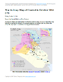
Detailed map of control in Iraq in late October 2014, including territory held by the Islamic State (ISIS, ISIL), the Baghdad government, and the Kurdistan Peshmerga.

Download PDF
Buy now


(Subscribe via Paypal to view all premium content online)
Research by Djordje Djukic and Evan Centanni

PolGeoNow presents our latest update on territorial control in Iraq, which is still split three ways between the Baghdad government, the Kurdistan Regional Government, and the Islamic State (ISIS). This report covers a number of important changes to territorial control since our last Iraq map update in August.

This map and article are exclusive premium content, available only to paid members or for individual purchase. Buy now (US$9.99)

Premium map includes:
  • Up-to-date map of current territorial control in Iraq, color-coded for the Iraqi government, ISIS/Islamic State extremists, and Kurdish Peshmerga forces
  • Detailed indication of city-by-city control, highlighting key towns relevant to current events
  • Includes recent areas of fighting including Hit, Jurf al-Sakar, Mosul Dam, Jalula, and more
  • Timeline-style report on changes to the situation since August, with links to sources

MEMBERS CLICK HERE TO PROCEED TO ARTICLE AND MAP

NOT A MEMBER YET? SUBSCRIBE NOW!


Monday, October 6, 2014

Syria Civil War Map: October 2014 (#15) (Premium)

There are newer versions of this map available. To see them, view all Syria updates.

Detailed map of territorial control in Syria's Civil War (Free Syrian Army and Nusra Front rebels, Kurdish groups, ISIS/ISIL/Islamic State and others), updated to October 2014 for siege of Kobani (Ayn al-Arab) and other developments.

Download PDF
buy


(Subscribe via Paypal to view all premium content online)
Our territorial control map of the Syrian Civil War has been updated for October, showing changes to the situation since the previous Syria map report in September. The map and accompanying timeline show the Islamic State's advance against Kurdish-held Kobani, as well as other developments from the past few weeks.

This map and article are exclusive premium content, available to paid subscribers or for individual purchase.
Buy now (US$9.99)

Premium map includes:
  • Up-to-date map of current territorial control in Syria, color-coded for the Assad government, rebel groups, Islamic State (ISIS) extremists, and Kurdish self-protection forces
  • Detailed indication of city-by-city control, highlighting key towns relevant to current events
  • Recent areas of fighting, including Kobani (Ayn al-Arab), Deir al-Adas, and others
  • Timeline of events since mid-September, with focus on changes to territorial control

MEMBERS CLICK HERE TO PROCEED TO ARTICLE AND MAP

NOT A MEMBER YET? SUBSCRIBE NOW!


Sunday, September 14, 2014

Syria Civil War Map: September 2014 (#14) (Premium)

There are newer versions of this map available. To see them, view all Syria updates.

Detailed map of fighting and territorial control in Syria's Civil War (Free Syrian Army and Nusra Front rebels, Kurdish groups, ISIS/ISIL/Islamic State and others), updated to September 2014.

Download PDF
buy


(Subscribe via Paypal to view all premium content online)
Our Syrian Civil War coverage continues with this updated situation map, showing changes to territorial control since our previous Syria map report in August. Government forces, the Islamic State (ISIS), and the allied rebels have all made territorial gains during the past weeks.

This map and article are exclusive premium content, available to paid subscribers or for individual purchase.
Buy now (US$9.99)

Premium map includes:
  • Up-to-date map of current territorial control in Syria, color-coded for the Assad government, rebel groups, Islamic State (ISIS) extremists, and Kurdish self-protection forces
  • Detailed indication of city-by-city control, highlighting key towns relevant to current events
  • Recent areas of fighting including Tabqa Airbase, Halfaya, Quneitra Province and more
  • Timeline of events since mid-August, including both territorial changes and major political happenings

MEMBERS CLICK HERE TO PROCEED TO ARTICLE AND MAP

NOT A MEMBER YET? SUBSCRIBE NOW!


Monday, August 18, 2014

Syria Civil War Map: August 2014 (#13)

There are newer versions of this map available. To see them, view all Syria updates.

Premium subscribers have already seen our new Syria map format, which shows full areas of control for each major faction in the civil war. Now, we present this month's update free of charge for your convenience. 

To get many more Syrian Civil War map updates like this one, sign up now for a premium subscription!

Map of fighting and territorial control in Syria's Civil War (Free Syrian Army rebels, Kurdish groups, Al-Nusra Front, Islamic State (ISIS/ISIL) and others), updated for August 2014. Highlights recent locations of conflict and territorial control changes.
Territorial control in the Syrian Civil War as of August 2014. Map by Evan Centanni, starting from blank map by NordNordWest. License: CC BY-SA
Premium members click here to view this article in the ad-free members area.

Threats from All Sides
Since our last Syria map update in early July, the lines of control in the civil war have not changed drastically. However, fighting on all fronts has resulted in numerous small but important changes to the situation, as the Assad government is now facing serious challenges from both the newly rebranded Islamic State (formerly ISIS/ISIL) and a loose coalition of various other rebel groups (including both the Free Syrian Army and Al-Nusra).

Sunday, August 10, 2014

Iraq Conflict Control Map: August 2014 (Premium)

There are newer versions of this map available. To see them, view all Iraq updates.

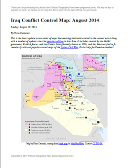
Detailed map of territorial control in Iraq in August 2014, including cities and countryside held by the Islamic State (ISIS, ISIL) and the Kurdistan Peshmerga.

Download PDF
buy


(Subscribe via Paypal to view all premium content online)
This is the latest update to our series of maps documenting territorial control in the current war in Iraq, with a number of updates since the previous edition in late June. 

It includes control by the Maliki goverment, Kurdish forces, and the Islamic State (formerly known as ISIS), and has been re-styled to fit seamlessly with our popular control maps of the Syrian Civil War.

This map and article are exclusive premium content, available only to paid members or for individual purchase. Buy now (US$9.99)

Premium map includes:
  • Up-to-date map of current territorial control in Iraq, color-coded for the Maliki government, ISIS/Islamic State extremists, and Kurdish forces
  • Detailed indication of city-by-city control, highlighting key towns relevant to current events
  • Includes recent areas of fighting including Sinjar, Qaraqosh, Mosul Dam, Erbil province, and more
  • In-depth article summarizes changes since June, including ISIS's declaration of an Islamic caliphate, with links to sources

MEMBERS CLICK HERE TO PROCEED TO ARTICLE AND MAP

NOT A MEMBER YET? SUBSCRIBE NOW!


Thursday, July 3, 2014

Syria Civil War: Territorial Control Map #12.3 (Premium)

There are newer versions of this map available. To see them, view all Syria updates.

Detailed map of fighting and territorial control in Syria's Civil War (Free Syrian Army and Nusra Front rebels, Kurdish groups, ISIS/ISIL/Islamic State and others), updated to July 3, 2014.

Download PDF
buy


(Subscribe via Paypal to view all premium content online)
This is the Syria update you've been waiting for: our new map includes not only cities, but a full illustration of territorial control for each faction in the civil war. Also includes many updates to the situation since the last edition in April.

This map and article are exclusive premium content, available to paid subscribers or for individual purchase.
Buy now (US$9.99)

Premium map includes:
  • Up-to-date map of current territorial control in Syria, color-coded for the Assad government, rebel groups, ISIS/Islamic State extremists, and Kurdish self-protection forces
  • Detailed indication of city-by-city control, highlighting key towns relevant to current events
  • Includes recent areas of fighting including Deir ez-Zor, Abu Kamal, Mayadin, Khan Shaykhun, and many more
  • In-depth article summarizes changes since April, including ISIS's declaration of an Islamic caliphate, with links to the sources of information
Members click here to proceed to article and map

Not a member yet? Subscribe Now!


Tuesday, June 24, 2014

Iraq's New War: Detailed Map of ISIS Takeover (Premium)

There are newer versions of this map available. To see them, view all Iraq updates.

Detailed map of territorial control in Iraq in June 2014, including cities and countryside held by the Islamic State of Iraq and al-Sham (ISIS, ISIL) and the Kurdistan Peshmerga.

Download PDF
buy


(Subscribe via Paypal to view all premium content online)
Since our last Iraq map update less than a month ago, the conflict has blown up with a spectacularly successful offensive by ISIS rebels. PolGeoNow presents here our updated map of territorial control in Iraq, more detailed and accurate than any of the maps available on news websites.

This map and article are exclusive premium content, available only to members or for individual purchase.

 Buy now (US$9.99).


 Premium map includes:
  • Territorial control in Iraq by city, color coded for government, ISIS, or Kurdistan Government
  • Detail of ISIS control and attempted control of small towns, military bases, and border crossings
  • Inset map with extra detail for Kirkuk province, where ISIS and Kurdish forces are facing off
  • Shading showing the estimated total area of ISIS control
  • Article summarizing events since May, explaining the information on the map, and providing in-line links to sources cited
Members click here to proceed to article and map

Not a member yet? Subscribe Now!


Tuesday, May 27, 2014

Iraq: Updated Map of ISIS Control (Premium)

There are newer versions of this map available. To see them, view all Iraq updates.
 
Map of territorial control in Iraq in May 2014, including cities and countryside held by the Islamic State of Iraq and al-Sham (ISIS, ISIL) as well as areas administered by the Kurdistan Region. Includes detail of towns in flashpoint provinces of Anbar and Diyala

Download PDF
buy


(Subscribe via Paypal)
This is our first update to January's map of Al Qaeda control in Iraq. The map has been expanded to show much more detail of the ongoing campaign of control by the Islamic State of Iraq and al-Sham (ISIS), now no longer an Al Qaeda affiliate.

This map and article are exclusive premium content, available only to members or for individual purchase. Buy now (US$9.99).


 Premium map includes:
  • Territorial control in Iraq by city, color coded for government, ISIS, or Kurdistan
  • Detail of ISIS control and attempted control in small towns, including in the eastern flashpoint province of Diyala
  • Inset map with extra detail for Anbar province, where ISIS controls the most populated territory
  • Indications of estimated ISIS control/influence in the countryside
  • Article summarizing events since January, explaining the information on the map, and providing in-line links to the sources of information
Members click here to proceed to article and map

Not a member yet? Subscribe Now!


Thursday, April 24, 2014

Syria Civil War Map: April 2014 (#12.2) (Premium)

There are newer versions of this map available. To see them, view all Syria updates.

Map of territorial control in Syria's civil war, updated for April 2014. Shows control by government, rebels, ISIS extremists, and Kurdish militias. Includes important sites of recent fighting such as Yabroud, Maloula, Kasab, Azaz, Morek, Al Bukamal, and more.

Download PDF
buy


(Subscribe via Paypal)
PolGeoNow's popular Syria civil war control maps are back! Here's the second of our member-exclusive premium updates. 

Developments since our previous Syria map update in January include advances by both the government and the rebels, as well as changes in territorial control for the Islamic State of Iraq and Syria (ISIS).

This map and article are exclusive premium content, available only to members or for individual purchase. Buy now (US$9.99).

Premium article includes:
  • Map of current territorial control in Syria by city, color-coded for the Assad government, rebel groups, ISIS extremists, and Kurdish militias
  • Map includes recent areas of fighting such as Yabroud, Maloula, Kasab, Azaz, Al Bukamal, and more
  • Article summarizing changes since January, with links to the sources of information
Members click here to proceed to article and map

Not a member yet? Subscribe Now!