Old Portal (members.polgeonow.com) | New Portal (controlmaps.polgeonow.com)
There are newer versions of this map available. To see them, view all Ukraine articles on PolGeoNow.
Research by Djordje Djukic. Map by Evan Centanni and Djordje Djukic

(Note: This edition of our Ukraine control map captures the situation in the days prior to Russia's Kherson retreat, while our next report, coming soon, will document the results of the withdrawal itself.)
Despite small gains in Donetsk, Russia and allied forces were already losing major ground in Ukraine prior to this week's Kherson withdrawal. In the month or so leading up to the retreat, Ukraine had already captured significant parts Kherson and Kharkiv provinces, plus bits of Luhansk and other parts of Donetsk.
See all this and more on the latest update to PolGeoNow's concise, professional Ukraine war control map, which includes a detailed chronicle of changes and events since our previous Ukraine map report of September 26, with sources cited, as well as a close-up map of control within the claimed borders of the Donetsk and Lugansk People's Republics (now claimed to be self-governing regions within Russia).
This map and report are premium content, available to paid subscribers of the PolGeoNow Conflict Mapping Service.
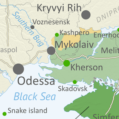
Want to see before you subscribe? Check out our most recent FREE SAMPLE Ukraine map!
Exclusive map report includes:
SUBSCRIBERS CLICK HERE TO VIEW FULL ARTICLE AND MAP:
Old Portal (members.polgeonow.com) | New Portal (controlmaps.polgeonow.com)
Not signed up yet? Click here to learn more about our professional subscription service!
Can I purchase just this map?
This map and report are not available for automated purchase to non-subscribers. If you need access or republication rights for only this map report, contact service@polgeonow.com for options.
This map and report are premium content, available to paid subscribers of the PolGeoNow Conflict Mapping Service.
Want to see before you subscribe? Check out our most recent FREE SAMPLE Ukraine map!
Exclusive map report includes:
- Up-to-date illustration of current territorial control in Ukraine, color-coded for the Ukrainian government on one side and the Russian military and allied rebels on the other side, with areas of uncertainty indicated. Colorblind accessible.
- Darker color indicating which areas were already under Russian or allied control before the 2022 invasion began
- Lines showing Russia's newly-claimed border after its annexations of Donetsk, Luhansk, Zaporizhzhia, and Kherson provinces.
Close-up map of territorial control within the self-proclaimed boundaries of the Donetsk People's Republic and Lugansk People's Republic, which now claim to be part of Russia (based on the design of our classic map of rebel control in the Donbas, upgraded to include roads and terrain)
Donbas close-up map - Detailed indication of city-by-city control, including key towns and other locations important to current events
- Locations of recent control changes and other important events, including Lyman, Kupiansk, Davydiv Brid, Kreminna, the Crimean Bridge, and many more
- Detailed timeline of important events and changes to territorial control since September 26, 2022, with links to sources.
SUBSCRIBERS CLICK HERE TO VIEW FULL ARTICLE AND MAP:
Old Portal (members.polgeonow.com) | New Portal (controlmaps.polgeonow.com)
Not signed up yet? Click here to learn more about our professional subscription service!
Can I purchase just this map?
This map and report are not available for automated purchase to non-subscribers. If you need access or republication rights for only this map report, contact service@polgeonow.com for options.