Old Portal (members.polgeonow.com) | New Portal (controlmaps.polgeonow.com)
(To see more map reports in this series, view all Nagorno-Karabakh articles on PolGeoNow.)
Map by Evan Centanni, Djordje Djukic, Bourrichon, and Lesqual; article by Djordje Djukic and Evan Centanni

Almost two years after the two countries' war ended in a ceasefire, continued clashes have seen Azerbaijan capture several areas apparently within Armenia, while the Russia-enforced corridor from Armenia to Nagorno-Karabakh has moved to a different location.
This subscriber-exclusive report goes in-depth on territorial issues and conflict-related developments since our previous Nagorno-Karabakh map report in early 2021, with increased focus on the contested border between Azerbaijan and Armenia proper.
This map and report are premium content, available to paid subscribers of the PolGeoNow Conflict Mapping Service.
Want to see before you subscribe? Check out our most recent FREE SAMPLE Nagorno-Karabakh map!
Exclusive map report includes:
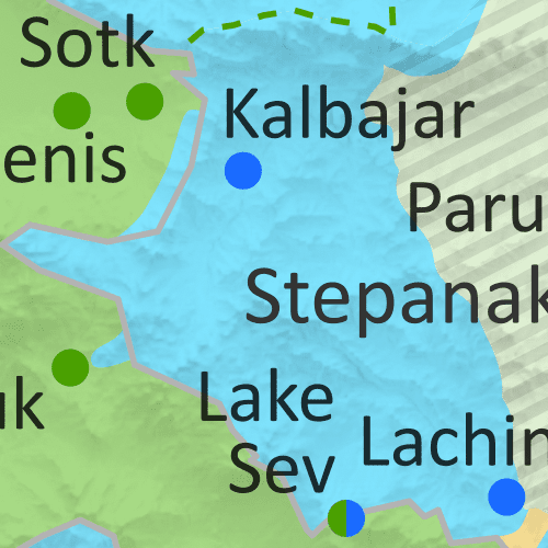
- Up-to-date illustration of current territorial control in Azerbaijan, Armenia, and the disputed Nagorno-Karabakh region, including the self-proclaimed Republic of Artsakh and the apparent Azerbaijani incursions into Armenia proper. Colorblind accessible.
- Claimed borders of the Republic of Artsakh, as well as the former extent of the Soviet-era Nagorno-Karabakh Autonomous Oblast (NKAO).
- NEW: Terrain shading on map to give a better idea of the physical geography context
- Key locations of conflict and contention, including Parukh, Lake Sev, Jermuk, Lachin, and more.
- Detailed timeline of territorial changes and conflict events since January 28, 2021, as well as key military/political developments, with sources cited.
SUBSCRIBERS CLICK HERE TO VIEW FULL ARTICLE AND MAP:
Old Portal (members.polgeonow.com) | New Portal (controlmaps.polgeonow.com)
Not signed up yet? Click here to learn more about our professional subscription service!
