Showing posts with label premium. Show all posts

Monday, December 28, 2020

Yemen Control Map & Report - December 2020 (Subscription)

SUBSCRIBERS CLICK HERE TO PROCEED TO ARTICLE AND MAP

There are newer versions of this map available. To see them, view all Yemen articles on PolGeoNow.

Timeline by Djordje Djukic. Map by Evan Centanni, Djordje Djukic, and onestopmap.com

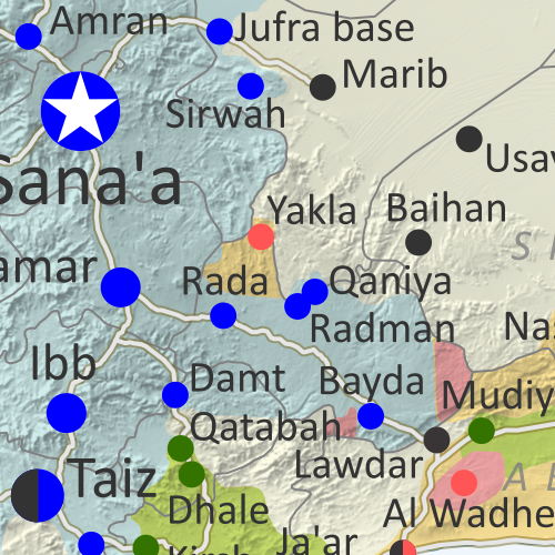
Map of what's happening in Yemen as of December 2020, including territorial control for the unrecognized Houthi government, president-in-exile Hadi and his allies in the Saudi-led coalition, the UAE-backed southern separatist Southern Transitional Council (STC), and Al Qaeda in the Arabian Peninsula (AQAP). Includes recent locations of fighting and other events, including Maas base, Lawdar, Al-Uqlah, Zinjibar, and more.
Subscribe for full access to all conflict map reports!

In the past two months, Yemen's Houthis have continued to gain ground against both the Hadi government and Al Qaeda, while the separatist conflict in the south moves closer to a possible resolution.

See all this and more on the newest update to PolGeoNow's Yemen territorial control map, which includes a timeline of changes and important events since our previous Yemen map report in October.

This map and report are premium content available to paid subscribers of the PolGeoNow Conflict Mapping Service.

Want to see before you buy? Check out our most recent FREE SAMPLE Yemen map report!

Exclusive report includes:
  • Up-to-date map of current territorial control in Yemen, color-coded for the pro-Hadi coalition, the separatist Southern Transitional Council (STC), Houthi forces, and Al Qaeda in the Arabian Peninsula (AQAP)
  • Detailed indication of town-by-town control, including provincial boundaries, all major cities, and many smaller ones
  • Markers for recent areas of fighting, including Maas base, Lawdar, Al Uqlah, Zinjibar, and more
  • Timeline of changes to the situation since October 30, 2020, with links to sources 

SUBSCRIBERS CLICK HERE TO PROCEED TO ARTICLE AND MAP

Not a member yet? Click here to learn more about our professional subscription service!

Can I purchase just this map?
This map and report are not available for automated purchase to non-subscribers. If you need access or republication rights for only this map report, contact service@polgeonow.com for options.

Monday, November 23, 2020

Syria Control Map & Report: Army Takes Last IS Stronghold - November 2020 (Subscription)

SUBSCRIBERS CLICK HERE TO PROCEED TO ARTICLE AND MAP

There are newer versions of this map available. To see them, view all Syria updates.

Research by Djordje Djukic. Map by onestopmap.com, Evan Centanni, and Djordje Djukic

Subscribe for full access to all conflict map reports!

Syrian Civil War map: Territorial control in Syria in late November 2020 (Free Syrian Army rebels, Kurdish YPG, Syrian Democratic Forces (SDF), Hayat Tahrir al-Sham (HTS / Al-Nusra Front), and others). Includes areas of dispersed operational presence for so-called Islamic State (ISIS/ISIL), Turkish/TFSA control, joint SDF-Assad control, US deconfliction zone, and Turkey-Russia security corridor, plus recent locations of conflict and territorial control changes, including Doubayat gas field, Al Karak, Morek, and more. Colorblind accessible. The so-called "Islamic State" (ISIS/ISIL) has lost control of a remote gas field that formed its last clearly-held territory in Syria. But it hasn't disappeared: The group has continued carrying out attacks in the central desert through a dispersed, mobile operations network.

See all this and more on the latest update to PolGeoNow's concise, professional Syrian Civil War control map, which includes a timeline of changes since our previous Syria map report in July, with sources cited.

This map and report are premium content, available to paid subscribers of the PolGeoNow Conflict Mapping Service.

Want to see before you subscribe? Check out our most recent FREE SAMPLE Syria map!

Exclusive map report includes:
  • Up-to-date illustration of current territorial control in Syria, color-coded for the Assad government, rebel groups, and the Kurdish-led Syrian Democratic Forces (SDF). Colorblind accessible.
  • NEW: Pattern showing areas of "Islamic State" (ISIS/ISIL) dispersed operational presence now that the group has lost its last firmly-held territory.
  • Special symbols for joint Turkish/rebel control and joint SDF/government control in the border region
  • Extent of "security corridor" sponsored by Turkey and Russia in the rebel-held northwest
  • Outline showing approximate location of the one publicly-known US "deconfliction zone"
  • Special symbols indicating towns dominated by rebels of the former Al Qaeda Nusra Front (now Hayat Tahrir al-Sham or HTS) and by the Kurdish YPG militia (part of the SDF anti-"Islamic State" coalition)
  • Detailed indication of city-by-city control, including key towns and other locations important to current events
  • Locations of recent control changes and other important events, including Doubayat gas field, Al Karak, Morek, and more
  • Detailed timeline of important events and changes to territorial control since July 30, 2020, compiled by our Syria-Iraq expert, with links to sources.

SUBSCRIBERS CLICK HERE TO PROCEED TO ARTICLE AND MAP

Not signed up yet? Click here to learn more about our professional subscription service!

Can I purchase just this map?
This map and report are not available for automated purchase to non-subscribers. If you need access or republication rights for only this map report, contact service@polgeonow.com for options.

Tuesday, November 10, 2020

Nagorno-Karabakh Control Map & Timeline: Peace Deal Reached - November 10, 2020 (Subscription)

SUBSCRIBERS CLICK HERE TO PROCEED TO ARTICLE AND MAP

There are newer versions of this map available. To see them, view all Nagorno-Karabakh articles on PolGeoNow.

Map by Evan Centanni, Djordje Djukic, Bourrichon, and Lesqual

Subscribe for full access to all conflict map reports!

Preview thumbnail of Nagorno-Karabakh control map, showing territorial claims and control in the Azerbaijan-Armenia war, including the self-proclaimed Republic of Artsakh. Updated to November 10, 2020, the date when the Russia-brokered ceasefire went into effect. Colorblind accessible.
The six-week war between Azerbaijan and the Armenia-backed, self-proclaimed Republic of Artsakh has come screeching to a halt with a new Russia-brokered peace agreement. Azerbaijan has captured ever-bigger sections of the disputed Nagorno-Karabakh region, and will hold onto them under the terms of the new deal.

See all this and more on the latest update to PolGeoNow's concise, professional map of control in the Armenia-Azerbaijan war, which includes a timeline of territorial changes and key events since our previous Nagorno-Karabakh map report of October 25, with sources cited.

This map and report are premium content, available to paid subscribers of the PolGeoNow Conflict Mapping Service.

Want to see before you subscribe? Check out our most recent FREE SAMPLE Nagorno-Karabakh map!

Exclusive map report includes:

  • Up-to-date illustration of current territorial control in Azerbaijan, Armenia, and the disputed Nagorno-Karabakh region, including the self-proclaimed Republic of Artsakh. Areas of mixed or unclear control indicated separately. Colorblind accessible. 
  • Claimed borders of the Republic of Artsakh, as well as the former extent of the Soviet-era Nagorno-Karabakh Autonomous Oblast (NKAO).
  • Indication of town-by-town control along the frontlines.
  • Locations of recent fighting and other important events, including Shusha, Qubadli, Lachin, and more.
  • Detailed timeline of territorial control changes and key military/political developments since October 25, 2020, with sources cited. 

SUBSCRIBERS CLICK HERE TO PROCEED TO ARTICLE AND MAP

Not signed up yet? Click here to learn more about our professional subscription service!

Monday, October 26, 2020

Nagorno-Karabakh (Artsakh) Control Map & Timeline - October 25, 2020 (Subscription)

SUBSCRIBERS CLICK HERE TO PROCEED TO ARTICLE AND MAP

There are newer versions of this map available. To see them, view all Nagorno-Karabakh articles on PolGeoNow.

Map by Evan Centanni, Djordje Djukic, Bourrichon, and Lesqual

Subscribe for full access to all conflict map reports!

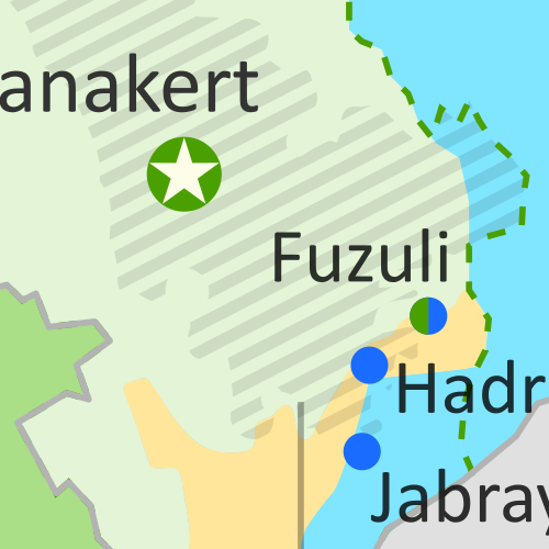
Nagorno-Karabakh control map, showing territorial claims and control in the new Azerbaijan-Armenia war, including the self-proclaimed Republic of Artsakh. Updated to October 2, 2020, showing claimed Azerbaijani advances around the edges of the disputed territory. Colorblind accessible.
In the first few weeks of the new war, Azerbaijan's forces have managed to capture significant stretches of rural territory governed by the Armenia-affiliated, self-proclaimed Republic of Artsakh. However, the region's core remains solidly under Artsakh/Armenian control, with towns around the periphery marking the hotly-contested frontlines.

See all this and more on the latest update to PolGeoNow's concise, professional map of control in the Armenia-Azerbaijan war, which includes a timeline of territorial changes and key events since our previous Nagorno-Karabakh map report of October 2, with sources cited.

This map and report are premium content, available to paid subscribers of the PolGeoNow Conflict Mapping Service.

Want to see before you subscribe? Check out our most recent FREE SAMPLE Nagorno-Karabakh map!

Exclusive map report includes:

  • Up-to-date illustration of current territorial control in Azerbaijan, Armenia, and the disputed Nagorno-Karabakh region, including the self-proclaimed Republic of Artsakh. Areas of mixed or unclear control indicated separately. Colorblind accessible. 
  • Claimed borders of the Republic of Artsakh, as well as the former extent of the Soviet-era Nagorno-Karabakh Autonomous Oblast (NKAO).
  • Indication of town-by-town control along the frontlines.
  • Locations of recent fighting and other important events, including Hadrut, Jabrayil, Zenglan, Talish, and more.
  • Detailed timeline of territorial control changes and key military/political developments since October 2, 2020, with sources cited. 
  • Summary of the conflict situation and changes to the map over the past three weeks.

SUBSCRIBERS CLICK HERE TO PROCEED TO ARTICLE AND MAP

Not signed up yet? Click here to learn more about our professional subscription service!

Tuesday, October 20, 2020

Somalia Control Map & Timeline - October 2020 (Subscription)

SUBSCRIBERS CLICK HERE TO PROCEED TO ARTICLE AND MAP

There are newer versions of this map available. To see them, view all Somalia articles on PolGeoNow.

Map by onestopmap.com, Evan Centanni, and Djordje Djukic

Subscribe for full access to all conflict map reports!

Who controls Somalia? Map (October 2020). With states, regions, and territorial control. Best Somalia control map online, thoroughly researched, detailed but concise. Shows territorial control by Federal Government of Somalia (FGS), Al Shabaab, so-called Islamic State (ISIS/ISIL), separatist Somaliland, autonomous state Puntland, and boundaries of additional federal member states Galmudug, Jubaland, South West, and Hirshabelle. Now labels state capitals and disputed boundaries between Somaliland and Puntland, as well as key towns from the news such as Kurtunwarey, Gendershe, Daynunay, Mubarak, Bulacle, and more. Updated to October 20, 2020. Colorblind accessible.
In the last five months, Somalia's federal government and its allies have made modest gains against Al Shabaab, capturing the first district capital in two years. Meanwhile Galmudug state, under new leadership, has become increasingly integrated with the federal-aligned military coalition.

See all this and more on the latest update to PolGeoNow's concise, professional Somalia control map, which includes a timeline of territorial changes and key events since our previous Somalia map report of May 2020, with sources cited.

This map and report are premium content, available to paid subscribers of the PolGeoNow Conflict Mapping Service.

Want to see before you subscribe? Check out our most recent FREE SAMPLE Somalia map!

Exclusive map report includes:

  • Up-to-date illustration of current territorial control in Somalia, color-coded for the federal government coalition (including AMISOM peacekeepers), autonomous unionist forces, separatist Somaliland, Al Qaeda affiliate Al Shabaab, and fighters aligned with the so-called "Islamic State" (IS; formerly ISIS/ISIL). Areas of mixed or unclear control indicated separately. Colorblind accessible.
  • Boundaries and labels for Somalia's official regions and states, including the self-proclaimed independent Republic of Somaliland and federal states Puntland, Galmudug, Jubaland, South West, and Hirshabelle. Illustrates the claims of both sides in the Somaliland-Puntland border dispute, as well as actual control.
  • Detailed indication of city-by-city control, including many relevant smaller towns and villages.
  • Locations of recent fighting and other important events, including Kurtunwarey, Gendershe, Daynunay, Mubarak, Bulacle, and more.
  • Detailed timeline of territorial control changes and key political developments since May 20, 2020, with sources cited. 
  • Summary of the conflict situation and changes to the map over the past five months.

SUBSCRIBERS CLICK HERE TO PROCEED TO ARTICLE AND MAP

Not signed up yet? Click here to learn more about our professional subscription service!

Friday, August 28, 2020

Yemen Control Map & Report: Al Qaeda / IS Enclave Eliminated - August 2020 (Subscription)

SUBSCRIBERS CLICK HERE TO PROCEED TO ARTICLE AND MAP

There are newer versions of this map available. To see them, view all Yemen articles on PolGeoNow.

Timeline by Djordje Djukic. Map by Evan Centanni, Djordje Djukic, and onestopmap.com

Map of what's happening in Yemen as of August 2020, including territorial control for the unrecognized Houthi government, president-in-exile Hadi and his allies in the Saudi-led coalition, the UAE-backed southern separatist Southern Transitional Council (STC), and Al Qaeda in the Arabian Peninsula (AQAP). Includes recent locations of fighting and other events, including Yakla, Qaniya, Damt, and more.
Subscribe for full access to all conflict map reports!

Over the past month, Yemen's Houthi government has continued slowly gaining ground, both against the internationally-recognized Hadi government and against Al Qaeda and "Islamic State" (ISIS/ISIL) forces.

See all this and more on the newest update to PolGeoNow's Yemen territorial control map, which includes a timeline of changes and important events since our previous Yemen map report in July.

This map and report are premium content available to paid subscribers of the PolGeoNow Conflict Mapping Service.

Want to see before you buy? Check out our most recent FREE SAMPLE Yemen map report!

Exclusive report includes:
  • Up-to-date map of current territorial control in Yemen, color-coded for the pro-Hadi coalition, the separatist Southern Transitional Council (STC), Houthi forces, and Al Qaeda in the Arabian Peninsula (AQAP)
  • Detailed indication of town-by-town control, including provincial boundaries, all major cities, and many smaller ones
  • Markers for recent areas of fighting, including Yakla, Qaniya, Damt, and more
  • Timeline of changes to the situation since July 25, 2020, with links to sources 

SUBSCRIBERS CLICK HERE TO PROCEED TO ARTICLE AND MAP

Not a member yet? Click here to learn more about our professional subscription service!

Can I purchase just this map?
This map and report are not available for automated purchase to non-subscribers. If you need access or republication rights for only this map report, contact service@polgeonow.com for options.
Saturday, August 22, 2020

Iraq Control Map & Timeline: Turkey Expands Control in North - August 2020 (Subscription)

SUBSCRIBERS CLICK HERE TO PROCEED TO ARTICLE AND MAP

(To see other maps in this series, view all Iraq articles.)

Research by Djordje Djukic. Map by onestopmap.com, Evan Centanni, and Djordje Djukic

Subscribe for full access to all conflict map reports!

Iraq Control Map 2020, updated to August 21. Shows areas of Iraq under Turkey's military contro, ISIS control (Islamic State/ISIL/Daesh), and under the control of the Baghdad government, the Kurdistan Peshmerga, and the Yezidi Sinjar Alliance (YBS and YJE). Marks Khamtir and Halukah Mountains (Jabal Khamtir and Jabal Halukah), controlled by Turkish forces. Colorblind accessible.
While Iraq's lines of control have mostly stayed the same since the beginning of the year, Turkey's military has been gradually increasing its control of the north. The incursion is part of the Turkish war against the Kurdish PKK, a rebel group from Turkey that now bases itself across the border in Iraq.

See all this and more on the latest update to PolGeoNow's concise, professional map of control in Iraq, including a timeline of changes since our previous Iraq map report of January 2020.

This map and report are premium content, available to paid subscribers of the PolGeoNow Conflict Mapping Service.

Want to see before you subscribe? Check out our most recent FREE SAMPLE Iraq map report!

Exclusive report includes:
  • Up-to-date map of current territorial control in Iraq, color-coded for the Iraqi government, "Islamic State" (ISIS/ISIL) fighters, Kurdistan's Peshmerga forces, and Yezidi militias. Colorblind accessible.
  • NEW: Turkish military control along the northern border, including key sites Mt. Khamtir (Jabal Khamtir) and Mt. Halukah (Jabal Halukah).
  • Detailed indication of town-by-town control, including all major cities and many smaller ones, as well as terrain, major roads, and provincial boundaries
  • Timeline of changes to the situation and related events since January, compiled by our Iraq-Syria specialist, with links to sources.
SUBSCRIBERS CLICK HERE TO PROCEED TO ARTICLE AND MAP

Not signed up yet? Click here to learn more about our professional subscription service!

Can I purchase just this map?
This map and report are not available for automated purchase to non-subscribers. If you need access or republication rights for only this map report, contact service@polgeonow.com for options.

Sunday, July 26, 2020

Yemen Control Map & Report: Separatists Take Socotra - July 2020 (Subscription)

SUBSCRIBERS CLICK HERE TO PROCEED TO ARTICLE AND MAP

There are newer versions of this map available. To see them, view all Yemen articles on PolGeoNow.

Timeline by Djordje Djukic. Map by Evan Centanni, Djordje Djukic, and onestopmap.com

Map of what's happening in Yemen as of July 2020, including territorial control for the unrecognized Houthi government, president-in-exile Hadi and his allies in the Saudi-led coalition, the UAE-backed southern separatist Southern Transitional Council (STC), and Al Qaeda in the Arabian Peninsula (AQAP). Includes recent locations of fighting and other events, including Socotra, Qaniya, Radman, Ja'ar, Jardan, and more.
Subscribe for full access to all conflict map reports!

In the last two months, Yemen's internationally-recognized government has lost more ground to both northern Houthi forces and southern separatists, including a separatist takeover over the entire island province of Socotra.

See all this and more on the newest update to PolGeoNow's Yemen territorial control map, which includes a timeline of changes and important events since our previous Yemen map report in May.

This map and report are premium content available to paid subscribers of the PolGeoNow Conflict Mapping Service.

Want to see before you buy? Check out our most recent FREE SAMPLE Yemen map report!

Exclusive report includes:
  • Up-to-date map of current territorial control in Yemen, color-coded for the pro-Hadi coalition, the separatist Southern Transitional Council (STC), Houthi forces, and Al Qaeda in the Arabian Peninsula (AQAP)
  • Detailed indication of town-by-town control, including provincial boundaries, all major cities, and many smaller ones
  • Markers for recent areas of fighting, including Hadibu, Qaniya, Radman, Ja'ar, Jardan, and more
  • Timeline of changes to the situation since May 20, 2020, with links to sources 

SUBSCRIBERS CLICK HERE TO PROCEED TO ARTICLE AND MAP

Not a member yet? Click here to learn more about our professional subscription service!

Can I purchase just this map?
This map and report are not available for automated purchase to non-subscribers. If you need access or republication rights for only this map report, contact service@polgeonow.com for options.
Monday, June 22, 2020

Libyan Civil War Map & Timeline: Tables Turned in Tripoli - June 2020 (Subscription)

SUBSCRIBERS CLICK HERE TO PROCEED TO ARTICLE AND MAP

There are newer versions of this map available. To see them, view all Libya updates.

Research by Djordje Djukic. Map by onestopmap.com, Evan Centanni, and Djordje Djukic.

Subscribe for full access to all conflict map reports!

Libya: Who controls what? A concise, professional map of who controls Libya now (June 2020). Shows detailed territorial control in the Libyan Civil War as of June 21, 2020, including all major parties (Government of National Accord (GNA); Tobruk House of Representatives, General Haftar's Libyan National Army (LNA), and allies; Tuareg and Toubou (Tebu, Tubu) militias in the south; and the so-called Islamic State (ISIS/ISIL)). Includes terrain, major roads, and recent locations of interest including the Tripoli International Airport, Tarhuna, Bani Walid, Qurayyat, and more. Colorblind accessible. Over the past few weeks, the tables have turned dramatically in western Libya, with the LNA driven completely out of its footholds within the city of Tripoli, and expelled from almost the whole northwest. 

See all this and more on the latest update to PolGeoNow's concise, professional Libyan Civil War control map, which comes with a timeline of changes since our previous Libya control map report of May 29, 2020.

This map and report are premium content available to paid subscribers of the PolGeoNow Conflict Mapping Service.

Want to see before you subscribe? Check out our most recent FREE SAMPLE Libya map!

Exclusive report includes:
  • Up-to-date map of current territorial control in Libya, color-coded for the UN-backed Government of National Accord (GNA), the rival Tobruk parliament and Khalifa Haftar's Libyan National Army (LNA), the so-called "Islamic State" (ISIS/ISIL), and Toubou and Tuareg militias in the south. Colorblind accessible.
  • Detailed indication of city-by-city control, including key towns and other locations important to current events.
  • Locations of recent fighting and changes of control, including the Tripoli International Airport, Tarhuna, Bani Walid, Qurayyat, and more.
  • Detailed timeline of important events and changes to territorial control since May 29, 2020, with links to sources.

SUBSCRIBERS CLICK HERE TO PROCEED TO ARTICLE AND MAP

Not signed up yet? Click here to learn more about our professional subscription service!

Can I purchase just this map?
This map and report are not available for automated purchase to non-subscribers. If you need access or republication rights for only this map report, please contact service@polgeonow.com for options.

Friday, May 22, 2020

Yemen Control Map & Report: Separatist Conflict Expands - May 2020 (Subscription)

SUBSCRIBERS CLICK HERE TO PROCEED TO ARTICLE AND MAP

There are newer versions of this map available. To see them, view all Yemen articles on PolGeoNow.

Timeline by Djordje Djukic. Map by Evan Centanni, Djordje Djukic, and onestopmap.com

Map of what's happening in Yemen as of May 2020, including territorial control for the unrecognized Houthi government, president-in-exile Hadi and his allies in the Saudi-led coalition, the UAE-backed southern separatist Southern Transitional Council (STC), and Al Qaeda in the Arabian Peninsula (AQAP). Includes recent locations of fighting and other events, including Hadibu, al-Labanat, al-Khanjar, Balhaf, Jufra base, and more.
Subscribe for full access to all conflict map reports!

Since March, Houthi forces have continued advancing eastwards, while the conflict between the Hadi government and southern separatists has erupted into open warfare, expanding as far as the remote island province of Socotra.

See all this and more on the newest update to PolGeoNow's Yemen territorial control map, which includes a timeline of changes and important events since our previous Yemen map report in March.

This map and report are premium content available to paid subscribers of the PolGeoNow Conflict Mapping Service.

Want to see before you buy? Check out our most recent FREE SAMPLE Yemen map report!

Exclusive report includes:
  • Up-to-date map of current territorial control in Yemen, color-coded for the pro-Hadi coalition, the separatist Southern Transitional Council (STC), Houthi forces, and Al Qaeda in the Arabian Peninsula (AQAP)
  • Detailed indication of town-by-town control, including provincial boundaries, all major cities, and many smaller ones
  • Markers for recent areas of fighting, including Hadibu, al-Labanat, al-Khanjar, Balhaf, Jufra base, and more
  • Timeline of changes to the situation since March 29, 2020, with links to sources 

SUBSCRIBERS CLICK HERE TO PROCEED TO ARTICLE AND MAP

Not a member yet? Click here to learn more about our professional subscription service!

Can I purchase just this map?
This map and report are not available for automated purchase to non-subscribers. If you need access or republication rights for only this map report, contact service@polgeonow.com for options.

Wednesday, May 20, 2020

New & Improved: Somalia Control Map & Timeline - May 2020 (Subscription)

SUBSCRIBERS CLICK HERE TO PROCEED TO ARTICLE AND MAP

There are newer versions of this map available. To see them, view all Somalia articles on PolGeoNow.

Map by onestopmap.com, Evan Centanni, and Djordje Djukic

Subscribe for full access to all conflict map reports!

Who controls Somalia? Map (May 2020). With states, regions, and territorial control. Best Somalia control map online, thoroughly researched, detailed but concise. Shows territorial control by Federal Government of Somalia (FGS), Al Shabaab, so-called Islamic State (ISIS/ISIL), separatist Somaliland, and autonomous states Puntland and Galmudug, plus boundaries of federal states Jubaland, South West, and Hirshabelle. Now labels state capitals and disputed boundaries between Somaliland and Puntland. Updated to May 20, 2020. Colorblind accessible. Since December, Al Shabaab has lost control of some towns in Somalia, while disputes over governance in Jubaland and Galmudug states have erupted briefly into armed battles with the federal government. Meanwhile, the country is battling with a major outbreak of the COVID-19 coronavirus.

This edition of the map includes a number of improvements, including the addition of state capitals, more regional boundaries, and territorial claims by Somaliland and Puntland. City and town sizes have also been reviewed and overhauled based on better data.

See all this and more on the latest update to PolGeoNow's concise, professional Somalia control map, which includes a timeline of changes since our previous Somalia map report of December 2019, with sources cited.

This map and report are premium content, available to paid subscribers of the PolGeoNow Conflict Mapping Service.

Want to see before you subscribe? Check out our most recent FREE SAMPLE Somalia map!

Exclusive map report includes:
  • Up-to-date illustration of current territorial control in Somalia, color-coded for the federal government coalition (including AMISOM peacekeepers), autonomous unionist forces, separatist Somaliland, Al Qaeda affiliate Al Shabaab, and fighters aligned to the so-called "Islamic State" (ISIS/ISIL). Areas of mixed or unclear control indicated separately. Colorblind accessible.
  • Boundaries and labels for Somalia's official regions and states, including the autonomous administrations of Somaliland, Puntland, and Galmudug as well as the federally-supported Jubaland, South West, and Hirshabelle states. 
  • New: State capitals, more regional boundaries in north, and border claims in Puntland and Somaliland's border disputes.
  • Detailed indication of city-by-city control, including many relevant smaller towns and villages.
  • New: City and town sizes newly reviewed and overhauled based on better data.
  • Locations of recent fighting and other important events, including Janale, Lego, Belet Hawo, Dhusamareb, and more.
  • Detailed timeline of territorial control changes and key political developments since December 31, 2019, with sources cited. 
  • New: Timeline includes major events in Somalia's battle with the COVID-19 coronavirus pandemic, an important background for the political events happening in the country.
  • Summary of the conflict situation and changes to the map over the past five and a half months.

SUBSCRIBERS CLICK HERE TO PROCEED TO ARTICLE AND MAP

Not signed up yet? Click here to learn more about our professional subscription service!

Thursday, April 23, 2020

Libyan Civil War Map & Timeline: GNA Takes Sabratha - April 2020 (Subscription)

SUBSCRIBERS CLICK HERE TO PROCEED TO ARTICLE AND MAP

There are newer versions of this map available. To see them, view all Libya updates.

Research by Djordje Djukic. Map by onestopmap.com, Evan Centanni, and Djordje Djukic.

Subscribe for full access to all conflict map reports!

Libya: Who controls what? A concise, professional map of who controls Libya now (April 2020). Shows detailed territorial control in the Libyan Civil War as of April 22, 2020, including all major parties (Government of National Accord (GNA); Tobruk House of Representatives, General Haftar's Libyan National Army (LNA), and allies; Tuareg and Toubou (Tebu, Tubu) militias in the south; the so-called Islamic State (ISIS/ISIL); and other groups such as the National Salvation Government (NSG)). Includes terrain, major roads, and recent locations of interest including Sabratha, Aziziyah, Al-Watiyah Airbase, Waw an Namus, and more. Colorblind accessible. As the fight for Tripoli rages on, Libya's UN-recognized government has captured the city of Sabratha, securing control of the whole coastline west of the capital for the first time in a year.

See all this and more on the latest update to PolGeoNow's concise, professional Libyan Civil War control map, which comes with a timeline of changes since our previous Libya control map report of January 26, 2020.

This map and report are premium content available to paid subscribers of the PolGeoNow Conflict Mapping Service.

Want to see before you subscribe? Check out our most recent FREE SAMPLE Libya map!

Exclusive report includes:
  • Up-to-date map of current territorial control in Libya, color-coded for the UN-backed Government of National Accord (GNA), the rival Tobruk parliament and Khalifa Haftar's Libyan National Army (LNA), the so-called "Islamic State" (ISIS/ISIL), and Toubou and Tuareg militias in the south. Colorblind accessible.
  • Detailed indication of city-by-city control, including key towns and other locations important to current events.
  • Locations of recent fighting and changes of control, including Sabratha, Aziziyah, Al-Watiyah Airbase, Waw an Namus, and more.
  • Detailed timeline of important events and changes to territorial control since January 26, 2020, with links to sources.

SUBSCRIBERS CLICK HERE TO PROCEED TO ARTICLE AND MAP

Not signed up yet? Click here to learn more about our professional subscription service!

Can I purchase just this map?
This map and report are not available for automated purchase to non-subscribers. If you need access or republication rights for only this map report, please contact service@polgeonow.com for options.

Sunday, March 29, 2020

Yemen Control Map & Report: Houthis Make Key Gains - March 2020 (Subscription)

SUBSCRIBERS CLICK HERE TO PROCEED TO ARTICLE AND MAP

There are newer versions of this map available. To see them, view all Yemen articles on PolGeoNow.

Timeline by Djordje Djukic. Map by Evan Centanni, Djordje Djukic, and onestopmap.com

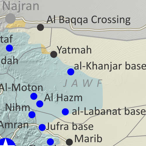
Map of what's happening in Yemen as of March 2020, including territorial control for the unrecognized Houthi government, president-in-exile Hadi and his allies in the Saudi-led coalition, the UAE-backed southern separatist Southern Transitional Council (STC), and Al Qaeda in the Arabian Peninsula (AQAP). Includes recent locations of fighting and other events, such as Al-Hazm, Yatmah, Shahan, Durayhimi, al-Labanat base, and more.
Subscribe for full access to all conflict map reports!

Since February, Houthi forces have expanded their control in northern Yemen, putting the internationally-backed Hadi government on the defensive, even as the conflict between Hadi and formerly-allied separatists simmers on in the south.

See all this and more on the newest update to PolGeoNow's Yemen territorial control map, which includes a timeline of changes and important events since our previous Yemen map report in February.

This map and report are premium content available to paid subscribers of the PolGeoNow Conflict Mapping Service.

Want to see before you buy? Check out our most recent FREE SAMPLE Yemen map report!

Exclusive report includes:
  • Up-to-date map of current territorial control in Yemen, color-coded for the pro-Hadi coalition, the separatist Southern Transitional Council (STC), Houthi forces, and Al Qaeda in the Arabian Peninsula (AQAP).
  • Detailed indication of town-by-town control, including provincial boundaries, all major cities, and many smaller ones
  • Markers for recent areas of fighting, including Al-Hazm, Yatmah, Shahan, Durayhimi, and more
  • Timeline of changes to the situation since February 16, 2020, with links to sources 

SUBSCRIBERS CLICK HERE TO PROCEED TO ARTICLE AND MAP

Not a member yet? Click here to learn more about our professional subscription service!

Can I purchase just this map?
This map and report are not available for automated purchase to non-subscribers. If you need access or republication rights for only this map report, contact service@polgeonow.com for options.
Sunday, March 22, 2020

Syrian Civil War Map & Timeline: New Ceasefire Lines in Northwest - March 2020 (Subscription)

SUBSCRIBERS CLICK HERE TO PROCEED TO ARTICLE AND MAP

There are newer versions of this map available. To see them, view all Syria updates.

Research by Djordje Djukic. Map by onestopmap.com, Evan Centanni, and Djordje Djukic

Subscribe for full access to all conflict map reports!

Map of Syrian Civil War (Syria control map): Territorial control in Syria in March 2020 (Free Syrian Army rebels, Kurdish YPG, Syrian Democratic Forces (SDF), Hayat Tahrir al-Sham (HTS / Al-Nusra Front), Islamic State (ISIS/ISIL), and others). Includes Turkish/TFSA control, joint SDF-Assad control, US deconfliction zone, and Turkey-Russia security corridor, plus recent locations of conflict and territorial control changes, including Kafr Nabl, Nayrab, Anadan, Al Sanamayn, and more. Colorblind accessible. Since last month, Syria's Assad government has gained more ground against the rebels and come into direct conflict with the Turkish military. Now, a deal between Russia and Turkey has brought a new ceasefire to the area.

See all this and more on the latest update to PolGeoNow's concise, professional Syrian Civil War control map, which includes a timeline of changes since our previous Syria map report in February, with sources cited.

This map and report are premium content, available to paid subscribers of the PolGeoNow Conflict Mapping Service.

Want to see before you subscribe? Check out our most recent FREE SAMPLE Syria map!

Exclusive map report includes:
  • Up-to-date illustration of current territorial control in Syria, color-coded for the Assad government, rebel groups, "Islamic State" (ISIS/ISIL) fighters, and the Kurdish-led Syrian Democratic Forces (SDF). Colorblind accessible.
  • Special symbols for joint Turkish/rebel control and joint SDF/government control in the border region
  • Extent of "security corridor" sponsored by Turkey and Russia in the rebel-held northwest
  • Outline showing approximate location of the one publicly-known US "deconfliction zone"
  • Special symbols indicating towns dominated by rebels of the former Al Qaeda Nusra Front (now Hayat Tahrir al-Sham or HTS) and by the Kurdish YPG militia (part of the SDF anti-IS coalition)
  • Detailed indication of city-by-city control, including key towns and other locations important to current events
  • Locations of recent control changes and other important events, including Kafr Nabl, Nayrab, Anadan, Al Sanamayn, and more
  • Detailed timeline of important events and changes to territorial control since February 14, 2020, compiled by our Syria-Iraq expert, with links to sources.

SUBSCRIBERS CLICK HERE TO PROCEED TO ARTICLE AND MAP

Not signed up yet? Click here to learn more about our professional subscription service!

Can I purchase just this map?
This map and report are not available for automated purchase to non-subscribers. If you need access or republication rights for only this map report, contact service@polgeonow.com for options.

Monday, February 17, 2020

Yemen Control Map & Report - February 2020 (Subscription)

SUBSCRIBERS CLICK HERE TO PROCEED TO ARTICLE AND MAP

There are newer versions of this map available. To see them, view all Yemen articles on PolGeoNow.

Timeline by Djordje Djukic. Map by Evan Centanni, Djordje Djukic, and onestopmap.com

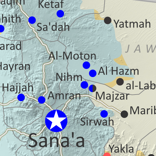
Map of what is happening in Yemen as of February 2020, including territorial control for the unrecognized Houthi government, president-in-exile Hadi and his allies in the Saudi-led coalition, the UAE-backed southern separatist Southern Transitional Council (STC), and Al Qaeda in the Arabian Peninsula (AQAP). Includes recent locations of fighting and other events, such as Nihm, Majzar, Yakla, and more.
Subscribe for full access to all conflict map reports!

Over the past two months, the Houthi government has gained some ground in central Yemen against the internationally-backed government of President Hadi, and separatists still hold key towns in the south despite shrinking estimates of their total control.

See all this and more on the newest update to PolGeoNow's Yemen territorial control map, which includes a timeline of changes and important events since our previous Yemen map report in December.

This map and report are premium content available to paid subscribers of the PolGeoNow Conflict Mapping Service.

Want to see before you buy? Check out our most recent FREE SAMPLE Yemen map report!

Exclusive report includes:
  • Up-to-date map of current territorial control in Yemen, color-coded for the pro-Hadi coalition, the separatist Southern Transitional Council (STC), Houthi forces, and Al Qaeda in the Arabian Peninsula (AQAP).
  • Detailed indication of town-by-town control, including provincial boundaries, all major cities, and many smaller ones
  • Markers for recent areas of fighting, including Nihm, Majzar, Yakla, and more
  • Timeline of changes to the situation since December 15, 2019, with links to sources 

SUBSCRIBERS CLICK HERE TO PROCEED TO ARTICLE AND MAP

Not a member yet? Click here to learn more about our professional subscription service!

Can I purchase just this map?
This map and report are not available for automated purchase to non-subscribers. If you need access or republication rights for only this map report, contact service@polgeonow.com for options.

Friday, February 14, 2020

Syrian Civil War Map & Timeline: Assad Retakes Key Highway - February 2020 (Subscription)

SUBSCRIBERS CLICK HERE TO PROCEED TO ARTICLE AND MAP

There are newer versions of this map available. To see them, view all Syria updates.

Research by Djordje Djukic. Map by onestopmap.com, Evan Centanni, and Djordje Djukic

Subscribe for full access to all conflict map reports!

Map of Syrian Civil War (Syria control map): Territorial control in Syria in February 2020 (Free Syrian Army rebels, Kurdish YPG, Syrian Democratic Forces (SDF), Hayat Tahrir al-Sham (HTS / Al-Nusra Front), Islamic State (ISIS/ISIL), and others). Includes Turkish/TFSA control, joint SDF-Assad control, US deconfliction zone, and Turkey-Russia demilitarized buffer zone, plus recent locations of conflict and territorial control changes, including Marat al-Numan, Saraqeb, Regiment 46, Al-Eiss, and more. Colorblind accessible. Over the past month, forces loyal to Syria's Assad government have many major gains in the northwest, capturing two rebel strongholds and reestablishing control along the entire Damascus-Aleppo highway for the first time in eight years.

 See all this and more on the latest update to PolGeoNow's concise, professional Syrian Civil War control map, which includes a timeline of changes since our previous Syria map report in January, with sources cited.

This map and report are premium content, available to paid subscribers of the PolGeoNow Conflict Mapping Service.

Want to see before you subscribe? Check out our most recent FREE SAMPLE Syria map!

Exclusive map report includes:
  • Up-to-date illustration of current territorial control in Syria, color-coded for the Assad government, rebel groups, "Islamic State" (ISIS/ISIL) fighters, and the Kurdish-led Syrian Democratic Forces (SDF). Colorblind accessible.
  • Special symbols for joint Turkish/rebel control and joint SDF/government control in the border region
  • Extent of "buffer zone" sponsored by Turkey and Russia in the rebel-held northwest
  • Outline showing approximate location of the one publicly-known US "deconfliction zone"
  • Special symbols indicating towns dominated by rebels of the former Al Qaeda Nusra Front (now Hayat Tahrir al-Sham or HTS) and by the Kurdish YPG militia (part of the SDF anti-IS coalition)
  • Detailed indication of city-by-city control, including key towns and other locations important to current events
  • Locations of recent control changes and other important events, including Marat al-Numan, Saraqeb, the Regiment 46 base, Al-Eiss, and more
  • Detailed timeline of important events and changes to territorial control since January 20, 2020, compiled by our Syria-Iraq expert, with links to sources.

SUBSCRIBERS CLICK HERE TO PROCEED TO ARTICLE AND MAP

Not signed up yet? Click here to learn more about our professional subscription service!

Can I purchase just this map?
This map and report are not available for automated purchase to non-subscribers. If you need access or republication rights for only this map report, contact service@polgeonow.com for options.

Monday, January 27, 2020

Libyan Civil War Map & Timeline: LNA Takes Sirte - January 2020 (Subscription)

SUBSCRIBERS CLICK HERE TO PROCEED TO ARTICLE AND MAP

There are newer versions of this map available. To see them, view all Libya updates.

Research by Djordje Djukic. Map by onestopmap.com, Evan Centanni, and Djordje Djukic.

Subscribe for full access to all conflict map reports!

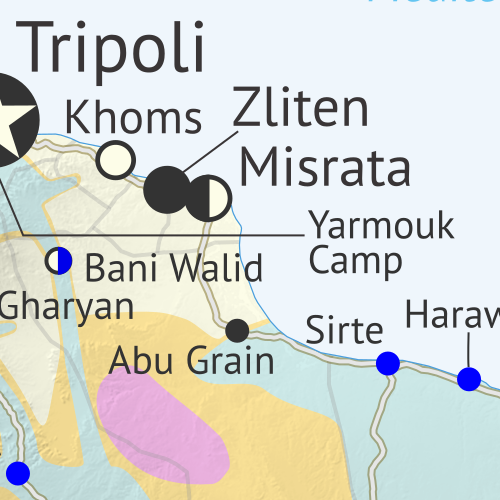
Libya: Who controls what? A concise, professional map of who controls Libya now (December 2019). Shows detailed territorial control in the Libyan Civil War as of January 26, 2020, including all major parties (Government of National Accord (GNA); Tobruk House of Representatives, General Haftar's Libyan National Army (LNA), and allies; Tuareg and Toubou (Tebu, Tubu) militias in the south; the so-called Islamic State (ISIS/ISIL); and other groups such as the National Salvation Government (NSG)). Includes terrain, major roads, and recent locations of interest including Sirte, Yarmouk Camp, Abu Grain, and more. Colorblind accessible. Since a month ago, the eastern-based Libyan National Army has captured the coastal town of Sirte and reached the doorstep of western-controlled capital Tripoli, even as the western government welcomes reinforcements from the Turkish military and allied Syrian rebels.

See all this and more on the latest update to PolGeoNow's concise, professional Libyan Civil War control map, which comes with a timeline of changes since our previous Libya control map report of December 27, 2019.

This map and report are premium content available to paid subscribers of the PolGeoNow Conflict Mapping Service.

Want to see before you subscribe? Check out our most recent FREE SAMPLE Libya map!

Exclusive report includes:
  • Up-to-date map of current territorial control in Libya, color-coded for the UN-backed Government of National Accord (GNA), the rival Tobruk parliament and Khalifa Haftar's Libyan National Army (LNA), the so-called "Islamic State" (ISIS/ISIL), and Toubou and Tuareg militias in the south. Colorblind accessible.
  • Detailed indication of city-by-city control, including key towns and other locations important to current events.
  • Locations of recent fighting and changes of control, including Sirte, Yarmouk Camp, Abu Grain, and more.
  • Detailed timeline of important events and changes to territorial control since December 27, 2019, with links to sources.

SUBSCRIBERS CLICK HERE TO PROCEED TO ARTICLE AND MAP

Not signed up yet? Click here to learn more about our professional subscription service!

Can I purchase just this map?
This map and report are not available for automated purchase to non-subscribers. If you need access or republication rights for only this map report, please contact service@polgeonow.com for options.

Wednesday, January 22, 2020

Syrian Civil War Map & Timeline - January 2020 (Subscription)

SUBSCRIBERS CLICK HERE TO PROCEED TO ARTICLE AND MAP

There are newer versions of this map available. To see them, view all Syria updates.

Research by Djordje Djukic. Map by onestopmap.com, Evan Centanni, and Djordje Djukic

Subscribe for full access to all conflict map reports!

Map of Syrian Civil War (Syria control map): Territorial control in Syria in January 2020 (Free Syrian Army rebels, Kurdish YPG, Syrian Democratic Forces (SDF), Hayat Tahrir al-Sham (HTS / Al-Nusra Front), Islamic State (ISIS/ISIL), and others). Includes Turkish/TFSA control, joint SDF-Assad control, US deconfliction zone, and Turkey-Russia demilitarized buffer zone, plus recent locations of conflict and territorial control changes, including Marat al-Numan, Al-Hayl Gas Field, Abu Kamal, and more. Colorblind accessible.Since November, Syrian army forces loyal to the Bashar al-Assad government have captured more small parts of the rebel-dominated Idlib province, even as the so-called "Islamic State" (ISIS/ISIL) continues its activities in the eastern desert.

See all this and more on the latest update to PolGeoNow's concise, professional Syrian Civil War control map, which includes a timeline of changes since our previous Syria map report in November, with sources cited.

This map and report are premium content, available to paid subscribers of the PolGeoNow Conflict Mapping Service.

Want to see before you subscribe? Check out our most recent FREE SAMPLE Syria map!

Exclusive map report includes:
  • Up-to-date illustration of current territorial control in Syria, color-coded for the Assad government, rebel groups, "Islamic State" (ISIS/ISIL) fighters, and the Kurdish-led Syrian Democratic Forces (SDF). Colorblind accessible.
  • Special symbols for joint Turkish/rebel control and joint SDF/government control in the border region
  • Extent of "buffer zone" sponsored by Turkey and Russia in the rebel-held northwest
  • Outline showing approximate location of the one publicly-known US "deconfliction zone"
  • Special symbols indicating towns dominated by rebels of the former Al Qaeda Nusra Front (now Hayat Tahrir al-Sham or HTS) and by the Kurdish YPG militia (part of the SDF anti-IS coalition).
  • Detailed indication of city-by-city control, including key towns and other locations important to current events.
  • Locations of recent control changes and other important events, including Ras al-Ayn, Tel Abyad, Ayn Issa, and more.
  • Detailed timeline of important events and changes to territorial control since November 28, 2019, compiled by our Syria-Iraq expert, with links to sources. 

SUBSCRIBERS CLICK HERE TO PROCEED TO ARTICLE AND MAP

Not signed up yet? Click here to learn more about our professional subscription service!

Can I purchase just this map?
This map and report are not available for automated purchase to non-subscribers. If you need access or republication rights for only this map report, contact service@polgeonow.com for options.

Saturday, December 28, 2019

Libyan Civil War Map & Timeline - December 2019 (Subscription)

SUBSCRIBERS CLICK HERE TO PROCEED TO ARTICLE AND MAP

There are newer versions of this map available. To see them, view all Libya updates.

Research by Djordje Djukic. Map by onestopmap.com, Evan Centanni, and Djordje Djukic.

Subscribe for full access to all conflict map reports!

Libya: Who controls what? A concise, professional map of who controls Libya now (December 2019). Shows detailed territorial control in the Libyan Civil War as of September 27, 2019, including all major parties (Government of National Accord (GNA); Tobruk House of Representatives, General Haftar's Libyan National Army (LNA), and allies; Tuareg and Toubou (Tebu, Tubu) militias in the south; the so-called Islamic State (ISIS/ISIL); and other groups such as the National Salvation Government (NSG)). Includes terrain, major roads, and recent locations of interest including Yarmouk Camp, Tripoli International Airport, El Feel Oilfield, Tummo border crossing, and more. Colorblind accessible. Since November, forces loyal to Libya's eastern-based government have moved closer to Tripoli's center, where they hope to unseat the country's rival western-based government, even as Turkey prepares a military intervention to defend the government in Tripoli.

See all this and more on the latest update to PolGeoNow's concise, professional Libyan Civil War control map, which comes with a timeline of changes since our previous Libya control map report of November 19, 2019.

This map and report are premium content available to paid subscribers of the PolGeoNow Conflict Mapping Service.

Want to see before you subscribe? Check out our most recent FREE SAMPLE Libya map!

Exclusive report includes:
  • Up-to-date map of current territorial control in Libya, color-coded for the UN-backed Government of National Accord (GNA), the rival Tobruk parliament and Khalifa Haftar's Libyan National Army (LNA), the so-called "Islamic State" (ISIS/ISIL), and Toubou and Tuareg militias in the south. Colorblind accessible.
  • Detailed indication of city-by-city control, including key towns and other locations important to current events.
  • Locations of recent fighting and changes of control, including Yarmouk Camp, Tripoli International Airport, El Feel Oilfield, Tummo border crossing, and more.
  • Detailed timeline of important events and changes to territorial control since November 19, 2019, with links to sources.

SUBSCRIBERS CLICK HERE TO PROCEED TO ARTICLE AND MAP

Not signed up yet? Click here to learn more about our professional subscription service!

Can I purchase just this map?
This map and report are not available for automated purchase to non-subscribers. If you need access or republication rights for only this map report, please contact service@polgeonow.com for options.