Wednesday, December 7, 2016

Libya's "Islamic State" Loses Last City: Dec. 2016 Control Map & Timeline (Subscription)

SUBSCRIBERS CLICK HERE TO PROCEED TO ARTICLE AND MAP

There are newer versions of this map available. To see them, view all Libya updates.

Research by Djordje Djukic, with Evan Centanni. Map by onestopmap.com and Evan Centanni.
Subscribe for full access to all conflict map reports!

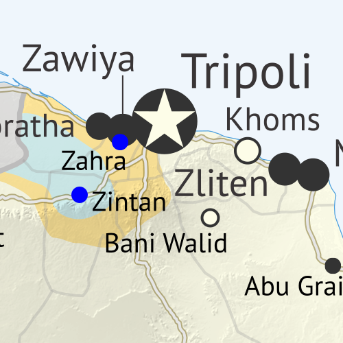
Libya control map: Shows detailed territorial control in Libya's civil war as of December 2016, including all major parties (Government of National Accord (GNA); Tobruk House of Representatives, General Haftar's Libyan National Army, Zintan militias, Petroleum Facilities Guard (PFG); Tripoli GNC government, Libya Dawn, and Libya Shield Force; Shura Council of Benghazi Revolutionaries and other hardline Islamist groups; and National Salvation Government). Also file under: Map of Islamic State (ISIS or ISIL) control in Libya. Now includes terrain and major roads. Colorblind accessible. In the past three months, a lot has changed in Libya, including the expulsion of the so-called "Islamic State" (ISIS/ISIL) from its last territory in North Africa. Meanwhile, Libya now has three competing governments, and key oil ports have changed hands.
 
See all this and more on the latest update to PolGeoNow's concise, professional Libyan Civil War control map, which comes with a timeline of changes since our September 2016 Libya map report.

This map and report are premium content available to paid subscribers of the PolGeoNow Conflict Mapping Service.

Want to see before you subscribe? Check out our most recent FREE SAMPLE Libya map!

Exclusive report includes:
  • Up-to-date map of current territorial control in Libya, color-coded for the UN-backed Government of National Accord (GNA), the rival Tobruk parliament (supported by General Haftar's Libyan National Army), religious hardline groups, and other actors such as the revived "National Salvation Government" and unaligned local councils.
  • Detailed indication of city-by-city control, including key towns and other locations important to current events.
  • Locations of recent fighting and military operations, including Sirte, Sidra, Ras Lanuf, Brega, and more.
  • Detailed timeline of important events and changes to territorial control since September 6, 2016, with all sources cited.
  • New since last year: Major roads are marked on the map for reference

SUBSCRIBERS CLICK HERE TO PROCEED TO ARTICLE AND MAP

Not signed up yet? Click here to learn more about our professional subscription service!

Can I purchase just this map?
This map and report are not available for automated purchase to non-subscribers. If you need access or republication rights for only this map report, contact service@polgeonow.com for options.

Wednesday, November 23, 2016

Syrian Civil War Control Map & Report: November 2016

There are newer versions of this map available. To see them, view all Syria updates.

Map of fighting and territorial control in Syria's Civil War (Free Syrian Army rebels, Kurdish YPG, Syrian Democratic Forces (SDF), Jabhat Fateh al-Sham (Al-Nusra Front), Islamic State (ISIS/ISIL), and others), updated to November 23, 2016. Now includes terrain and major roads (highways). Includes recent locations of conflict and territorial control changes, such as Al-Bab, Khan al-Shih, Tal Saman, Qabasin, and more. Colorblind accessible.
Base map by Koen Adams of onestopmap.com, with territorial control by Evan Centanni and Djordje Djukic.
All rights reserved.
(Subscribers click here to view this article in the member area.)

Timeline by Djordje Djukic, with additional reporting by Evan Centanni

Situation Summary
In the past month since our previous Syrian Civil War map update, fighting has focused largely on the ongoing battle for the city of Aleppo, where rebels control a large enclave in the east, as well as a three-way fight for control of Al-Bab, the largest town in the countryside east of Aleppo (at least, according to pre-war census figures). Held for nearly three years by the so-called "Islamic State" (IS; formerly ISIS/ISIL), Al-Bab is now the target of both the Turkish-backed Free Syrian Army (FSA) rebels and the US-backed Syrian Democratic Forces (SDF) coalition led by Kurdish militias. The SDF has also made progress toward the IS capital of Raqqah in the east, while the Syrian Army of President Bashar al-Assad is making slow progress against rebels in the west of the country.

Friday, November 4, 2016

The Czech Republic is Now Officially "Czechia" For Short

(Subscribers click here to view this article in the members area.)

Czech Republic Changes Official Name

Location of "Czechia" within the European Union
Map by David Liuzzo (CC BY-SA)
Last month, we wrote about a formal name change for the Gambia, a small country in Africa. But the Gambia wasn't the only country to modify its official name this year: Europe's Czech Republic also filed a name change with the UN, of a slightly different kind.

Rather than changing the details of its full name, as the Gambia did when it switched out "Republic of the Gambia" for "Islamic Republic of the Gambia", the Czech Republic actually only changed its foreign language short name.

Long known for not really having a good short name in English, the Czech Republic now wants you to call it "Czechia" (pronounced "CHECK-ee-ah") in all casual contexts. (The complete formal name is still "Czech Republic".)

Iraq Control Map & Timeline: The Siege of Mosul - November 2016 (Subscription)

SUBSCRIBERS CLICK HERE TO PROCEED TO ARTICLE AND MAP

There are newer versions of this map available. To see them, view all Iraq updates.

Research by Djordje Djukic. Map by onestopmap.com, Evan Centanni, and Djordje Djukic

Subscribe for full access to all conflict map reports!

Detailed map of territorial control in Iraq as of November 4, 2016, including territory held by the so-called Islamic State (ISIS, ISIL), the Baghdad government, and the Kurdistan Peshmerga. Shows developments in the ongoing coalition battle to recapture the city of Mosul. Includes key locations from recent events, such as Bashiqa, Sharqat, and Bartella. Colorblind accessible. The battle is now on for Mosul, the so-called Islamic State's (ISIS/ISIL) biggest city. A grand coalition of Iraqi military, Shiite and Sunni militias, and Kurdistan's Peshmerga forces - with controversial help from the Turkish military - have now entered and mostly surrounded the city.
 
See all this and more on the latest update to PolGeoNow's concise, professional map of control in Iraq's civil war, including a timeline of changes since our previous Iraq map report of September 2016.

This map and report are premium professional content, available to paid subscribers of the PolGeoNow Conflict Mapping Service.

Want to see before you subscribe? Check out our most recent FREE SAMPLE Iraq map report!

Exclusive report includes:
  • Up-to-date map of current territorial control in Iraq, color-coded for the Iraqi government, "Islamic State" (ISIS/ISIL) extremists, and Kurdistan's Peshmerga forces. Colorblind accessible.
  • Detailed indication of town-by-town control, including provincial boundaries, all major cities, and many smaller ones
  • Markers for key areas of recent fighting such as Mosul, Bashiqa, Sharqat, and Bartella
  • Timeline of changes to the situation since early September, compiled by our Iraq specialist, with links to sources
SUBSCRIBERS CLICK HERE TO PROCEED TO ARTICLE AND MAP

Not signed up yet? Click here to learn more about our professional subscription service!

Can I purchase just this map?
This map and report are not available for automated purchase to non-subscribers. If you need access or republication rights for only this map report, contact service@polgeonow.com for options.

Friday, October 28, 2016

The Gambia's Name Change

(Subscribers click here to view this article in the members area.)

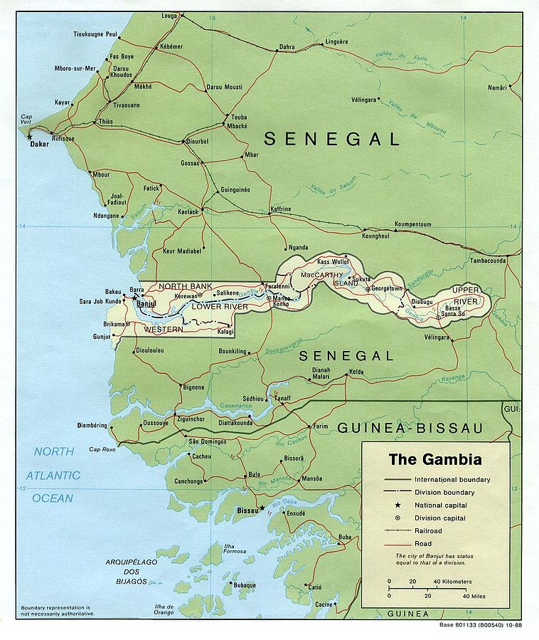
US government map of the Gambia (source)
The Gambia Changes Official Name
If you read our review of world political geography changes in 2015, you might remember a brief note on the official name of the Gambia, a tiny country located along the banks of a river in West Africa. Last December, the Gambia's maverick dictator decided to declare the country an "Islamic republic", a designation that can have various meanings and is used by four other countries in the world.

At the time, at least one regional news source claimed that the country's official name had indeed been changed from "Republic of The Gambia" to "Islamic Republic of The Gambia". But for a country's name to be formally changed, its government normally has to pass a law or at least issue some kind of proclamation, and at the time it wasn't clear whether that had actually  happened.