 |
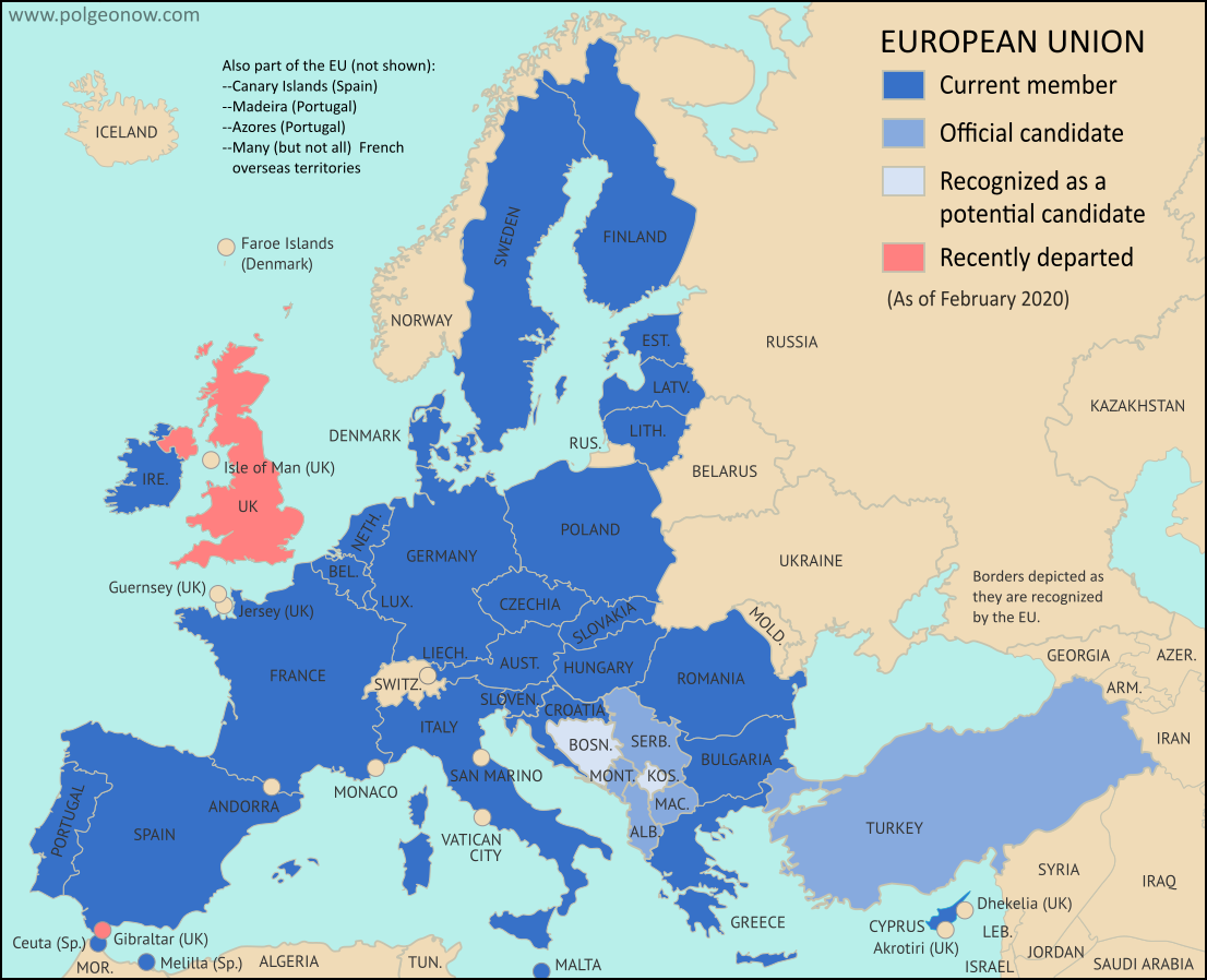
Map by Evan Centanni, from blank map by Ssolbergj. License: CC BY-SA |
Britain Finally Exits EU
Last week, the United Kingdom of Great Britain and Northern Ireland - "UK" or "Britain" for short - became the first country ever to formally leave the European Union (EU).This marks the turning point, but not the end, of the years-long saga nicknamed "Brexit" (short for "British exit"), which started with a 2016 referendum.
The long-delayed official exit finally arrived in the first second of February 1, 2020 at the EU headquarters in Belgium. Because of a time zone difference, this was 11:00 pm of January 31 in the UK. But because of a negotiated "transition period", most practical changes won't go into effect until at least the end of this year (read on for more about that).
The British territory of Gibraltar, located along the southern coast of Spain, was also pulled out of the EU alongside the UK.