Showing posts with label world. Show all posts

Thursday, June 12, 2014

World Cup 2014: Which Countries Are (and Aren't) Members of FIFA?

There are newer versions of this explainer available. To see them, view all FIFA World Cup articles on PolGeoNow.

 
World map showing the six continental confederations of national association football (soccer) teams, including all teams eligible for the World Cup
The six continental confederations of national football teams associated with FIFA. Not all confederation members are individually members of FIFA. Map by Evan Centanni, based on work by EOZyo (source).
Football/soccer fans around the world are tuning in tonight for the beginning of the month-long FIFA World Cup in Brazil. But how much do you know about which teams can compete? Which countries were eligible to enter the tournament, and which are excluded? Read on for an exclusive guide to the roster of FIFA national football teams...

Premium members click here to view this article in the ad-free members area. Not a member yet? Subscribe now!

Sunday, February 16, 2014

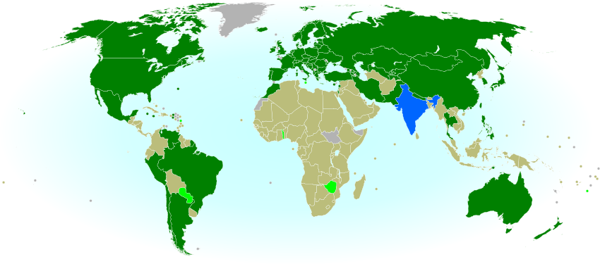
Olympics Map Update: Which Countries Are Attending Sochi 2014?

Map of countries with teams attending the 2014 Winter Olympics in Sochi, Russia, including seven countries making their Winter Olympics debut (highlighted), and one that was suspended but reinstated during the games.
Sochi 2014: Nations attending the Winter Olympics for the first time in bright green; suspended nations reinstated during the games in blue; all other nations attending Sochi 2014 in dark green; ineligible countries/territories in gray. By Evan Centanni, from public domain base map.
Premium members click here to view this article in the ad-free members area. Not a member yet? Subscribe now!

By Evan Centanni

India's Olympics Membership Reinstated
This is a quick update to the map of countries attending the Sochi 2014 Winter Olympics, which originally appeared in Sochi 2014: Which Countries Are (and Aren't) in the Olympics? That article explained that India was not officially included in this year's games due its suspension from the International Olympic Committee (IOC) over a voting issue.

However, on Tuesday India's IOC membership was reinstated, effective immediately. This means that the three Indian athletes at the games, who were allowed to participate independently under the Olympic flag during the opening ceremony and first few days of the event, may now officially represent India again. This is the first time in history that a country has been un-suspended from the the Olympics during the actual games.

Friday, February 7, 2014

Sochi 2014: Which Countries Are (and Aren't) in the Olympics?

This is an older version of our Parade of Nations article. Click here to see the newest edition!

[This article was first published in July 2012 as "Parade of Nations: Which Countries Are (and Aren't) in the Olympics?", in connection with that year's Summer Olympics in London. The following article is an updated version for the 2014 Sochi Winter games.]

World map showing the five continental associations of National Olympic Committees, including all nations eligible for the Olympic games
The five continental associations representing the world's Olympic Nations. Gold: Pan-American Sports Organization; Green: European Olympic Committees; Black: Olympic Council of Asia; Red: Oceania National Olympic Committees; Blue: Association of National Olympic Committees of Africa; Gray: non-member country or territory. Map by Evan Centanni, starting from this blank map and modeled after this Wikipedia map.
Premium members click here to view this article in the ad-free members area. Not a member yet? Subscribe now!

The 2014 Winter Olympics in Sochi, Russia officially begin tonight (Feb. 7), and it wouldn't be an Olympic opening ceremony without the Parade of Nations. But how many countries are there in the games, and is everyone included? Read on for an exclusive guide to the roster of Olympic Nations....

Monday, December 30, 2013

2013: The Year in Political Geography Changes

By Evan Centanni

Premium members click here to view this article in the ad-free members area. Not a member yet? Subscribe now!

 Although popular for maps of territorial control in conflict zones, PolGeoNow's original mission is tracking formal changes to the world's political geography. When new countries appear, borders change, and territorial disputes arise or are settled, you'll hear about it here. As 2013 draws to a close, here's our look back at the major events of the year:

Map of the Palestinian Territories, now known in the official standard as
"State of Palestine"

Country Name Changes
This year didn't see the creation of any new countries (unless you count the failed bid of the Bangsamoro Republik), but there were a few changes to country names. In October, the African island country of Cape Verde chose to change its official English name to "Cabo Verde", with the long form being "Republic of Cabo Verde". This brings it in line with the name in Portuguese, the country's official language. Meanwhile, in January, Libya established its full name as "State of Libya," after more than a year of going without an official long-form name. Since the 2011 revolution, the new government had been calling the country anything but Muammar Gaddafi's preferred "Great Socialist People's Libyan Arab Jamahiriya".

Thursday, September 5, 2013

Lies Your World Map Told You: 5 Ways You're Being Misled

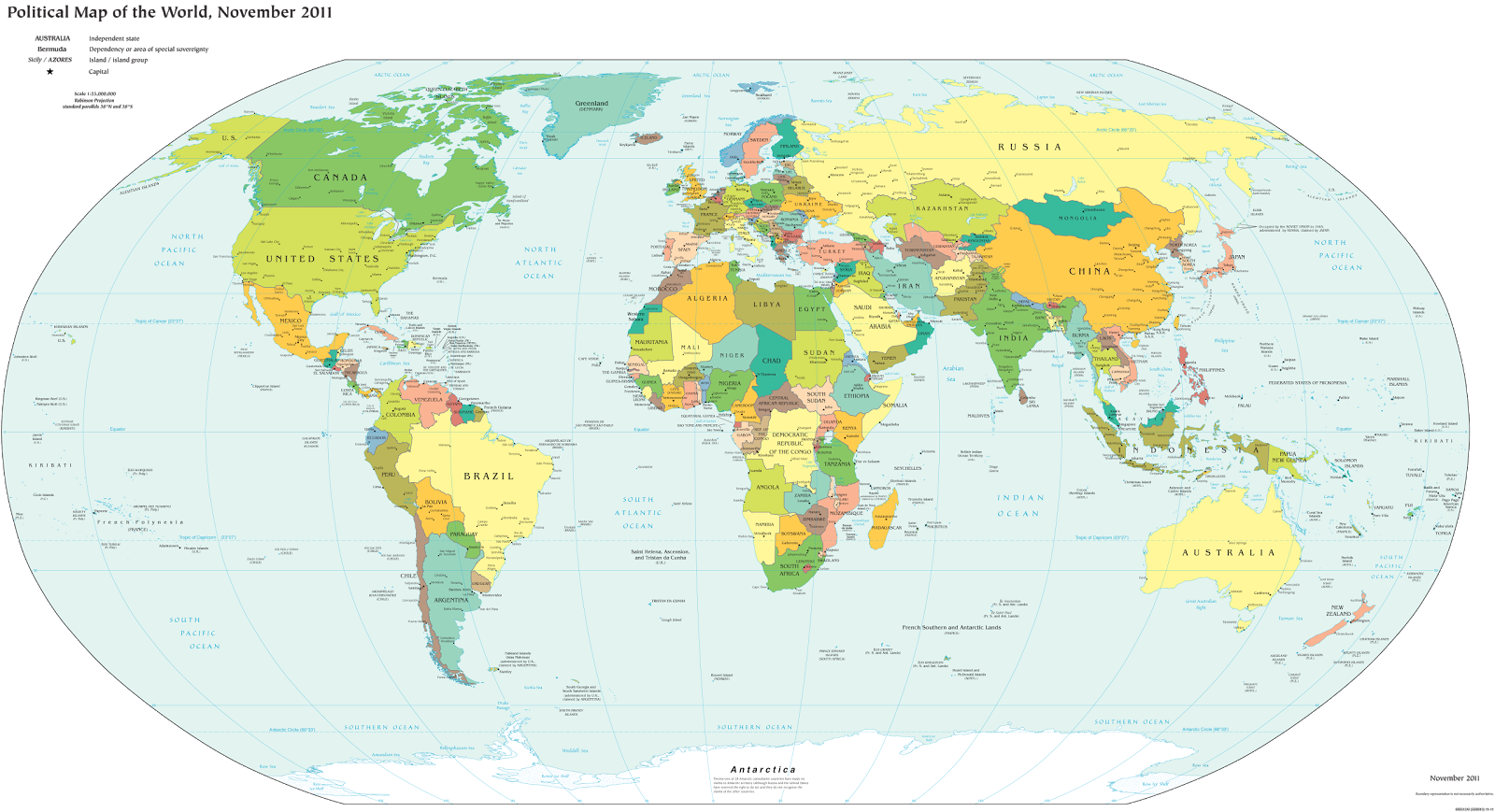
Unfortunately, most world political maps aren't telling you the whole story. The idea that Earth's land is cleanly divvied up into nation-states - one country for each of the world's peoples - is more an imaginative ideal than a reality. Read on to learn about five ways your map is lying to you about borders, territories, and even the roster of the world's countries.

Map of the world's countries according to the U.S. Central Intelligence Agency
The lines and coloring on this map are hiding major truths about the world's countries.
(Source: U.S. CIA; public domain)

Thursday, July 26, 2012

London 2012: Which Countries Are (and Aren't) in the Olympics?

This is an older version of our Parade of Nations article. Click here to see the newest edition!

The 2012 Summer Olympics in London begin tomorrow (July 27), and it wouldn't be an Olympic opening ceremony without the Parade of Nations. But how many countries are there in the games, and is everyone included? Read on for an exclusive guide to the roster of Olympic Nations....

World map showing the five continental associations of National Olympic Committees, including all nations eligible for the Olympic games
The five continental associations representing the world's Olympic Nations. Gold: Pan-American Sports Organization; Green: European Olympic Committees; Black: Olympic Council of Asia; Red: Oceania National Olympic Committees; Blue: Association of National Olympic Committees of Africa; Gray: non-member country or territory. Map by Evan Centanni, modified from public domain wiki map (source), and modeled after this Wikipedia map.