 |
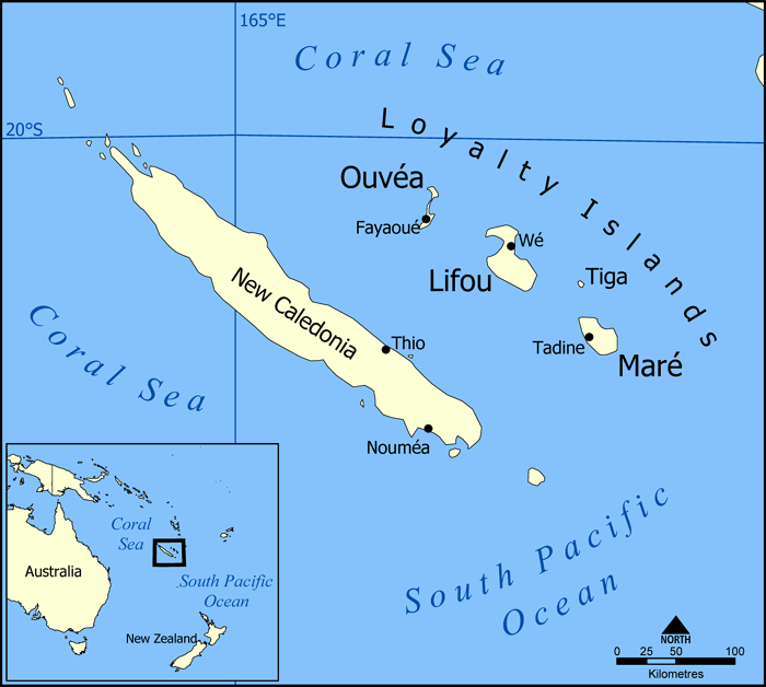
| The islands of New Caledonia, and their location in the South Pacific. Map by NormanEinstein (CC BY-SA; source) |
However, the proportion of YES and NO votes wasn't the same as two years ago: Support for independence rose from 43% in 2018 to 47% this time, suggesting that more residents than ever before want an independent country for their island home. Voter turnout was also even higher than last time, rising from 81% to 85%.
So what happens next? Well, for now New Caledonia will keep its current status as an autonomous region of France. But the islands could still become independent in the coming years.
