Friday, June 7, 2019

Libyan Civil War Map & Timeline - June 2019 (Subscription)

SUBSCRIBERS CLICK HERE TO PROCEED TO ARTICLE AND MAP

There are newer versions of this map available. To see them, view all Libya updates.

Research by Djordje Djukic. Map by onestopmap.com, Evan Centanni, and Djordje Djukic.

Subscribe for full access to all conflict map reports!

Libya: Who controls what? A concise, professional map of of who controls Libya now (June 2019). Shows detailed territorial control in the Libyan Civil War as of June 4, 2019, including all major parties (Government of National Accord (GNA); Tobruk House of Representatives, General Haftar's Libyan National Army (LNA), and allies; Tuareg and Toubou (Tebu, Tubu) militias in the south; the so-called Islamic State (ISIS/ISIL); and other groups such as the National Salvation Government (NSG) and religious hardline fighters). Includes terrain, major roads, and recent locations of interest including Aziziyah, Ain Zara, Tripoli International Airport, and more. Colorblind accessible. Over the past month and a half, fighting in Libya has focused in on the southern suburbs of Tripoli, where the country's two rival governments are jockeying for the upper hand in the capital city. Meanwhile, the so-called "Islamic State" (ISIS/ISIL) continues to launch attacks in southern towns.

See all this and more on the latest update to PolGeoNow's concise, professional Libyan Civil War control map, which comes with a timeline of changes since our previous Libya control map report in April 14, 2019.

This map and report are premium content available to paid subscribers of the PolGeoNow Conflict Mapping Service.

Want to see before you subscribe? Check out our most recent FREE SAMPLE Libya map!

Exclusive report includes:
  • Up-to-date map of current territorial control in Libya, color-coded for the UN-backed Government of National Accord (GNA), the rival Tobruk parliament and Khalifa Haftar's Libyan National Army (LNA), the so-called "Islamic State" (ISIS/ISIL), and Toubou and Tuareg militias in the south. Colorblind accessible.
  • Detailed indication of city-by-city control, including key towns and other locations important to current events.
  • Locations of recent fighting and changes of control, including Aziziya, Ain Zara, Tripoli International Airport, and more.
  • Detailed timeline of important events and changes to territorial control since April 14, 2019, with links to sources.

SUBSCRIBERS CLICK HERE TO PROCEED TO ARTICLE AND MAP

Not signed up yet? Click here to learn more about our professional subscription service!

Can I purchase just this map?
This map and report are not available for automated purchase to non-subscribers. If you need access or republication rights for only this map report, please contact service@polgeonow.com for options.

Wednesday, May 15, 2019

Syrian Civil War Map & Timeline: Fight Resumes for Northwest - May 2019 (Subscription)

SUBSCRIBERS CLICK HERE TO PROCEED TO ARTICLE AND MAP

There are newer versions of this map available. To see them, view all Syria updates.

Research by Djordje Djukic. Map by onestopmap.com, Evan Centanni, and Djordje Djukic

Subscribe for full access to all conflict map reports!

Map of Syrian Civil War (Syria control map): Territorial control in Syria in May 2019 (Free Syrian Army rebels, Kurdish YPG, Syrian Democratic Forces (SDF), Hayat Tahrir al-Sham (HTS / Al-Nusra Front), Islamic State (ISIS/ISIL), and others). Includes US deconfliction zone and Turkey-Russia demilitarized buffer zone, plus recent locations of conflict and territorial control changes, such as Al Kawm, Qalaat al-Madiq, Kafr Nabudah, and more. Colorblind accessible. A new phase of fighting has begun in Syria's northwest, as the Assad government makes a new push across the Turkish-Russian "buffer zone" into rebel-held territory. Meanwhile, the so-called "Islamic State" (ISIS/ISIL) has captured a new town in the central desert.

See all this and more on the latest update to PolGeoNow's concise, professional Syrian Civil War control map, which includes a timeline of changes since our previous Syria map report in March, with sources cited.

This map and report are premium content, available to paid subscribers of the PolGeoNow Conflict Mapping Service.

Want to see before you subscribe? Check out our most recent FREE SAMPLE Syria map!

Exclusive map report includes:
  • Up-to-date illustration of current territorial control in Syria, color-coded for the Assad government, rebel groups, "Islamic State" (ISIS/ISIL) fighters, and the Kurdish-led Syrian Democratic Forces (SDF). Colorblind accessible.
  • Location of the demilitarized buffer zone sponsored by Turkey and Russia
  • Outline showing the approximate location of the one publicly-known US "deconfliction zone"
  • Special symbols indicating towns dominated by rebels of the former Al Qaeda Nusra Front (now Hayat Tahrir al-Sham or HTS) and by the Kurdish YPG militia (part of the US-backed SDF).
  • Detailed indication of city-by-city control, including key towns and other locations important to current events.
  • Locations of recent control changes and other important events, including Al Kawm, Qalaat al-Madiq, Kafr Nabudah, and more.
  • Detailed timeline of important events and changes to territorial control since March 28, 2019, compiled by our Syria-Iraq expert, with links to sources. 

SUBSCRIBERS CLICK HERE TO PROCEED TO ARTICLE AND MAP

Not signed up yet? Click here to learn more about our professional subscription service!

Can I purchase just this map?
This map and report are not available for automated purchase to non-subscribers. If you need access or republication rights for only this map report, contact service@polgeonow.com for options.

Monday, April 15, 2019

Libyan Civil War Map & Timeline: Battle for Tripoli Begins - April 14, 2019 (Subscription)

SUBSCRIBERS CLICK HERE TO PROCEED TO ARTICLE AND MAP

There are newer versions of this map available. To see them, view all Libya updates.

Research by Djordje Djukic. Map by onestopmap.com, Evan Centanni, and Djordje Djukic.

Subscribe for full access to all conflict map reports!

Libya: Who controls what? A concise, professional map of of who controls Libya now (April 2019). Shows detailed territorial control in the Libyan Civil War as of April 14, 2019, including all major parties (Government of National Accord (GNA); Tobruk House of Representatives, General Haftar's Libyan National Army (LNA), and allies; Tuareg and Toubou (Tebu, Tubu) militias in the south; the so-called Islamic State (ISIS/ISIL); and other groups such as the National Salvation Government (NSG) and religious hardline fighters). Includes terrain, major roads, and recent locations of interest including Aziziyah, Ain Zara, Tripoli International Airport, and more. Colorblind accessible. After years of proxy fighting in central and southern Libya, forces allied to the country's two rival governments are finally facing off directly around capital city Tripoli. In just the past two weeks, there have already been many changes to territorial control - mostly gains for the eastern-allied Libyan National Army (LNA).

See all this and more on the latest update to PolGeoNow's concise, professional Libyan Civil War control map, which comes with a timeline of changes since our previous Libya control map report in April 1, 2019.

This map and report are premium content available to paid subscribers of the PolGeoNow Conflict Mapping Service.

Want to see before you subscribe? Check out our most recent FREE SAMPLE Libya map!

Exclusive report includes:
  • Up-to-date map of current territorial control in Libya, color-coded for the UN-backed Government of National Accord (GNA), the rival Tobruk parliament and Khalifa Haftar's Libyan National Army (LNA), the so-called "Islamic State" (ISIS/ISIL), and Toubou and Tuareg militias in the south. Colorblind accessible.
  • Detailed indication of city-by-city control, including key towns and other locations important to current events.
  • Locations of recent fighting and changes of control, including Aziziya, Ain Zara, Tripoli International Airport, and more.
  • Detailed timeline of important events and changes to territorial control since April 1, 2019, with links to sources.

SUBSCRIBERS CLICK HERE TO PROCEED TO ARTICLE AND MAP

Not signed up yet? Click here to learn more about our professional subscription service!

Can I purchase just this map?
This map and report are not available for automated purchase to non-subscribers. If you need access or republication rights for only this map report, contact service@polgeonow.com for options.

Tuesday, April 2, 2019

Libyan Civil War Map & Timeline - April 1, 2019 (Subscription)

SUBSCRIBERS CLICK HERE TO PROCEED TO ARTICLE AND MAP

There are newer versions of this map available. To see them, view all Libya updates.

Research by Djordje Djukic. Map by onestopmap.com, Evan Centanni, and Djordje Djukic.

Subscribe for full access to all conflict map reports!

Libya: Who controls what? A concise, professional map of of who controls Libya now (April 2019). Shows detailed territorial control in the Libyan Civil War as of April 1, 2019, including all major parties (Government of National Accord (GNA); Tobruk House of Representatives, General Haftar's Libyan National Army (LNA), and allies; Tuareg and Toubou (Tebu, Tubu) militias in the south; the so-called Islamic State (ISIS/ISIL); and other groups such as the National Salvation Government (NSG) and religious hardline fighters). Includes terrain, major roads, and recent locations of interest including Murzuq, Ghadduwah, Qatrun, Uwaynat, and more. Colorblind accessible. Over the past month, the eastern Libyan National Army (LNA) has continued its rapid advances across the south, seizing control of several towns and oil fields previously controlled by independent Toubou and Tuareg militias. Meanwhile, Libya's two major rival governments continue vying for power in the north, and the so-called "Islamic State" (ISIS/ISIL) is still present in some desert areas.

See all this and more on the latest update to PolGeoNow's concise, professional Libyan Civil War control map, which comes with a timeline of changes since our previous Libya control map report in February 2019.

This map and report are premium content available to paid subscribers of the PolGeoNow Conflict Mapping Service.

Want to see before you subscribe? Check out our most recent FREE SAMPLE Libya map!

Exclusive report includes:
  • Up-to-date map of current territorial control in Libya, color-coded for the UN-backed Government of National Accord (GNA), the rival Tobruk parliament and Khalifa Haftar's Libyan National Army (LNA), the so-called "Islamic State" (ISIS/ISIL), and Toubou and Tuareg militias in the south. Colorblind accessible.
  • Detailed indication of city-by-city control, including key towns and other locations important to current events.
  • Locations of recent fighting and changes of control, including Murzuq, Ghadduwah, Qatrun, Uwaynat, and more.
  • Detailed timeline of important events and changes to territorial control since February 24, 2019, with links to sources.

SUBSCRIBERS CLICK HERE TO PROCEED TO ARTICLE AND MAP

Not signed up yet? Click here to learn more about our professional subscription service!

Can I purchase just this map?
This map and report are not available for automated purchase to non-subscribers. If you need access or republication rights for only this map report, contact service@polgeonow.com for options.
Saturday, March 30, 2019

Syrian Civil War Map & Timeline: IS Loses Last Town - March 2019 (Subscription)

SUBSCRIBERS CLICK HERE TO PROCEED TO ARTICLE AND MAP

There are newer versions of this map available. To see them, view all Syria updates.

Research by Djordje Djukic. Map by onestopmap.com, Evan Centanni, and Djordje Djukic

Subscribe for full access to all conflict map reports!

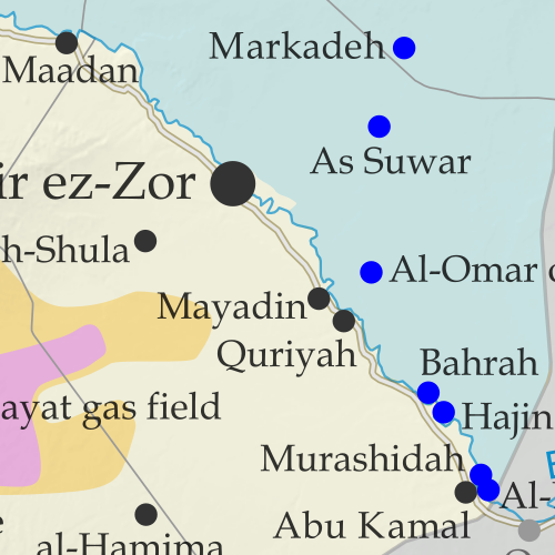
Map of Syrian Civil War (Syria control map): Territorial control in Syria in March 2019, when IS control has been reduced to only some areas of desert after the group lost its last town (Free Syrian Army rebels, Kurdish YPG, Syrian Democratic Forces (SDF), Hayat Tahrir al-Sham (HTS / Al-Nusra Front), Islamic State (ISIS/ISIL), and others). Includes US deconfliction zone and Turkey-Russia demilitarized buffer zone, plus recent locations of conflict and territorial control changes, such as Baghuz, Murashidah, the Doubayat gas field, and more. Colorblind accessible. The so-called "Islamic State" (ISIS/ISIL) has lost its last populated territory in Syria, but it still operates freely in some remote desert areas. Meanwhile, the situation remains tense along the Russia-Turkey-brokered "buffer zone" between rebel and government territory in the northwest.

See all this and more on the latest update to PolGeoNow's concise, professional Syrian Civil War control map, which includes a timeline of changes since our previous Syria map report in January, with sources cited.

This map and report are premium content, available to paid subscribers of the PolGeoNow Conflict Mapping Service.

Want to see before you subscribe? Check out our most recent FREE SAMPLE Syria map!

Exclusive map report includes:
  • Up-to-date illustration of current territorial control in Syria, color-coded for the Assad government, rebel groups, "Islamic State" (ISIS/ISIL) fighters, and the Kurdish-led Syrian Democratic Forces (SDF). Colorblind accessible.
  • Location of the demilitarized buffer zone sponsored by Turkey and Russia
  • Outline showing the approximate location of the one publicly-known US "deconfliction zone"
  • Special symbols indicating towns dominated by rebels of the former Al Qaeda Nusra Front (now Hayat Tahrir al-Sham or HTS) and by the Kurdish YPG militia (part of the US-backed SDF).
  • Detailed indication of city-by-city control, including key towns and other locations important to current events.
  • Locations of recent control changes and other important events, including Baghuz, Murashidah, Saraqeb, Arima and more.
  • Detailed timeline of important events and changes to territorial control since January 27, 2019, compiled by our Syria-Iraq expert, with links to sources. 

SUBSCRIBERS CLICK HERE TO PROCEED TO ARTICLE AND MAP

Not signed up yet? Click here to learn more about our professional subscription service!

Can I purchase just this map?
This map and report are not available for automated purchase to non-subscribers. If you need access or republication rights for only this map report, contact service@polgeonow.com for options.