Showing posts with label invasions. Show all posts

Saturday, November 30, 2019

Syrian Civil War Map & Timeline - November 2019 (Subscription)

SUBSCRIBERS CLICK HERE TO PROCEED TO ARTICLE AND MAP

There are newer versions of this map available. To see them, view all Syria updates.

Research by Djordje Djukic. Map by onestopmap.com, Evan Centanni, and Djordje Djukic

Subscribe for full access to all conflict map reports!

Map of Syrian Civil War (Syria control map): Territorial control in Syria in November 2019 (Free Syrian Army rebels, Kurdish YPG, Syrian Democratic Forces (SDF), Hayat Tahrir al-Sham (HTS / Al-Nusra Front), Islamic State (ISIS/ISIL), and others). Includes Turkish/TFSA control, joint SDF-Assad control, US deconfliction zone, and Turkey-Russia demilitarized buffer zone, plus recent locations of conflict and territorial control changes, including Ras al-Ayn, Tel Abyad, Ayn Issa, and more. Colorblind accessible. In the past month, Turkey and its allies have further consolidated their chunk of territory in northern Syria, while the Assad-loyal Syrian military has deployed along most of the rest of the border, in line with the Russia-brokered agreement for a "safe zone" free of Kurdish militia fighters.

See all this and more on the latest update to PolGeoNow's concise, professional Syrian Civil War control map, which includes a timeline of changes since our previous Syria map report in October, with sources cited.

This map and report are premium content, available to paid subscribers of the PolGeoNow Conflict Mapping Service.

Want to see before you subscribe? Check out our most recent FREE SAMPLE Syria map!

Exclusive map report includes:
  • NEW: Special symbols for joint Turkish/rebel control and joint SDF/government control, so you can track Turkey's intervention in the border region
  • Up-to-date illustration of current territorial control in Syria, color-coded for the Assad government, rebel groups, "Islamic State" (ISIS/ISIL) fighters, and the Kurdish-led Syrian Democratic Forces (SDF). Colorblind accessible.
  • Extent of "buffer zone" sponsored by Turkey and Russia in the rebel-held northwest
  • Outline showing approximate location of the one publicly-known US "deconfliction zone"
  • Special symbols indicating towns dominated by rebels of the former Al Qaeda Nusra Front (now Hayat Tahrir al-Sham or HTS) and by the Kurdish YPG militia (part of the SDF anti-IS coalition).
  • Detailed indication of city-by-city control, including key towns and other locations important to current events.
  • Locations of recent control changes and other important events, including Ras al-Ayn, Tel Abyad, Ayn Issa, and more.
  • Detailed timeline of important events and changes to territorial control since October 27, 2019, compiled by our Syria-Iraq expert, with links to sources. 

SUBSCRIBERS CLICK HERE TO PROCEED TO ARTICLE AND MAP

Not signed up yet? Click here to learn more about our professional subscription service!

Can I purchase just this map?
This map and report are not available for automated purchase to non-subscribers. If you need access or republication rights for only this map report, contact service@polgeonow.com for options.

Sunday, October 27, 2019

Syrian Civil War Map & Timeline: Turkey Enters Northeast - October 2019 (Subscription)

SUBSCRIBERS CLICK HERE TO PROCEED TO ARTICLE AND MAP

There are newer versions of this map available. To see them, view all Syria updates.

Research by Djordje Djukic. Map by onestopmap.com, Evan Centanni, and Djordje Djukic

Subscribe for full access to all conflict map reports!

Map of Syrian Civil War (Syria control map): Territorial control in Syria in October 2019 (Free Syrian Army rebels, Kurdish YPG, Syrian Democratic Forces (SDF), Hayat Tahrir al-Sham (HTS / Al-Nusra Front), Islamic State (ISIS/ISIL), and others). Includes Turkish control, joint SDF-Assad control, US deconfliction zone, and Turkey-Russia demilitarized buffer zone, plus recent locations of conflict and territorial control changes, including Ras al-Ayn, Tel Abyad, Ayn Issa, and more. Colorblind accessible. Amid a US withdrawal, Turkey and its rebel allies have begun their long-threatened intervention against Kurdish-led fighters in northeastern Syria, who now have struck a deal with the Assad government to share their territory and jointly fight back against Turkey.

See all this and more on the latest update to PolGeoNow's concise, professional Syrian Civil War control map, which includes a timeline of changes since our previous Syria map report in September, with sources cited.

This map and report are premium content, available to paid subscribers of the PolGeoNow Conflict Mapping Service.

Want to see before you subscribe? Check out our most recent FREE SAMPLE Syria map!

Exclusive map report includes:
  • NEW: Special symbols for joint Turkish/rebel control and joint SDF/government control, so you can track Turkey's intervention in the border region
  • EXTRA: Label for Barisha village, where IS leader Abu Bakr al-Baghdadi died in a US raid this weekend
  • Up-to-date illustration of current territorial control in Syria, color-coded for the Assad government, rebel groups, "Islamic State" (ISIS/ISIL) fighters, and the Kurdish-led Syrian Democratic Forces (SDF). Colorblind accessible.
  • Extent of "buffer zone" sponsored by Turkey and Russia in the rebel-held northwest
  • Outline showing approximate location of the one publicly-known US "deconfliction zone"
  • Special symbols indicating towns dominated by rebels of the former Al Qaeda Nusra Front (now Hayat Tahrir al-Sham or HTS) and by the Kurdish YPG militia (part of the SDF anti-IS coalition).
  • Detailed indication of city-by-city control, including key towns and other locations important to current events.
  • Locations of recent control changes and other important events, including Ras al-Ayn, Tel Abyad, Ayn Issa, and more.
  • Detailed timeline of important events and changes to territorial control since September 10, 2019, compiled by our Syria-Iraq expert, with links to sources. 

SUBSCRIBERS CLICK HERE TO PROCEED TO ARTICLE AND MAP

Not signed up yet? Click here to learn more about our professional subscription service!

Can I purchase just this map?
This map and report are not available for automated purchase to non-subscribers. If you need access or republication rights for only this map report, contact service@polgeonow.com for options.

Monday, October 3, 2016

Syrian Civil War Control Map & Report: October 2, 2016 (Subscription)

SUBSCRIBERS CLICK HERE TO PROCEED TO ARTICLE AND MAP

There are newer versions of this map available. To see them, view all Syria updates.

Research by Djordje Djukic. Map by onestopmap.com, Evan Centanni, and Djordje Djukic

Subscribe for full access to all conflict map reports!

Map of fighting and territorial control in Syria's Civil War (Free Syrian Army rebels, Kurdish YPG, Syrian Democratic Forces (SDF), Jabhat Fateh al-Sham (Al-Nusra Front), Islamic State (ISIS/ISIL), and others), updated for October 2016. Now includes terrain and major roads (highways). Includes recent locations of conflict and territorial control changes, such as Dabiq, Halfaya, Suran, Jarabulus, and more (colorblind accessible). During the past month, a continued Turkish military incursion into Syria completely cut off the so-called "Islamic State" from the self-proclaimed caliphate's last international border in the region (other than its boundaries with Syrian and Iraqi territory).

Meanwhile, the Assad government and rebel groups have continued to take territory from each other despite a brief attempt at a country-wide ceasefire.
 
See all this and more on the latest update to PolGeoNow's concise, professional Syrian Civil War control map, which includes a timeline of changes since our previous Syria map report in late August, with sources cited.

This map and report are premium professional content, available to paid subscribers of the PolGeoNow Conflict Mapping Service.

Want to see before you subscribe? Check out our most recent FREE SAMPLE Syria map!

Exclusive report includes:
  • Up-to-date map of current territorial control in Syria, color-coded for the Assad government, rebel groups, "Islamic State" (ISIS/ISIL) fighters, and Kurdish/SDF forces. Colorblind accessible.
  • Special symbols indicating towns dominated by rebels of the former Nusra Front (now Jabhat Fateh al-Sham) and US-backed Syrian Democratic Forces (SDF).
  • Detailed indication of city-by-city control, including key towns and other locations important to current events.
  • Locations of recent fighting and military operations, including Dabiq, Halfaya, Suran, Jarabulus, and more.
  • Detailed timeline of important events and changes to territorial control since August 27, 2016, compiled by our Syria-Iraq expert, with links to sources.

SUBSCRIBERS CLICK HERE TO PROCEED TO ARTICLE AND MAP

Not signed up yet? Click here to learn more about our professional subscription service!

Can I purchase just this map?
This map and report are not available for automated purchase to non-subscribers. If you need access or republication rights for only this map report, contact service@polgeonow.com for options.

Monday, August 29, 2016

Syrian Civil War Control Map & Report: August 2016 (Subscription)

SUBSCRIBERS CLICK HERE TO PROCEED TO ARTICLE AND MAP

There are newer versions of this map available. To see them, view all Syria updates.

Research by Djordje Djukic. Map by onestopmap.com, Evan Centanni, and Djordje Djukic

Subscribe for full access to all conflict map reports!

Map of fighting and territorial control in Syria's Civil War (Free Syrian Army rebels, Kurdish YPG, Syrian Democratic Forces (SDF), Al-Nusra Front, Islamic State (ISIS/ISIL), and others), updated for August 2016. Now includes terrain and major roads (highways). Includes recent locations of conflict and territorial control changes, such as Jarabulus, Manbij, Daraya, Hasakah, and more (color blind accessible). Syria's war has seen several major territorial changes in the past month, with a Turkish military intervention bringing IS defeats even as the rival, Kurdish-led Syrian Democratic Forces have captured key territory from both IS and the Assad government. Meanwhile, the government has scored some major victories of its own against rebel forces.
 
See all this and more on the latest update to PolGeoNow's concise, professional Syrian Civil War control map, which includes a timeline of changes since our previous Syria map report in late July, with sources cited.

This map and report are premium professional content, available to paid subscribers of the PolGeoNow Conflict Mapping Service.

Want to see before you subscribe? Check out our most recent FREE SAMPLE Syria map!

Exclusive report includes:
  • Up-to-date map of current territorial control in Syria, color-coded for the Assad government, rebel groups, "Islamic State" (ISIS/ISIL) fighters, and Kurdish/SDF forces. Color blind accessible.
  • Special symbols indicating towns dominated by rebels of the Nusra Front (now Jabhat Fateh al-Sham) and US-backed Syrian Democratic Forces (SDF).
  • Detailed indication of city-by-city control, including key towns and other locations important to current events.
  • Locations of recent fighting and military operations, including Jarabulus, Manbij, Daraya, Hasakah, and more.
  • Detailed timeline of important events and changes to territorial control since July 25, 2016, compiled by our Syria-Iraq expert, with links to sources.

SUBSCRIBERS CLICK HERE TO PROCEED TO ARTICLE AND MAP

Not signed up yet? Click here to learn more about our professional subscription service!

Can I purchase just this map?
This map and report are not available for automated purchase to non-subscribers. If you need access or republication rights for only this map report, contact service@polgeonow.com for options.

Saturday, April 5, 2014

Update: Ukraine Control Overview Map (Premium)

Updated map of control in Ukraine, as of April 5, 2014. Includes final protester occupations, annexation of Crimea, and areas seized by Russian and Ukrainian militaries outside of Crimea.

Download PDF
buy


(Subscribe via Paypal)
This is a brief supplement to our Mar. 4 report, Ukraine Map: Occupations, Autonomy, & Invasion. See that report for a detailed overview of protester occupations and declarations of autonomy in the first two stages of the Ukraine crisis: the anti-Yanukovich Maidan movement and the eastern pro-Russian protests. 

The current article is an update on the current control situation in Ukraine from Mar. 4 to the present. This map and article are exclusive premium content, available only to members or for individual purchase. Buy now (US$5.99).

Premium article includes:
  • Simple updated map of the political situation in Ukraine since Mar. 4
  • Shows the last of the pro-Russian protester occupations, the annexation of Crimea, and seizures by the Ukrainian and Russian militaries outside of Crimea proper
  • Report on the course of events since the last report, explaining each detail shown on the map
  • In-line links to sources of information

Members click here to proceed to article and map

Not a member yet? Subscribe Now!


Thursday, March 27, 2014

Crimea Joins Russia, Gives Up Independence, Becomes Disputed Territory

Premium members click here to view this article in the ad-free members area. Not a member yet? Subscribe now!

Map of the claimed Republic of Crimea, which briefly declared independence from Ukraine on Mar. 17 before being annexed by Russia
The claimed Republic of Crimea which has now joined Russia (click to see full-sized map). By Evan Centanni, based on this blank map.
By Evan Centanni

Russia Annexes Crimea
The Crimean peninsula, which declared independence from Ukraine ten days ago as the Republic of Crimea, has now been absorbed into Russia. This was part of the plan all along - the claimed Republic of Crimea had requested to join Russia at the same time that it declared independence.

Related: Complete Map of Locations Seized by Russia in Crimea (Premium)

Wednesday, March 26, 2014

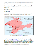
Premium Map Report: Russian Control of Crimea

Map of Russian seizures and military actions in the Crimea region which it recently annexed from Ukraine.

Download PDF
buy


(Subscribe via Paypal)
After a month of low-level conflict, Russian military control of Crimea appears to be nearly complete. Here's a complete map - to the best of our knowledge - of all locations of Russian seizures and other military actions inside and outside of the Crimea region. This map and article are exclusive premium content, available only to members and for individual purchase. Buy now (US$4.99).

Premium article includes:
  • Exclusive map of Russian seizure and attack locations inside and outside of Crimea
  • Guide to all locations on the map, with brief summary of what has happened at each
  • In-line links to sources of information

Members click here to proceed to article and map

Not a member yet? Subscribe Now!


Monday, March 3, 2014

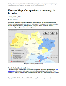
Ukraine Map: Occupations, Autonomy, & Invasion (Premium)

Map of the 2014 Ukraine crisis, before and after the ouster of President Yanukovich, updated to March 3, 2014. Details shown include protester occupations, declarations of autonomy, and Russian invasion.

Download PDF
buy


(Subscribe via Paypal)
PolGeoNow begins our Ukraine coverage with this overview of the political situation from January to the present, both before and after the overthrow of President Viktor Yanukovich's government. Details shown include protester occupations, declarations of autonomy, and Russian invasion. This map and article are exclusive premium content, available only to members and for individual purchase. Buy now (US$5.99).

Premium article includes:
  • Exclusive map of the political situation in Ukraine's 2014 crisis
  • Shows protester occupations, regional capitals overrun, autonomy declarations, and locations of Russian military siege
  • Report on the course of events, explaining each detail shown on the map
  • In-line links to sources of information

Members click here to proceed to article and map

Not a member yet? Subscribe Now!