Showing posts with label al qaeda. Show all posts

Monday, July 25, 2016

Syrian Civil War Control Map & Report: July 2016 (Subscription)

MEMBERS CLICK HERE TO PROCEED TO ARTICLE AND MAP

There are newer versions of this map available. To see them, view all Syria updates.

Research by Djordje Djukic. Map by onestopmap.com, Evan Centanni, and Djordje Djukic

Subscribe for full access to all conflict map reports!

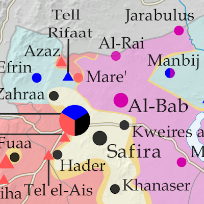
Map of fighting and territorial control in Syria's Civil War (Free Syrian Army rebels, Kurdish YPG, Syrian Democratic Forces (SDF), Al-Nusra Front, Islamic State (ISIS/ISIL), and others), updated for July 2016. Now includes terrain and major roads (highways). Highlights recent locations of conflict and territorial control changes, such as Manbij, Abu Kamal (Al Bukamal), Aleppo, Daraya, Kinsabba and more (color blind accessible). The past month has seen territorial gains both for Syria's Assad government and for rebel forces, while the so-called "Islamic State" (ISIS/ISIL) has mostly held its ground.
 
See all this and more on the latest update to PolGeoNow's concise, professional Syrian Civil War control map, which includes a timeline of changes since our previous Syria map report in late June, with sources cited.

This map and report are premium professional content, available to paid subscribers of the PolGeoNow Conflict Mapping Service.

Want to see before you subscribe? Check out our most recent FREE SAMPLE Syria map!

Exclusive map report includes:
  • Up-to-date map of current territorial control in Syria, color-coded for the Assad government, rebel groups, "Islamic State" (ISIS/ISIL) fighters, and Kurdish/SDF forces (color blind accessible).
  • Special symbols indicating towns dominated by rebels of Al Qaeda affiliate Jabhat al-Nusra (the Nusra Front) and US-backed Syrian Democratic Forces (SDF).
  • Detailed indication of city-by-city control, highlighting key towns and other locations important to current events.
  • Locations of recent fighting and military operations, including Manbij, Abu Kamal (Al Bukamal), Daraya, Kinsabba, and more.
  • Detailed timeline of important events and changes to territorial control since June 26, 2016, compiled by our Syria-Iraq expert, with links to sources.

MEMBERS CLICK HERE TO PROCEED TO ARTICLE AND MAP

Not a member yet? Click here to learn more about our professional subscription service!

Can I purchase just this map?
This map and report are not available for automated purchase to non-subscribers. If you need access or republication rights for only this map report, contact service@polgeonow.com for options.

Tuesday, June 28, 2016

Syrian Civil War Control Map & Report: June 2016 (Subscription)

MEMBERS CLICK HERE TO PROCEED TO ARTICLE AND MAP

There are newer versions of this map available. To see them, view all Syria updates.

Research by Djordje Djukic. Map by onestopmap.com, Evan Centanni, and Djordje Djukic

Subscribe for full access to all conflict map reports!

Map of fighting and territorial control in Syria's Civil War (Free Syrian Army rebels, Kurdish YPG, Syrian Democratic Forces (SDF), Al-Nusra Front, Islamic State (ISIS/ISIL), and others), updated for June 2016. Now includes terrain and major roads (highways). Highlights recent locations of conflict and territorial control changes, such as Manbij, Mare, Tanf border crossing, Thawra/Tabqa, Arak, and more. A lot has happened in Syria in the past month, with major SDF and Syrian Army advances against the so-called "Islamic State" (ISIS/ISIL), as well as various smaller changes to rebel control.
 
See all this and more on the latest update to PolGeoNow's concise, professional Syrian Civil War control map, which includes a timeline of changes since our previous Syria map report in mid-May.

This map and report are premium professional content, available to paid subscribers of the PolGeoNow Conflict Mapping Service.

Want to see before you subscribe? Check out our most recent FREE SAMPLE Syria map!

Exclusive map report includes:
  • Up-to-date map of current territorial control in Syria, color-coded for the Assad government, rebel groups, "Islamic State" (ISIS/ISIL) extremists, and Kurdish/SDF forces. 
  • Special symbols indicating towns dominated by rebels of Al Qaeda affiliate Jabhat al-Nusra (the Nusra Front) and US-backed Syrian Democratic Forces (SDF).
  • Detailed indication of city-by-city control, highlighting key towns and other locations important to current events.
  • Locations of recent fighting and military operations, including Manbij, Thawra (Tabqa), Mare, Tanf border crossing, Arak, and more.
  • Detailed timeline of important events and changes to territorial control since May 13, 2016, compiled by our Syria-Iraq expert, with links to sources.

MEMBERS CLICK HERE TO PROCEED TO ARTICLE AND MAP

Not a member yet? Click here to learn more about our professional subscription service!

Can I purchase just this map?
This map and report are not available for automated purchase to non-subscribers. If you need access or republication rights for only this map report, contact service@polgeonow.com for options.

Sunday, May 15, 2016

Syrian Civil War Control Map & Report: May 2016 (Subscription)

MEMBERS CLICK HERE TO PROCEED TO ARTICLE AND MAP

There are newer versions of this map available. To see them, view all Syria updates.

Research by Djordje Djukic. Map by onestopmap.com, Evan Centanni, and Djordje Djukic

Subscribe for full access to all conflict map reports!

Map of fighting and territorial control in Syria's Civil War (Free Syrian Army rebels, Kurdish YPG, Syrian Democratic Forces (SDF), Al-Nusra Front, Islamic State (ISIS/ISIL), and others), updated for March 2016. Now includes terrain and major roads (highways). Highlights recent locations of conflict and territorial control changes, such as Daraa, Khanaser, Tell Rifaat, Shadadi, the Aleppo Power Plant, and more. The so-called "Islamic State" (ISIS/ISIL) has lost control of several towns in Syria over the past month and a half, but has also scored some victories. Meanwhile, a partial breakdown in the UN-brokered ceasefire has resulted in resumed fighting between government and rebel forces in the Aleppo area.
 
See all this and more on the latest update to PolGeoNow's concise, professional Syrian Civil War control map, which includes a timeline of changes since our previous Syria map report at the end of March.

This map and report are premium professional content, available to paid subscribers of the PolGeoNow Conflict Mapping Service.

Want to see before you subscribe? Check out our most recent FREE SAMPLE Syria map!

Exclusive map report includes:
  • Up-to-date map of current territorial control in Syria, color-coded for the Assad government, rebel groups, "Islamic State" (ISIS/ISIL) extremists, and Kurdish/SDF forces. 
  • Special symbols indicating towns dominated by rebels of Al Qaeda affiliate Jabhat al-Nusra (the Nusra Front) and by multi-ethnic anti-ISIS Syrian Democratic Forces (SDF).
  • Detailed indication of city-by-city control, highlighting key towns and other locations important to current events.
  • Locations of recent fighting and military operations, including Qaryatain, Al-Rai, Shaer gas field, and more.
  • Detailed timeline of important events and changes to territorial control since March 31, 2016, compiled by our Syria-Iraq expert, with links to sources.

MEMBERS CLICK HERE TO PROCEED TO ARTICLE AND MAP

Not a member yet? Click here to learn more about our professional subscription service!

Can I purchase just this map?
This map and report are not available for automated purchase to non-subscribers. If you need access or republication rights for only this map report, contact service@polgeonow.com for options.

Monday, May 2, 2016

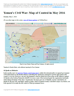
Yemen Control Map & Report: May 2016 (Subscription)

MEMBERS CLICK HERE TO PROCEED TO ARTICLE AND MAP

There are newer versions of this map available. To see them, view all Yemen updates.

Map of territorial control in Yemen as of May 1, 2016, including territory held by the Houthi rebels and former president Saleh's forces, president-in-exile Hadi and his allies in the Saudi-led coalition and Southern Movement, Al Qaeda in the Arabian Peninsula (AQAP), and the so-called Islamic State (ISIS/ISIL). Includes recent locations of fighting, such as Taiz, Aden, Houta, Mukalla, and more.
Subscribe for full access to all conflict map reports!

Download PDF:
Buy now
New discounted price!
Timeline by Djordje Djukic. Map by Louis Martin-Vézian, Evan Centanni, and Djordje Djukic

In the months since our previous Yemen control map report, Al Qaeda has lost some of its most important territory in Yemen, including a major city it's held for the past year. Fighting has also continued between the Hadi government and the Houthi alliance, despite attempts at a ceasefire. 


See all this and more on the newest update to PolGeoNow's Yemen territorial control map, which includes a timeline of changes and important events since our previous Yemen map report in February.

This map and report are exclusive premium content, available to paid subscribers or for individual purchase. Download PDF (US$14.99) New discounted price!

Want to see before you buy? Check out our most recent FREE SAMPLE Yemen map report!

Exclusive report includes:

Map of territorial control in Yemen as of May 1, 2016, including territory held by the Houthi rebels and former president Saleh's forces, president-in-exile Hadi and his allies in the Saudi-led coalition and Southern Movement, Al Qaeda in the Arabian Peninsula (AQAP), and the so-called Islamic State (ISIS/ISIL). Includes recent locations of fighting, such as Taiz, Aden, Houta, Mukalla, and more.
  • Up-to-date map of current territorial control in Yemen, color-coded for the pro-Hadi coalition, Houthi/Saleh forces, Al Qaeda in the Arabian Peninsula (AQAP), and the so-called "Islamic State" (ISIS/ISIL).
  • Color scheme recently updated for consistency with Syria, Iraq, and Libya map series
  • Detailed indication of town-by-town control, including provincial boundaries, all major cities, and many smaller ones
  • Markers for recent areas of fighting, including Taiz, Mukalla, Harib, Ghayl Ba Wazir, and more
  • Timeline of changes to the situation since February 19, 2016, with links to sources

MEMBERS CLICK HERE TO PROCEED TO ARTICLE AND MAP

Not a member yet? Learn more about our professional subscription service!

Thursday, March 31, 2016

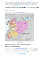
Syrian Civil War Control Map: April 2016

There are newer versions of this map available. To see them, view all Syria updates.

Map of fighting and territorial control in Syria's Civil War (Free Syrian Army rebels, Kurdish YPG, Syrian Democratic Forces (SDF), Al-Nusra Front, Islamic State (ISIS/ISIL), and others), updated for the beginning of April 2016. Now includes terrain and major roads (highways). Highlights recent locations of conflict and territorial control changes, including Palmyra, Qaryatayn, Deir Ez-Zor, and more. (Color blind accessible.)
Base map by Koen Adams of onestopmap.com, with territorial control by Evan Centanni and Djordje Djukic. All rights reserved.
Subscribers click here to view this article in the ad-free members area. Not a member yet? Learn about PolGeoNow subscriptions!

Timeline by Djordje Djukic

Recapture of Palmyra
Since our previous Syria control map report in early March, the Syrian government of Bashar al-Assad has recaptured the historic city of Palmyra (known in modern Arabic as Tadmur) from the so-called "Islamic State" (IS, formerly known as ISIS/ISIL). The military has also pushed back against IS in Qaryatain, one of the group's westernmost outposts, even as IS is showing an increasingly prominent presence in the southwestern corner of Syria near the Golan Heights. Meanwhile, fighting between government and anti-Assad rebel forces has continued, though at a relatively low level, since the implementation of the UN-brokered ceasefire.

Wednesday, March 9, 2016

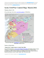
Syrian Civil War Control Map: March 2016 (Subscription)

MEMBERS CLICK HERE TO PROCEED TO ARTICLE AND MAP

There are newer versions of this map available. To see them, view all Syria updates.

Research by Djordje Djukic. Map by onestopmap.com, Evan Centanni, and Djordje Djukic

Subscribe for full access to all conflict map reports!

Download PDF:
Buy now
New discounted price!
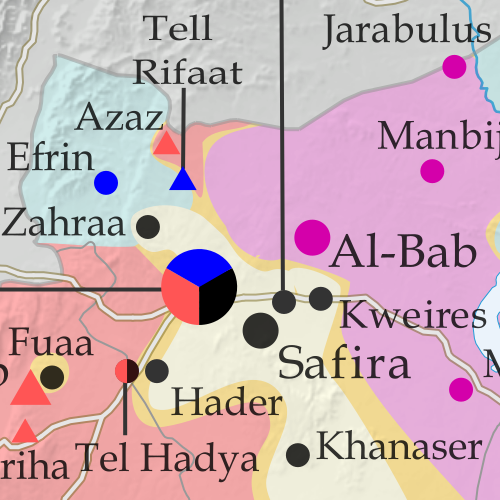
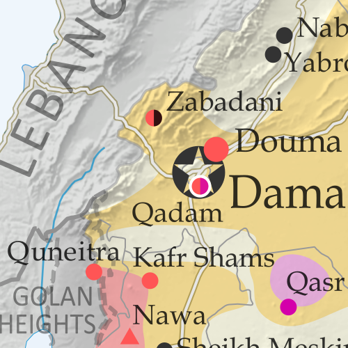
Map of fighting and territorial control in Syria's Civil War (Free Syrian Army rebels, Kurdish YPG, Syrian Democratic Forces (SDF), Al-Nusra Front, Islamic State (ISIS/ISIL), and others), updated for March 2016. Now includes terrain and major roads (highways). Highlights recent locations of conflict and territorial control changes, such as Daraa, Khanaser, Tell Rifaat, Shadadi, the Aleppo Power Plant, and more. New: Improved map now includes terrain and major roads!

With Syria's UN-brokered truce partially holding, government, Kurdish, and rebel forces alike have turned their attention to carving away territory from the so-called "Islamic State" (ISIS/ISIL). However, the rebels also sustained some losses to government forces prior to the ceasefire taking effect.
 
See all this and more on the latest update to PolGeoNow's concise, professional Syrian Civil War control map, which includes a timeline of changes since our previous Syria map report in early February.

This map and report are professional subscriber content, available to paid members or for separate purchase. Download PDF (US$14.99) New discounted price!

Want to see before you buy? Check out our most recent FREE SAMPLE Syria map!

Exclusive map report includes:
Map of fighting and territorial control in Syria's Civil War (Free Syrian Army rebels, Kurdish YPG, Syrian Democratic Forces (SDF), Al-Nusra Front, Islamic State (ISIS/ISIL), and others), updated for March 2016. Now includes terrain and major roads (highways). Highlights recent locations of conflict and territorial control changes, such as Daraa, Khanaser, Tell Rifaat, Shadadi, the Aleppo Power Plant, and more.
  • New since last year: Terrain shading and major highways included on map for geographic context!
  • Up-to-date map of current territorial control in Syria, color-coded for the Assad government, rebel groups, "Islamic State" (ISIS/ISIL) extremists, and Kurdish/SDF forces. 
  • Special symbols indicate towns dominated by rebels of Al Qaeda affiliate Jabhat al-Nusra (the Nusra Front) and by multi-ethnic anti-ISIS Syrian Democratic Forces (SDF).
  • Detailed indication of city-by-city control, highlighting key towns and other locations important to current events.
  • Locations of recent fighting and military operations, including Daraa, Khanaser, Tell Rifaat, Shadadi, the Aleppo Power Plant, and more.
  • Detailed timeline of important events and changes to territorial control since February 10, 2016, compiled by our Syria-Iraq expert, with links to sources.

MEMBERS CLICK HERE TO PROCEED TO ARTICLE AND MAP

Not a member yet? Click here to learn more about our professional subscription service!


Friday, February 19, 2016

Map of Control in Yemen's Civil War: February 2016 (Subscription)

MEMBERS CLICK HERE TO PROCEED TO ARTICLE AND MAP

There are newer versions of this map available. To see them, view all Yemen updates.

Map of territorial control in Yemen as of February 19, 2016, including territory held by the Houthi rebels and former president Saleh's forces, president-in-exile Hadi and his allies in the Saudi-led coalition and Southern Movement, Al Qaeda in the Arabian Peninsula (AQAP), and the so-called Islamic State (ISIS/ISIL). Includes recent areas of Al Qaeda takeovers and locations of other fighting, such as Shuqrah, Azzan, Habban, Ahwar, Misrakh, Fardat Nahm, and more.
Subscribe for full access to all conflict map reports!

Download PDF:
Buy now
New discounted price!
Timeline by Djordje Djukic, with additional reporting by Evan Centanni; map by Louis Martin-Vézian and Evan Centanni

Though it's been less than three weeks since our last Yemen control map update, there have already been several changes to territorial control. Most notably, Al Qaeda in the Arabian Peninsula (AQAP) has rapidly expanded its territory, recapturing most of the towns it held from 2011 to 2012.

Meanwhile, the Saudi-led coalition supporting President Hadi has also made progress against the Houthi rebels over the past weeks.


See all this and more on the newest update to PolGeoNow's Yemen territorial control map, which includes a timeline of changes and important events since our previous Yemen map report at the end of January.

This map and report are exclusive premium content, available to paid subscribers or for individual purchase. Download PDF (US$14.99) New discounted price!

Want to see before you buy? Check out our most recent FREE SAMPLE Yemen map report!

Exclusive map report includes:
Map of territorial control in Yemen as of February 19, 2016, including territory held by the Houthi rebels and former president Saleh's forces, president-in-exile Hadi and his allies in the Saudi-led coalition and Southern Movement, Al Qaeda in the Arabian Peninsula (AQAP), and the so-called Islamic State (ISIS/ISIL). Includes recent areas of Al Qaeda takeovers and locations of other fighting, such as Shuqrah, Azzan, Habban, Ahwar, Misrakh, Fardat Nahm, and more.
  • Up-to-date map of current territorial control in Yemen, color-coded for the pro-Hadi coalition, Houthi/Saleh forces, Al Qaeda in the Arabian Peninsula (AQAP), and "Islamic State" (ISIS/ISIL).
  • Color scheme recently updated for consistency with Syria, Iraq, and Libya map series
  • Detailed indication of town-by-town control, including provincial boundaries, all major cities, and many smaller ones
  • Markers for recent areas of Al Qaeda takeovers and locations of other fighting, such as Shuqrah, Azzan, Habban, Ahwar, Misrakh, Fardat Nahm, and more
  • Timeline of changes to the situation since January 31 2016, with links to sources

MEMBERS CLICK HERE TO PROCEED TO ARTICLE AND MAP

Not a member yet? Click here to learn more about our professional subscription service!

Thursday, February 11, 2016

Syrian Civil War Control Map: February 2016 (Subscription)

MEMBERS CLICK HERE TO PROCEED TO ARTICLE AND MAP

There are newer versions of this map available. To see them, view all Syria updates.

Research by Djordje Djukic. Map by onestopmap.com and Evan Centanni.

Subscribe for full access to all conflict map reports!

Download PDF:
Buy now
New discounted price!
Map of fighting and territorial control in Syria's Civil War (Free Syrian Army rebels, Kurdish YPG, Syrian Democratic Forces (SDF), Al-Nusra Front, Islamic State (ISIS/ISIL), and others), updated for February 2016. Now includes terrain and major roads (highways). Highlights recent locations of conflict and territorial control changes, such as Menagh airbase, northern Aleppo, Salma, Rabia, Nubl, Baghaliya, Tishrin Dam, and more. New: Improved map now includes terrain and major roads!

As a UN-brokered truce approached, tables were beginning to turn in Syria, with the government's Russian-backed offensive making major breakthroughs against rebel forces in Aleppo, Latakia, and elsewhere. 

Meanwhile, the so-called "Islamic State" (ISIS) continued to hold vast tracts of the country, while Kurdish-led forces gradually expanded their control in victories against ISIS and rebel fighters alike.

See all this and more on the newest update to PolGeoNow's concise, professional Syrian Civil War control map, which includes a timeline of changes since our previous Syria map report in mid-December.

This map and report are professional subscriber content, available to paid members or for separate purchase. Download PDF (US$14.99) New discounted price!

Want to see before you buy? Check out our most recent FREE SAMPLE Syria map!

Exclusive map report includes:
Map of fighting and territorial control in Syria's Civil War (Free Syrian Army rebels, Kurdish YPG, Syrian Democratic Forces (SDF), Al-Nusra Front, Islamic State (ISIS/ISIL), and others), updated for February 2016. Now includes terrain and major roads (highways). Highlights recent locations of conflict and territorial control changes, such as Menagh airbase, northern Aleppo, Salma, Rabia, Nubl, Baghaliya, Tishrin Dam, and more.
  • New in this edition: Terrain shading and major highways included on map for geographic context!
  • Up-to-date map of current territorial control in Syria, color-coded for the Assad government, rebel groups, "Islamic State" (ISIS/ISIL) extremists, and Kurdish YPG forces. 
  • Special symbols indicate towns dominated by rebels of Al Qaeda affiliate Jabhat al-Nusra (the Nusra Front) and by multi-ethnic anti-ISIS Syrian Democratic Forces (SDF).
  • Detailed indication of city-by-city control, highlighting key towns and other locations important to current events.
  • Locations of recent fighting and military operations, including Menagh airbase, Aleppo, Salma, Rabia, Nubl, Baghaliya, Tishrin Dam, and more.
  • Detailed timeline of important events and changes to territorial control since December 9, 2015, compiled by our Syria-Iraq expert, with links to sources.

MEMBERS CLICK HERE TO PROCEED TO ARTICLE AND MAP

Not a member yet? Click here to learn more about our professional subscription service!


Sunday, January 31, 2016

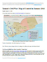
Yemen Civil War Control Map: January 2016 (Subscription)

MEMBERS CLICK HERE TO PROCEED TO ARTICLE AND MAP

There are newer versions of this map available. To see them, view all Yemen updates.

Map of territorial control in Yemen as of January 31, 2016, including territory held by the Houthi rebels and former president Saleh's forces, president-in-exile Hadi and his allies in the Saudi-led coalition and Southern Movement, Al Qaeda in the Arabian Peninsula (AQAP), and the so-called Islamic State (ISIS/ISIL). Includes recent areas of fighting, such as Aden, the Bab al-Mandeb Strait, Dhubab, Hanish Island, Harad, Maydee, Mukallah, and more.
Subscribe for full access to all conflict map reports!

Download PDF:
Buy now
Timeline by Djordje Djukic, with additional reporting by Evan Centanni; map by Louis Martin-Vézian and Evan Centanni

In the two months since our previous Yemen control map update, the Saudi-led coalition supporting President Hadi has opened new fronts against both the rival Houthis and Al Qaeda, using its naval forces to capture islands and seaports along Yemen's coast while also advancing across the border from Saudi Arabia for the first time. 

Meanwhile, the so-called "Islamic State" organization (formerly ISIS/ISIL), based in Iraq and Syria, has for the first time been alleged to control territory in Yemen.

See all this and more on the newest update to PolGeoNow's Yemen territorial control map, which includes a timeline of changes and important events since our previous Yemen map report in November.

This map and report are exclusive premium content, available to paid subscribers or for individual purchase. Download PDF (US$19.99)

Want to see before you buy? Check out our most recent FREE SAMPLE Yemen map report!

Exclusive map report includes:
  • Up-to-date map of current territorial control in Yemen, color-coded for the pro-Hadi coalition, Houthi/Saleh forces, Al Qaeda in the Arabian Peninsula (AQAP), and "Islamic State" (ISIS/ISIL).
  • Color scheme newly updated for consistency with Syria, Iraq, and Libya map series
  • Detailed indication of town-by-town control, including provincial boundaries, all major cities, and many smaller ones
  • Markers for key areas of recent fighting such as Aden, the Bab al-Mandeb Strait, Dhubab, Hanish Island, Harad, Maydee, Mukallah, and more
  • Timeline of changes to the situation since November 2015, with links to sources

MEMBERS CLICK HERE TO PROCEED TO ARTICLE AND MAP

Not a member yet? Click here to learn more about our professional subscription service!

Tuesday, November 17, 2015

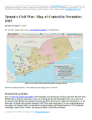
Yemen's Civil War: Map of Control in November 2015 (Subscription)

There are newer versions of this map available. To see them, view all Yemen updates.

Map of territorial control in Yemen as of November 17, 2015, including territory held by the Houthi rebels and former president Saleh's forces, president-in-exile Hadi and his allies in the Saudi-led coalition and Southern Movement, and Al Qaeda in the Arabian Peninsula (AQAP). Includes recent areas of fighting, such as Taiz, Wadiah, Bayda, Marib, Mukayras, Mocha, Dhubab, and the Bab al-Mandeb Strait.
Subscribe for full access to all conflict map reports!

Download PDF:
Buy now
Timeline by Djordje Djukic, with additional reporting by Evan Centanni; map by Louis Martin-Vézian and Evan Centanni

Over the past month and a half, all sides in Yemen's civil war have achieved territorial gains. The international coalition backing President Hadi - now including troops from Sudan, as well as Saudi Arabia, the UAE, and Qatar - has made gains against the Houthis, even as the Houthis have recaptured other areas. Meanwhile, Al Qaeda has taken advantage of the chaos to continue continued its gradual expansion of power.

See all this and more on the newest update to PolGeoNow's Yemen territorial control map, which includes a timeline of changes and important events since our previous Yemen map report in September.

This map and report are exclusive premium content, available to paid subscribers or for individual purchase. Download PDF (US$19.99)

Want to see before you buy? Check out our most recent FREE SAMPLE Yemen map report!

Exclusive map report includes:
  • Up-to-date map of current territorial control in Yemen, color-coded for the pro-Hadi coalition, Houthi/Saleh forces, and Al Qaeda in the Arabian Peninsula (AQAP).
  • Detailed indication of town-by-town control, including provincial boundaries, all major cities, and many smaller ones
  • Markers for key areas of recent fighting such as Taiz, Marib, Bayda, Mukayras, the Bab al-Mandeb Strait, and more
  • Timeline of changes to the situation since late September, with links to sources

MEMBERS CLICK HERE TO PROCEED TO ARTICLE AND MAP

Not a member yet? Click here to learn more about our professional subscription service!

Saturday, September 26, 2015

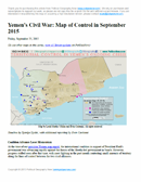
Yemen's Civil War: Map of Control in September 2015 (Subscription)

There are newer versions of this map available. To see them, view all Yemen updates.

Map of territorial control in Yemen as of September 25, 2015, including territory held by the Houthi rebels and former president Saleh's forces, president-in-exile Hadi and his allies in the Saudi-led coalition and Southern Movement, and Al Qaeda in the Arabian Peninsula (AQAP). Includes recent areas of fighting, such as Aden, Ibb, Taiz, Bayda, Marib, Mukayras, and more.
Subscribe for full access to all conflict map reports!

Download PDF:
Buy now
Timeline by Djordje Djukic, with additional reporting by Evan Centanni; map by Louis Martin-Vézian and Evan Centanni

Forces loyal to Yemen's exiled President Hadi, backed by troops from Saudi Arabia, the UAE, and now Qatar, have advanced rapidly against the Houthi rebels over the summer. However, with the offensive now losing momentum, battle lines are solidifying and groups such as Al Qaeda are moving to fill in the power vacuum left in the coalition's wake.

See all this and more on the newest update to PolGeoNow's Yemen territorial control map, which includes a timeline of changes and important events since our previous Yemen map report in August.

This map and report are exclusive premium content, available to paid subscribers or for individual purchase.
Download PDF (US$19.99)

Want to see before you buy? Check out our most recent FREE SAMPLE Yemen map report!

Exclusive map report includes:
  • Up-to-date map of current territorial control in Yemen, color-coded for the pro-Hadi coalition, Houthi/Saleh forces, and Al Qaeda in the Arabian Peninsula (AQAP).
  • Detailed indication of town-by-town control, including provincial boundaries, all major cities, and many smaller ones
  • Markers for key areas of recent fighting such as Marib, Aden, Ibb, Bayda, Mukayras, and more
  • Timeline of changes to the situation since mid-August, with links to sources

MEMBERS CLICK HERE TO PROCEED TO ARTICLE AND MAP

Not a member yet? Click here to learn more about our professional subscription service!

Friday, August 14, 2015

Yemen's Civil War: Map of Control in August 2015 (Subscription)

There are newer versions of this map available. To see them, view all Yemen updates.

Map of territorial control in Yemen as of August 14, 2015, during Saudi Arabia's military intervention, including territory held by the Houthi rebels and former president Saleh's forces, president-in-exile Hadi and the Southern Movement, and Al Qaeda in the Arabian Peninsula (AQAP). Includes recent areas of fighting, such as Houta, Al-Anad Airbase, Dhale, Ibb, Ataq, and more.

Download PDF:
Buy now


(Subscribe via Paypal to view all premium content online)
Timeline by Djordje Djukic, with additional reporting by Evan Centanni; map by Louis Martin-Vézian and Evan Centanni

Yemen's Houthi revolutionary government, despite support from Iran, is rapidly losing ground against the fighters aligned to President Hadi, and supporting forces from Saudi Arabia and the United Arab Emirates. 

A long list of towns have changed hands just within the last two weeks, and Al Qaeda is on the move as well. See all this and more on the newest update to PolGeoNow's Yemen territorial control map, which includes a timeline of changes since our previous Yemen map report in July.

This map and report are exclusive premium content, available to paid subscribers or for individual purchase.
Download PDF (US$14.99)

Want to see before you buy? Check out our most recent FREE SAMPLE Yemen map report!

Exclusive map report includes:
  • Up-to-date map of current territorial control in Yemen, color-coded for the Hadi coalition, Houthi/Saleh forces, and Al Qaeda in the Arabian Peninsula (AQAP).
  • Detailed indication of town-by-town control, including provincial boundaries, all major cities, and many smaller ones
  • Markers for key areas of recent fighting such as Houta, Al-Anad Airbase, Utmah, Ibb, Rabat, Lawdar, Bayda, Ataq, and more
  • Timeline of changes to the situation since the end of July, with links to sources

MEMBERS CLICK HERE TO PROCEED TO ARTICLE AND MAP

NOT A MEMBER YET? SUBSCRIBE NOW!

Thursday, July 30, 2015

Yemen's Civil War: Map of Control in July 2015 (Subscription)

There are newer versions of this map available. To see them, view all Yemen updates.

Map of territorial control in Yemen as of July 29, 2015, during Saudi Arabia's military intervention, including territory held by the Houthi rebels and former president Saleh's forces, president-in-exile Hadi and the Southern Movement, and Al Qaeda in the Arabian Peninsula (AQAP). Includes recent areas of fighting, such as Aden, Sabr, Al-Anad Airbase, Wadiah crossing, Marib, and more.

Download PDF:
Buy now


(Subscribe via Paypal to view all premium content online)
Timeline by Djordje Djukic, with additional reporting by Evan Centanni; map by Louis Martin-Vézian and Evan Centanni

In the past month, Yemen's Saudi-backed resistance forces have finally begun making inroads against the Houthis, capturing a major southern city while also extending their control to the northern border with Saudi Arabia.

See all this and more on the newest update to PolGeoNow's Yemen territorial control map, which includes a timeline of changes since our previous Yemen map report in June.

This map and report are exclusive premium content, available to paid subscribers or for individual purchase.
Download PDF (US$14.99)

Want to see before you buy? Check out our most recent FREE SAMPLE Yemen map report!

Exclusive map report includes:
  • Up-to-date map of current territorial control in Yemen, color-coded for the Hadi government, Houthi/Saleh forces, and Al Qaeda in the Arabian Peninsula (AQAP).
  • Detailed indication of town-by-town control, including provincial boundaries, all major cities, and many smaller ones
  • Markers for key areas of recent fighting such as Aden, Al-Anad, Sabr, Marib, Wadiah border crossing, and more
  • Timeline of changes to the situation since July, compiled by our Yemen specialist, with links to sources

MEMBERS CLICK HERE TO PROCEED TO ARTICLE AND MAP

NOT A MEMBER YET? SUBSCRIBE NOW!

Tuesday, June 23, 2015

Yemen's Civil War: Map of Control in June 2015

There are newer versions of this map available. To see them, view all Yemen updates.

This is part of a series of Yemen maps and infographics created in collaboration between PolGeoNow and CIGeography. Part 1 was the Map & Infographic of Foreign Military Deployments in Yemen, and Part 2 was War in Yemen: Map of Territorial Control (April 2015).

Map of territorial control in Yemen as of June 22, 2015, about two months into Saudi Arabia's military intervention, including territory held by the Houthi rebels and former president Saleh's forces, president-in-exile Hadi and the Southern Movement, and Al Qaeda in the Arabian Peninsula (AQAP).
Map by Louis Martin-Vézian and Evan Centanni (click to enlarge). All rights reserved.
Subscribers click here to view this article in the ad-free members area. Not a member yet? Subscribe now!

Timeline by Djordje Djukic, with additional reporting by Evan Centanni

Houthi Control Spreading Despite Saudi Airstrikes
Since our previous Yemen control map update in early April, Saudi Arabia and its coalition partners have continued their air and sea campaign in support of the ousted Yemeni government of President Abd Rabbuh Mansur Hadi, supported by parts of the Yemeni military and allied local and southern forces. But two months into the intervention, their opponents, the northern Houthi rebels and forces loyal to former president Ali Abdullah Saleh, have continued to expand eastward. Meanwhile, Al Qaeda fighters have consolidated their control in parts of eastern Yemen, and the port city of Aden is still divided by frequent battles.

Wednesday, June 10, 2015

Map of Rebel Control in Mali: June 2015

(To see other maps in this series, view all Mali articles.)

Map of territorial control in Mali as of June 2015. Includes separatist rebel control (CMA, MNLA, MAA, HCUA) and locations of UN peacekeeper (MINUSMA) deployments, as well as the location of a brief takeover by Al Qaeda in the Islamic Maghreb (AQIM).
Map by Evan Centanni, modified from this map by Orionist, Carport, and NordNordWest. License: CC BY-SA.
Subscribers click here to view this article in the ad-free members area. Not a member yet? Subscribe now!

Article by Evan Centanni

Separatist Return to Power
At the time of our last Mali rebel control map report, separatist rebels had just allowed the Malian government to resume control of the north as part of a ceasefire agreement ahead of elections. The rebels had for a time resumed control of the region after a French-led military intervention pushed out the religiously-oriented rebel groups who had usurped the initial separatist rebellion. In July 2013, Mali's territory was again united for the first time in over a year.

Friday, April 3, 2015

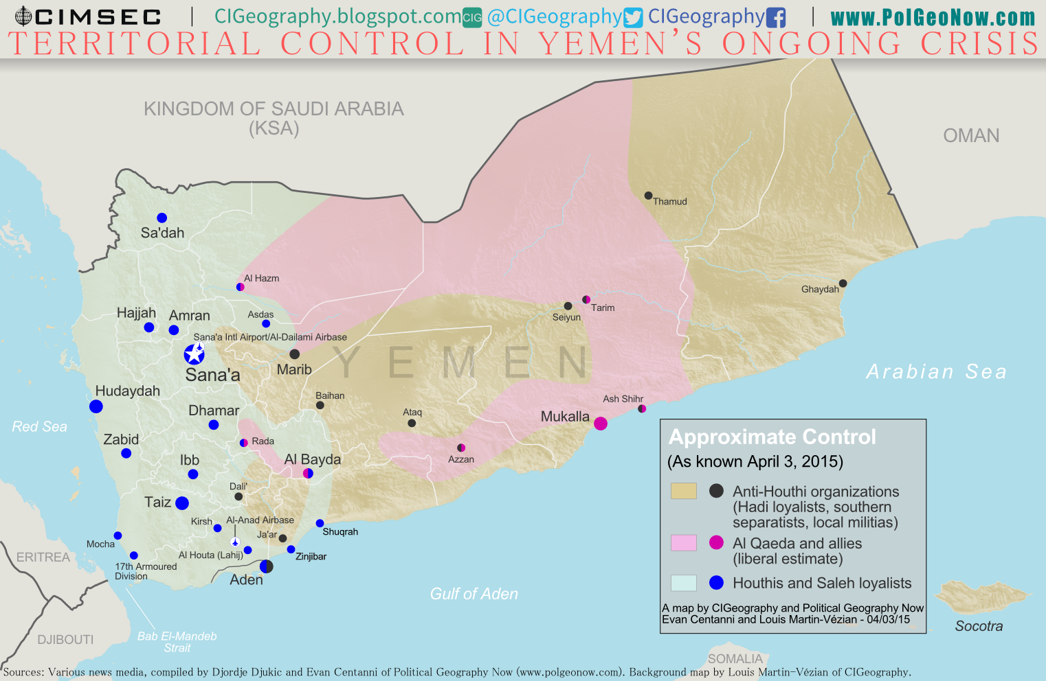
War in Yemen: Map of Territorial Control (April 2015)

Note: There are newer versions of this map available.

This is the second in a two-part report on the ongoing crisis in Yemen, a collaboration between PolGeoNow and CIGeography. Part 1 was the Map & Infographic of Foreign Military Deployments in Yemen.

The below article summarizes the political situation and presents a detailed chronicle of  events over the past several months. The map has been updated since Wednesday's infographic.

Map of territorial control in Yemen at the beginning of April 2015, at the time of Saudi Arabia's military intervention, including territory held by the Houthi rebels and former president Saleh's forces, president-in-exile Hadi and the Southern Movement, and Al Qaeda in the Arabian Peninsula (AQAP).
Map by Louis Martin-Vézian and Evan Centanni (click to enlarge). All rights reserved.
Subscribers click here to view this article in the ad-free members area. Not a member yet? Subscribe now!

Timeline by Djordje Djukic, with additional reporting by Evan Centanni

The Disintegration of Yemen
When PolGeoNow published our last Yemen control map two and a half years ago, the country appeared to be holding together, if only barely. Authoritarian president Ali Abdullah Saleh had stepped down in an internationally-backed political compromise to end the country's Arab Spring uprising, and the northern Houthi rebels had halted their advances after promises of political involvement.

Al Qaeda was on the run from its claimed emirates in the south after a military campaign overseen by the new President Abdurabuh Mansur Hadi, Saleh's former vice president. A movement for southern independence remained outspoken, but wasn't taking up arms in large numbers against the government.

Wednesday, April 1, 2015

War in Yemen: Map & Infographic of Foreign Military Deployments

This infographic map is a collaboration between PolGeoNow and CIGeography, a site focusing on infographics of military operations related to current events. For details on recent changes to territorial control and the political situation in Yemen, see our companion article, War in Yemen: Map of Territorial Control.

Map of territorial control in Yemen at the beginning of April 2015, with infographic on foreign military deployments to the country.
Map graphic by Louis Martin-Vézian and Evan Centanni (click to enlarge). All rights reserved.
Subscribers click here to view this article in the ad-free members area. Not a member yet? Subscribe now!

This map has also been posted at CIGeography and CIMSEC.

Following this story? View all Yemen maps on PolGeoNow.

Tuesday, January 28, 2014

Syria Civil War Map: January 28, 2014 (#12.1) (Premium)

There are newer versions of this map available. To see them, view all Syria updates.

Map of fighting and territorial control in Syria's Civil War (Free Syrian Army rebels, Kurdish groups, Al-Nusra Front, ISIS/ISIL and others), updated to January 28, 2014. Includes recent locations of conflict between ISIS and other rebel groups, including Raqqa, Jarabulus, Manbij, Kafranbel, and others.

Download PDF
buy


(Subscribe via Paypal)
PolGeoNow presents our first premium Syria map, part of our new more frequent updates for the Syrian Civil War! Since last month a major struggle has emerged between ISIS extremists and a coalition of other rebel groups, with several key towns changing hands. See the updated map and briefing in this premium report. Buy now (US$5.99).

Members click here to proceed to article and map

NOT A MEMBER YET? SUBSCRIBE HERE!


Sunday, January 12, 2014

Iraq: Map of Al Qaeda Control

There are newer versions of this map available. To see them, view all Iraq updates.

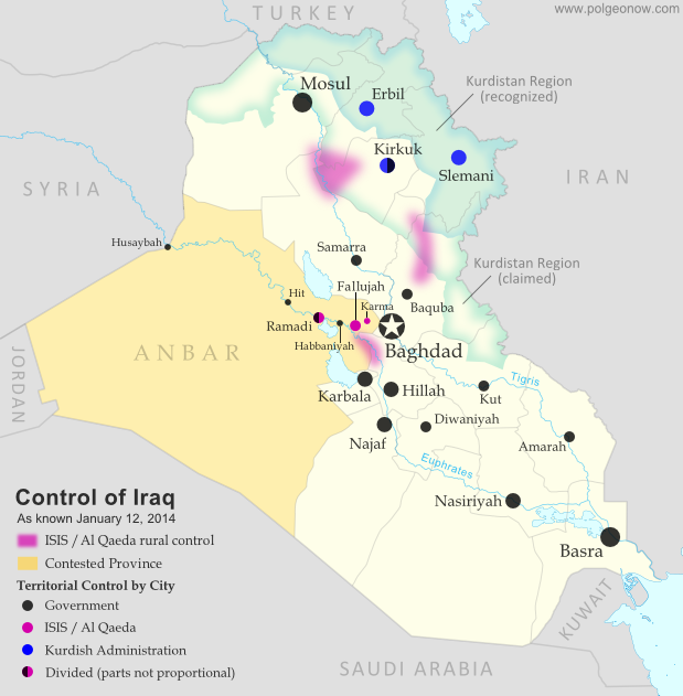
PolGeoNow presents our first map of Iraq, showing control by the government and Al Qaeda rebels in the country's ongoing crisis. Areas of autonomous Kurdish administration in the north are also indicated.

Want to see timely updates for this map? Subscribe to our premium member service!

Map of territorial control in Iraq in January 2014, including cities and countryside held by Al Qaeda (ISIS) as well as areas administered by Kurdistan
Territorial control in Iraq at the beginning of 2014. Map by Evan Centanni, starting from this blank map by German Wikipedia user NordNordWest. License: CC BY-SA
Premium members click here to view this article in the ad-free members area. Not a member yet? Subscribe now!

By Evan Centanni


Al Qaeda in Iraq
Though the reality is of course more complex, power politics in Iraq often revolve around the country's three largest ethnic groups: Shia (Shiite) Arabs, Sunni Arabs, and Kurds (most Kurds are religiously Sunni, but their language and cultural distinguish them from Arabs). Prime Minister Nouri al-Maliki, a Shia Arab, is often accused of manipulating Iraq's democracy to exclusively serve the country's Shia majority. The Kurds govern a highly autonomous region in the northeast, but the Sunni Arabs who dominate northwestern Iraq have relatively little political power. Into the fray has jumped Al Qaeda in Iraq, now part of the Islamic State of Iraq and al-Sham (ISIS) organization which also controls parts of Syria (map). Al Qaeda has waged a fierce campaign against the Iraqi government in the name of Sunnis, though the group is still rejected by many of the people it claims to protect.

Saturday, December 14, 2013

Syria Civil War Map: December 2013 (#12)

There are newer versions of this map available. To see them, view all Syria updates.

In addition to updates on the situation, our updated Syria control map now distinguishes the territory of extremist groups ISIS and Al-Nusra from that of Free Syrian Army or mixed rebel coalitions. (To see other maps in this series, view all Syria updates.)

Tired of waiting months for Syria map updates and briefings? Subscribers to our premium member service will soon begin seeing much more frequent Syria control updates. Don't miss out - sign up now!

Map of fighting and territorial control in Syria's Civil War (Free Syrian Army rebels, Kurdish groups, Al-Nusra Front, ISIS/ISIL and others), updated for December 2013. Includes recent locations of conflict and territorial control changes, Al-Safira, Khanaser, Maaloula, Qara, Nabek, and .
Area of fighting and territorial control in Syria's civil war, updated for December 2013. Map by Evan Centanni, starting from this blank map by German Wikipedia user NordNordWest. License: CC BY-SA
Premium members click here to view this article in the ad-free members area. Not a member yet? Subscribe now!

Al-Nusra and the ISIS
In addition to updates on the situation since our previous Syria war map, this edition of the map also shows which cities are controlled primarily by religious extremist groups the Al-Nusra Front and the Islamic State of Iraq and Syria (ISIS) (also translated from Arabic as ISIL, the Islamic State of Iraq and the Levant). While these groups share many of their goals with the Free Syrian Army and other rebel groups fighting the Assad government, and in many cases still cooperate strategically with those groups, they are increasingly emerging as a separate bloc in the multi-sided conflict.