 |
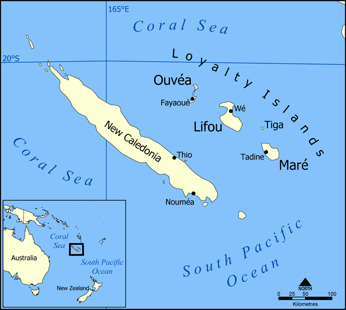
| The islands of New Caledonia, and their location in the South Pacific. Map by NormanEinstein (CC BY-SA; source) |
But this time was much different. In 2018, 43% of voters chose the independence option, and in 2020 that proportion grew to 47%. But last weekend, amid calls for a boycott from pro-independence campaigners, a only a staggeringly-small 3.5% of participants voted to separate from France. Total voter turnout was barely half the amount from last year.
Why did this happen, and what now? Read on for the answers.


